Altamahaw Dam
!
Altamahaw Cotton Mill was established in 1881 on the banks of Haw River, northwest of Burlington. Some of the original structures still stand, and the site is still operated by Glen Raven Mills as a North American shipping service.
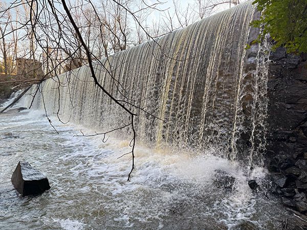
The 14-foot dam, built with large, chiseled stones, provided waterpower to operate the mill until 1913, when electricity took over. I assume, but do not know for certain, that a power plant operated on site using water coming from the dam.
The dam is located at Altamahaw Paddle Access. The small park here includes a gazebo and picnic table.
(120P-260338)
Driving Directions
Open driving directions in map appAltamahaw paddle Access is located off NC 87, about 10 miles northwest of Burlington. GPS is 36.183722, -79.510410.
Hiking Directions
Quick Glance
Cross the little bridge and walk toward the plainly visible dam.
Detailed Look
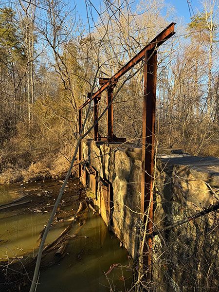
Walk across the steel bridge that crosses the old millrace. The dam is clearly visible upstream.
| Accessibility: | Grassy walk |
| County: | Alamance |
| River Basin: | Cape Fear |
| Watercourse: | Haw River |
| Watershed: | Medium/large |
| Type and Height: | 14-foot dam |
| Landowner: | Private, accessible to the public |
| Experience Rating: | Fair |
| Elevation: | 620 feet |
| USGS Map: | Ossipee |
| Hike Difficulty: | Easy |
| Hike Distance: | A few hundred feet. |
| Waterfall GPS: | 36.182894, -79.511081 |
| Trailhead GPS: | 36.183722, -79.51041 |
Photo Gallery
Click a photo to enlarge.