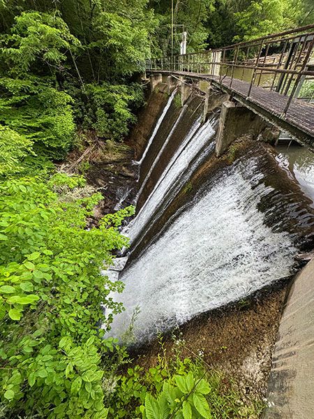
Balsam Lake Dam
!
A mostly easy walk along a beautiful mountain lake leads to the historic Balsam Lake Dam. The walk is great for families, especially those who enjoy fishing together.
The dam is gated, so you can’t get on the walkway that crosses the top, but you can get out on it enough for a decent view of the spillway and a great view of the lake.
(028N-264386)
Driving Directions
Open driving directions in map appThe trailhead is at Balsam Lake Recreation Area on Charleys Creek Road (SR 1756). From the east, turn off NC 215 onto Charleys Creek Road, 3.2 miles south of Blue Ridge Parkway. Follow Charleys Creek Road 5.3 miles to Balsam Lake. From the west, you can access Charleys Creek Road from NC 281, some 8.4 miles south of NC 107. From that direction, it is 5.4 miles to Balsam Lake.
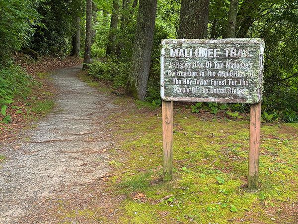
The trailhead is the same for Balsam Falls, Lower Balsam Falls, Patricia Falls, and Lauren Falls.
Hiking Directions
Quick Glance
Cross Wolf Creek on the footbridge and follow the path to the dam.
Detailed Look
No details needed.
| Accessibility: | Hiking trail |
| County: | Jackson |
| River Basin: | Little Tennessee |
| Watercourse: | Wolf Creek |
| Watershed: | Small/medium |
| Type and Height: | Small concrete dam measuring 31 feet high Height measured with rangefinder. |
| Landowner: | Nantahala NF, Nantahala RD |
| Experience Rating: | Good |
| Elevation: | 3520 feet |
| USGS Map: | Sam Knob |
| Hike Difficulty: | Easy There are a couple of spots where the trail is not flat and level. |
| Hike Distance: | 0.4 miles |
| Waterfall GPS: | 35.267653, -82.969284 |
| Trailhead GPS: | 35.272925, -82.969369 |
Photo Gallery
Click a photo to enlarge.