Bennett Cove Falls
!
Bennett Cove Falls, like most of the others nearby, is unremarkable, but it’s not too difficult to reach. It is one of four significant waterfalls, plus several smaller falls, that you can see in a half-day outing from the same trailhead.
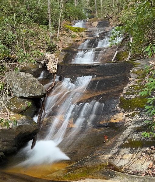
The main upper section. (065P-262694)
Driving Directions
Open driving directions in map appFrom the junction of US 64, US 276, and NC 80 in Brevard, drive north on US 276 for 10.3 miles (passing Looking Glass Falls on the way) and turn left on the unpaved FS 475B (Headwaters Road). From Blue Ridge Parkway, it is 4.7 miles south on US 276 to this point. Drive 0.15 mile on FS 475B and park on the left, just before the bridge.
Hiking Directions
Quick Glance
The gated FS 5032 begins across the road from the parking area. Follow it to where it makes a sharp right switchback and turn left onto an obvious path a few yards before the curve. Follow the path to the first creek crossing, after turning right at the split. Just before the creek is an obvious path on the right that leads to the falls.
Detailed Look
Start on FS 5032, which is across the road from the parking area. In 80 yards you’ll come to the gate. (Right before the gate is a side path on the right. If you’re combining No Name Cove Falls and/or Poundingmill Branch Falls with this hike, you can use this path on the return to save some time. See the listings for those falls for details.)
From the gate, it is less than 0.5 miles to a sharp right 180-degree turn. Ten yards before this turn is an obvious path on the left. Take this path, which follows an old logging grade. In a couple hundred feet, the path splits. Go right and ascend. At 0.15 miles from FS 5032, there is a side path on the right, about 50 feet before a creek crossing.
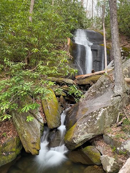
This side path ascends steeply for a little less than 0.2 miles to the falls. You’ll pass a nice little slide near the start. The path comes out at the base of the falls, from where you don’t have a very good view of the main upper section. To see it well, you can take the very steep path that splits off from the path to the base.
| Accessibility: | Forest road and hiking trail |
| County: | Transylvania |
| River Basin: | French Broad |
| Watercourse: | Tributary of Looking Glass Creek Gaia lists it as Looking Glass Creek, but all other references, including the USGS topo map, has it unnamed. |
| Watershed: | Very small |
| Type and Height: | Long series of steep slides and cascades; overall height is 88 feet Height measured with rangefinder. |
| Landowner: | Pisgah NF, Pisgah RD |
| Beauty Rating: | 4 |
| Elevation: | 3433 feet |
| USGS Map: | Shining Rock |
| Hike Difficulty: | Easy/Moderate+ |
| Hike Distance: | 0.8 miles |
| Waterfall GPS: | 35.335966, -82.802956 |
| Trailhead GPS: | 35.3391, -82.792 |
Photo Gallery
Click a photo to enlarge.