
Big Creek Falls
!
Big Creek Falls is about as far away as you can get on a paved road in North Carolina, which makes it that much more appealing to me. The route passes through the scenic Cane River Valley, paralleling the river until it turns north to join North Toe River, at which point it becomes the popular Nolichucky River of whitewater-rafting fame.
The proximity to the road and the power lines overhead lessen its appeal somewhat, but from the base you still get a feeling of isolation. My favorite time to visit is in summer when the vegetation is fullest, and when it’s raining. Standing at the base of the falls you feel like you’re in a rain forest.
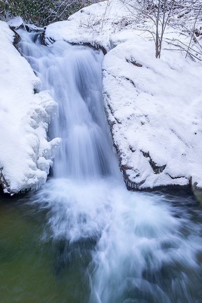
Big Creek Falls in winter. (004A-116823)
Driving Directions
Open driving directions in map appAbout 5 miles west of Burnsville on US 19E, turn north on US 19W. Drive 17.8 curvy miles to the waterfall, on the left. A small pullout is located right at the falls.
Hiking Directions
The waterfall is right beside the road. For the best view and photos, climb down the bank a few yards to the cliff viewpoint, and a few yards farther down to the base.
| Accessibility: | Roadside view and short bank scramble |
| County: | Yancey |
| River Basin: | French Broad |
| Watercourse: | Big Creek |
| Watershed: | Small |
| Type and Height: | Steep sliding falls about 25 feet high Height estimated. |
| Landowner: | Pisgah NF, Appalachian RD |
| Beauty Rating: | 4 |
| Elevation: | 2520 feet |
| USGS Map: | Chestoa NC/TN |
| Hike Difficulty: | View roadside Must make a short scramble down bank for best view. |
| Hike Distance: | A few yards |
| Waterfall GPS: | 36.03942, -82.37628 |
| Trailhead GPS: | 36.03929, -84.37621 |