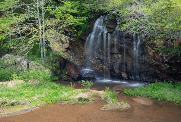
Bon Ami Falls
Emerald Village Falls
!
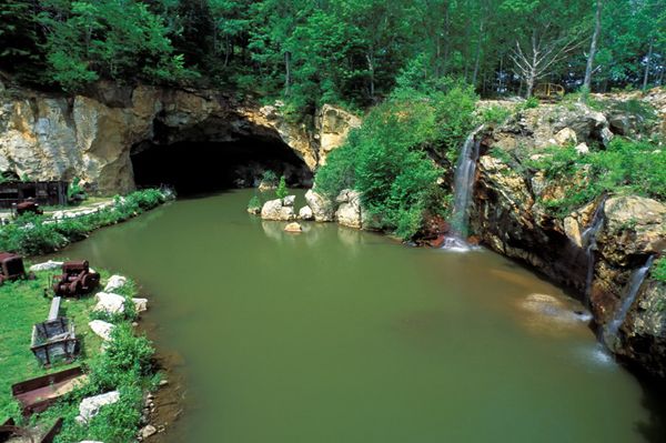
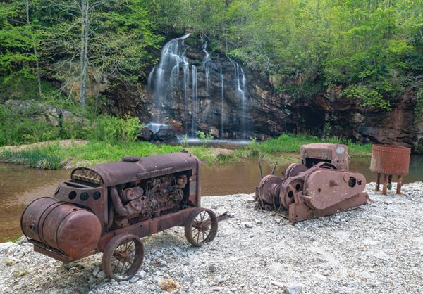
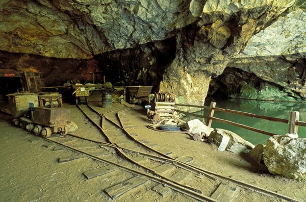
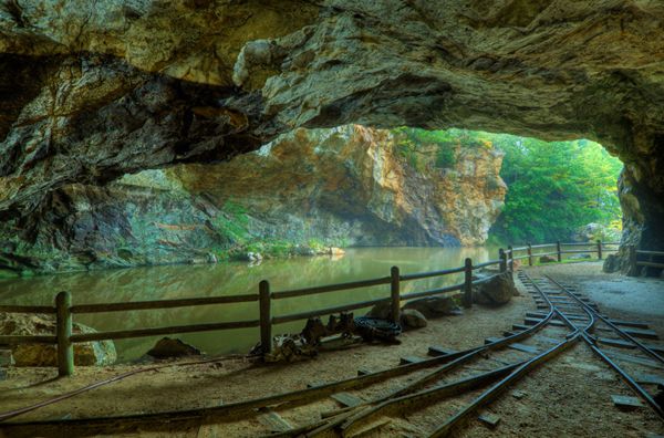
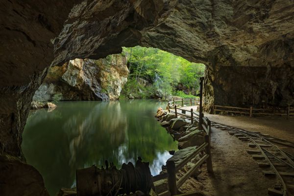
Among my favorite North Carolina waterfalls, Bon Ami Falls won’t wow you with its height, water volume, or structure. In fact, if it hasn’t rained in a while, you won’t see much more than a wet rock. But Bon Ami offers something that most waterfalls don’t: an authentic mining experience. If you think of a mine as just a hole in the ground, you’re in for a treat when you visit this waterfall.
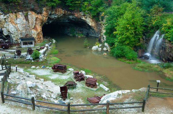
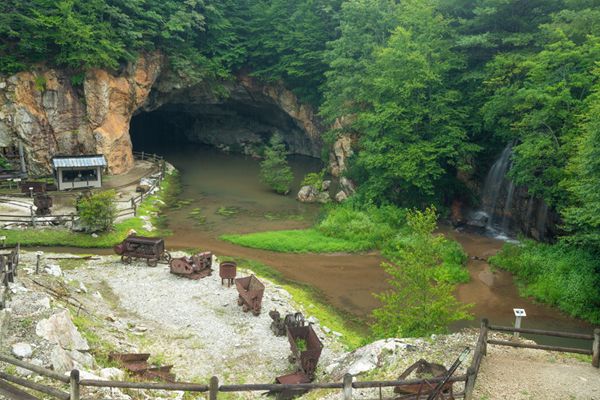
You can view the waterfall easily a few feet off the road, but for the best experience and photos, you should take the self-guided tour of the mine. In wet weather, you'll be treated to a couple of smaller waterfalls dropping off cliff into the pool. They can be included under the collective Bon Ami Falls name.
The mine is open daily from early April until early November. There are several ticket options. To see the falls and enter the mine, you want the self-guided underground mine tour at the North Carolina Mining Museum. Ticket prices in 2024 are $12 for adults. Visit www.emeraldvillage.com for more info.
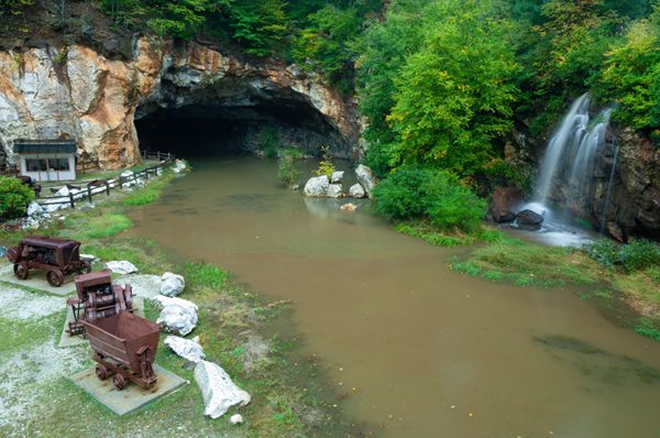
View shows entrance to mine and Bon Ami Falls. (024F-24677)
Driving Directions
Open driving directions in map appAt Milepost 333.9, turn off the Blue Ridge Parkway and follow the ramp to the stop sign. Turn right onto Chestnut Grove Church Road and drive back under the Parkway. Continue 0.9 miles and turn left on McKinney Mine Road (SR 1100). Drive 2 miles to the Emerald Village complex, which is on both sides of the road. Bon Ami Falls and North Carolina Mining Museum is on the right as you enter the complex.
Hiking Directions
If the mine is closed, you can view the falls by parking at the gravel pullout along the road and walking a few feet down to an overlook of the mine. If the mine is open, you will get the best view and have the best experience by taking the self-guided tour of the mine.
| Accessibility: | Roadside view and short path with steps |
| County: | Mitchell |
| River Basin: | French Broad |
| Watercourse: | Burnett Branch |
| Watershed: | Very small |
| Type and Height: | Cascading and freefalling falls about 25 feet high Height estimated. |
| Landowner: | Private |
| Beauty Rating: | 3 for just the falls; 8 when including falls in context with the mine Both ratings assume good water flow. |
| Elevation: | 3120 feet |
| USGS Map: | Little Switzerland |
| Hike Difficulty: | Easy You must descend a few steps to reach pond at base of falls. |
| Hike Distance: | Roadside view or short walk to base |
| Waterfall GPS: | 35.8469, -82.12592 |
| Trailhead GPS: | 35.846918, -82.126809 |
Photo Gallery
Click a photo to enlarge.