
Boxcar Falls
!
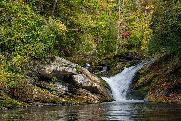
Given its size, access, and distant viewing requirement, this one won’t be high on the list for most people, whitewater kayakers excepted. The Class V+ falls presents a challenge for North Fork boaters.
(006D-252597)
Driving Directions
Open driving directions in map appFrom US 64, near Rosman, drive 4.1 miles north on NC 215 and park in the pullout on the left side of the road. If you come from the Blue Ridge Parkway, drive 12.9 miles south on NC 215 to the pullout on the right.
Hiking Directions
Quick Glance
Follow the obvious path that descends steeply to the river, then follow the path upstream to the falls, crossing the river along the way.
Detailed Look
Two paths begin at the south end of the pullout. The right fork ascends, the left descends. Take the left fork and descend steeply for 0.3 miles to a campsite beside the river. Now hike upstream for 0.5 miles. The path twists and turns and dips but is easily followed.
The path ends at the river crossing. (35.184221, -82.853731) If the water is up, turn around. This is a tricky crossing even when it’s low. If the water is muddy and you can’t see the bottom, turn around. The waterfall will be there once it clears up.
Once across, continue heading upstream. This part of the path is rough—a scramble, really, but by far the easiest route. You’ll pass several nice cascades, some more scenic than Boxcar Falls, though not as high.
At 0.25 miles from the river crossing there is a side path leading down to the river. It should be obvious if you pay attention. To see the falls well, you must get out on the big boulder in the riverbed. The best view requires wading out in the river. If you made it this far, you should be able to handle it okay. Regardless of your viewpoint, to see it from in front, it’s going to be from a distance downstream unless you swim.
| Accessibility: | Hiking trail |
| County: | Transylvania |
| River Basin: | French Broad |
| Watercourse: | North Fork French Broad River |
| Watershed: | Large |
| Type and Height: | 15 foot steep cascade Height estimated using rangefinder. |
| Landowner: | Pisgah NF, Pisgah RD |
| Beauty Rating: | 3 |
| Elevation: | 2500 feet |
| USGS Map: | Rosman |
| Hike Difficulty: | Difficult With a sketchy and potentially dangerous river wade. |
| Hike Distance: | A little over 1 mile |
| Waterfall GPS: | 35.186718, -82.852963 |
| Trailhead GPS: | 35.18414, -82.848295 |