Bridal Veil Falls
!
Bridal Veil Falls has captivated me ever since I saw Jim Bob Tinsley’s photo in The Land of Waterfalls.11 Then, a few years later when I watched The Last of the Mohicans, I was really enthralled. So, it’s no surprise that I wasted little time coming here after the falls became part of DuPont State Recreational Forest.
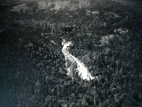
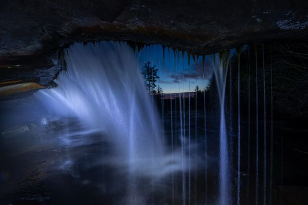
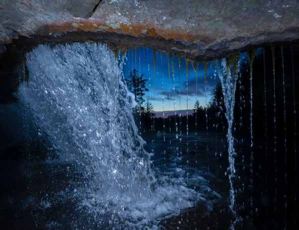
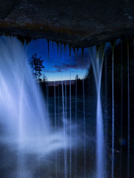
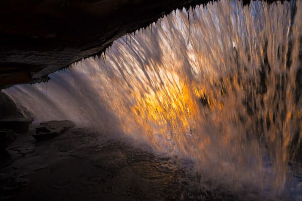
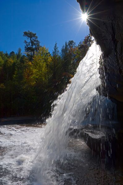
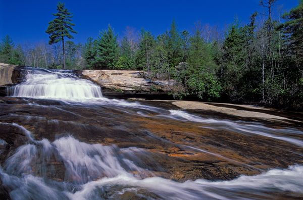
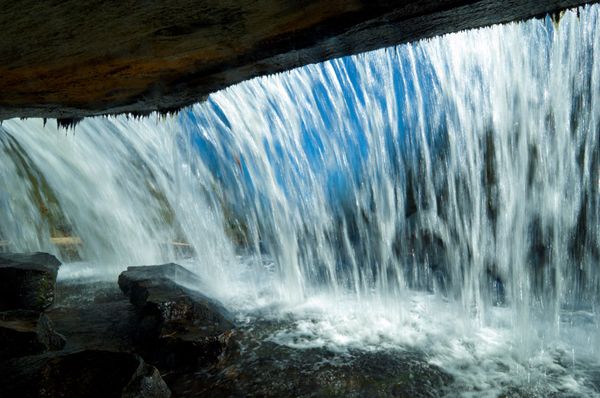
The waterfall starts as a short, overhanging drop that you can get behind, then goes on a long, gentle, sliding run before fanning out and falling over a steep, sloping rockface. Although other North Carolina waterfalls share some of Bridal Veil’s characteristics, few can compare with it. If there were a way to see all the waterfall from one vantage point (Tinsley shot from a tree), and if a high-power transmission line weren’t clearly visible at the top, I’d give it a beauty rating of 9, maybe even 10.
A sign at the base warns visitors to stay on the marked trail, but the trail ends at the base of the falls. Although a makeshift path climbs the river-right side to the upper drop, you can’t see much from it. Forest officials frown on climbing on the waterfall, and in fact doing so is against regulations, but you’ll see hordes of people all over the falls on weekends and most any day during summer and fall.
Exercise extreme caution here. The gentle slope in the middle of the falls can engender carelessness, and if you slip at the wrong place, you’re in serious trouble. As one official said, some algae-rich areas here make Teflon seem like flypaper. Even the flat areas can be difficult. On one trip, I watched several bicyclists bust their butts as they walked their bikes across the flat area at the base of the upper drop. I even saw some attempting to ride their bikes across, attempt being an apt description.
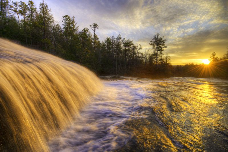
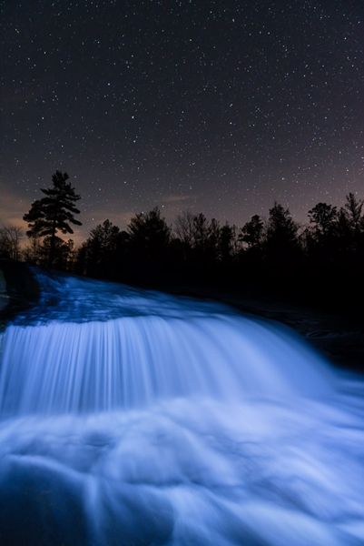
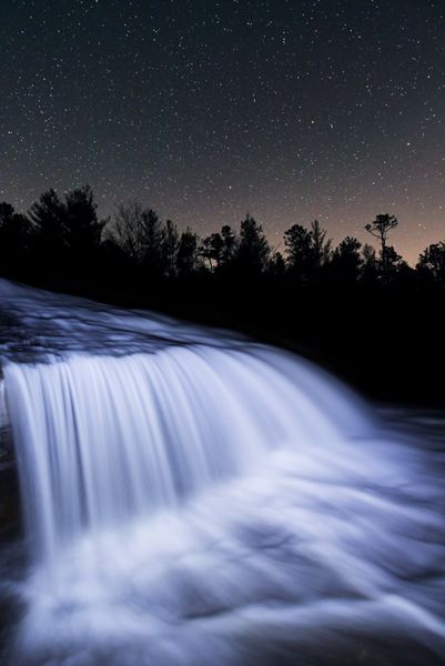
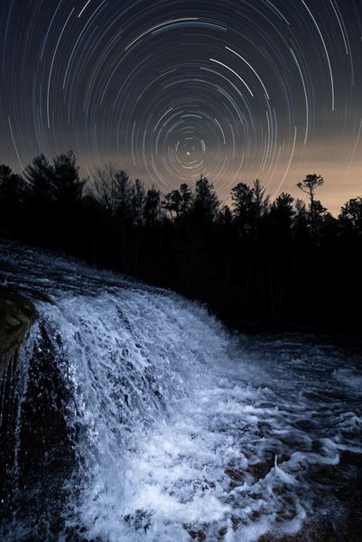
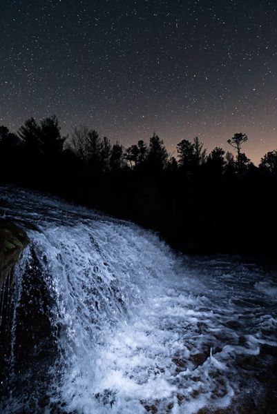
Sunrise at Bridal Veil Falls (030D-099050)
Driving Directions
Open driving directions in map appDuPont State Recreation Forest can be accessed easily from Hendersonville, Pisgah Forest, Brevard, and Cedar Mountain. Use the trailhead GPS coordinates to find the best route.
If you’re coming from the junction of US 64, US 276, and NC 280 near Brevard, drive 3.5 miles east on US 64 and turn right on Crab Creek Road (SR 1528). Go 4.2 miles and turn right on DuPont Road (SR 1259), which becomes Staton Road when it crosses from Henderson County into Transylvania County. Drive 4 miles on this road to the High Falls Access, on the left. A visitor center is located here.
You can also hike to the falls from the Fawn Lake Access off Reasonover Road. GPS for it is 35.16093, -82.60420.
Hiking Directions
Quick Glance
Follow Buck Forest Road for 0.5 mile and turn right on Conservation Road. Walk 1.2 miles and turn right on Bridal Veil Falls Road. From the end of the road, hike the path to the base of the falls.
Detailed Look
From High Falls Access Area, follow Buck Forest Road beyond the gate. After about 0.5 miles, you’ll reach the covered bridge over Little River. Look downstream to see the brink of High Falls. In another 100 yards, turn right on Conservation Road. Follow the road for about 1.2 miles and turn right on Bridal Veil Falls Road. Walk less than 0.5 miles to the traffic circle. A wide path continues from the circle and reaches the base of the falls in about 0.15 miles.
The route from Fawn Lake Access Area is a little shorter, but more difficult. If hiking it, use a trail app, good map, or snap a shot of the map on the kiosk at the trailhead.
| Accessibility: | Mostly unpaved roads, with short hiking trail |
| County: | Transylvania |
| River Basin: | French Broad |
| Watercourse: | Little River (tributary of French Broad River) |
| Watershed: | Medium/large |
| Type and Height: | Short, overhanging free fall, then long slide ending in short free fall; total drop over 100 feet Height measured with rangefinder. |
| Landowner: | DuPont State Recreational Forest |
| Beauty Rating: | 8 |
| Elevation: | 2640 feet |
| USGS Map: | Standing Stone Mtn NC/SC |
| Hike Difficulty: | Easy |
| Hike Distance: | About 2.4 miles |
| Waterfall GPS: | 35.177604, -82.619062 |
| Trailhead GPS: | 35.191761, -82.621697 Reading at High Falls Access. |
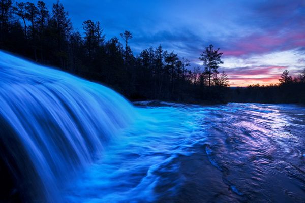
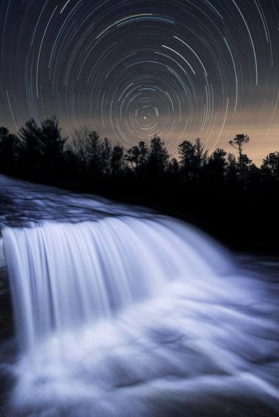
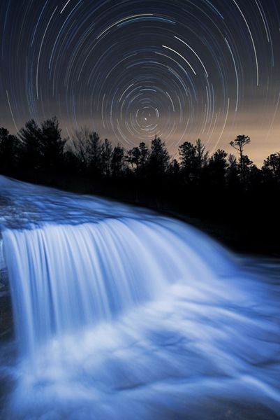
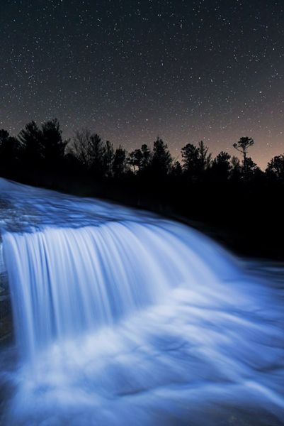
Photo Gallery
Click a photo to enlarge.
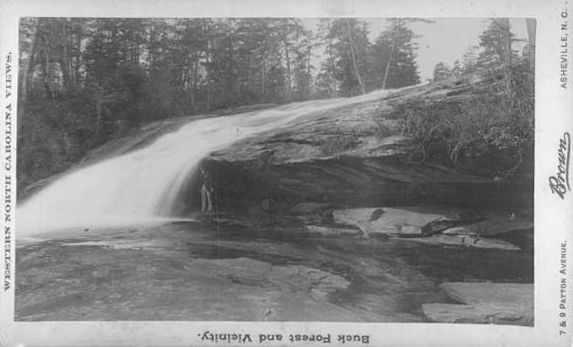
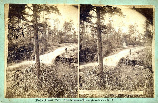
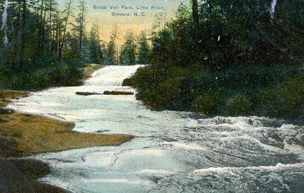
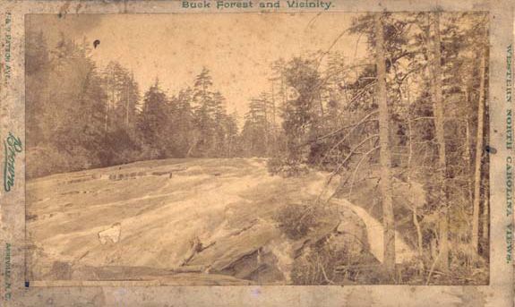
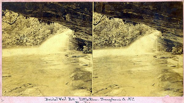
Historical Gallery
Click a photo to enlarge.