Buckhorn Dam
!
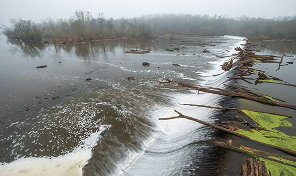
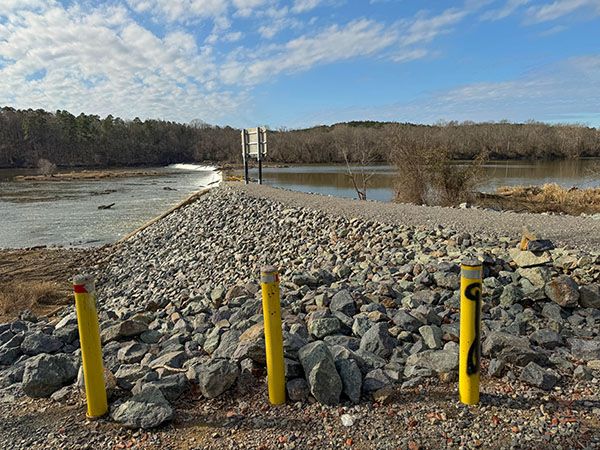
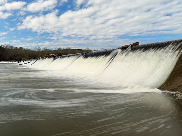
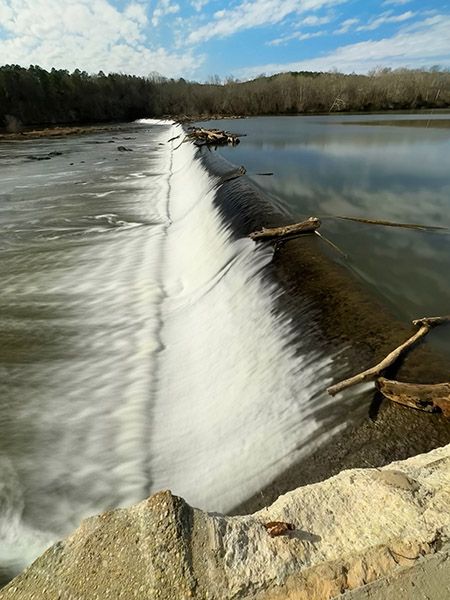
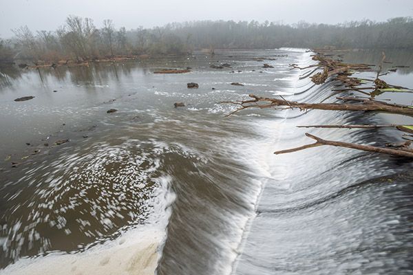
Spanning over 1,200 feet of Cape Fear River, the L-shaped Buckhorn Dam is a notable sight, despite being only 11 feet high. The dam no longer generates electricity and there has been talk of removing it, but I’m not aware of any imminent plans. For dam buffs, it’s a good one to visit, but for most people, it’s just a place to fish or launch a canoe or kayak.
For information about Cape Fear River in general, including a table listing all the waterfalls on the river, visit the River Basins & Rivers page and click on the Cape Fear River Basin tab.
(014M-115184)
Driving Directions
Open driving directions in map appAbout halfway between Fuquay-Varina and Sanford, turn south off NC 42 onto Buckhorn Road (SR1921). GPS for the turn is 35.567856, -78.998693. Follow Buckhorn Road 2.2 miles to the dam. The road changes to dirt and has several potholes.
Hiking Directions
Quick Glance
It’s right in front of you.
Detailed Look
No details needed for this one.
| Accessibility: | Roadside view |
| County: | Chatham, Lee |
| River Basin: | Cape Fear |
| Watercourse: | Cape Fear River |
| Watershed: | Amazon |
| Type and Height: | Overflow concrete dam, 11 feet high |
| Landowner: | Duke Energy |
| Experience Rating: | Good |
| Elevation: | — |
| USGS Map: | Cokesbury |
| Hike Difficulty: | View roadside |
| Hike Distance: | — |
| Waterfall GPS: | 35.540737, -78.989065 This is for the parking area right at the dam. |
| Parking GPS: | 35.540737, -78.989065 |
Photo Gallery
Click a photo to enlarge.