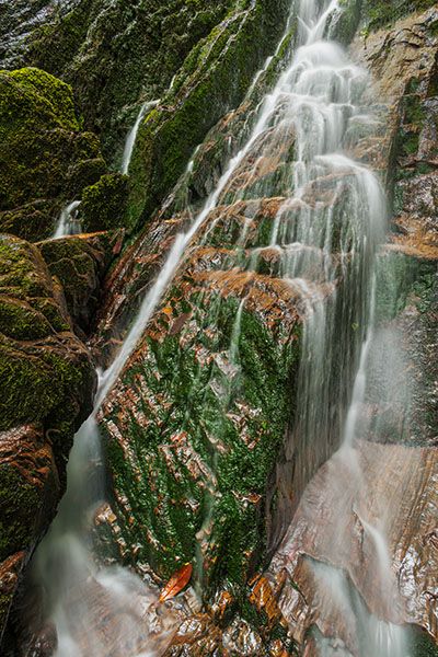
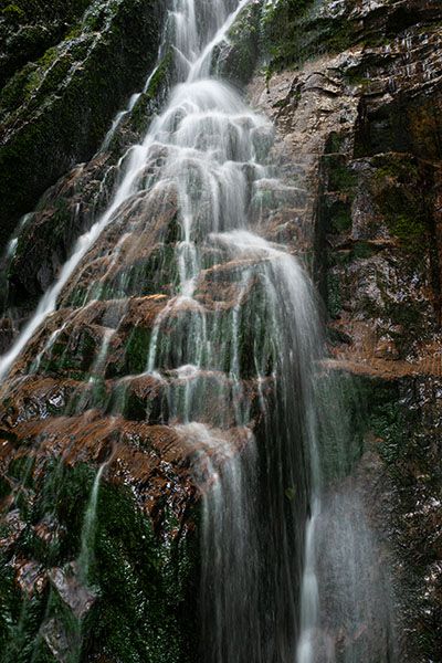
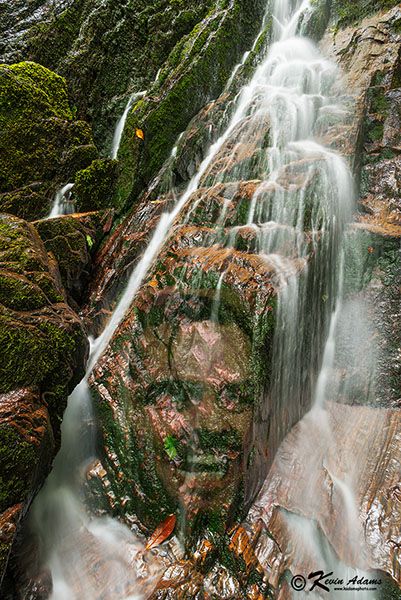
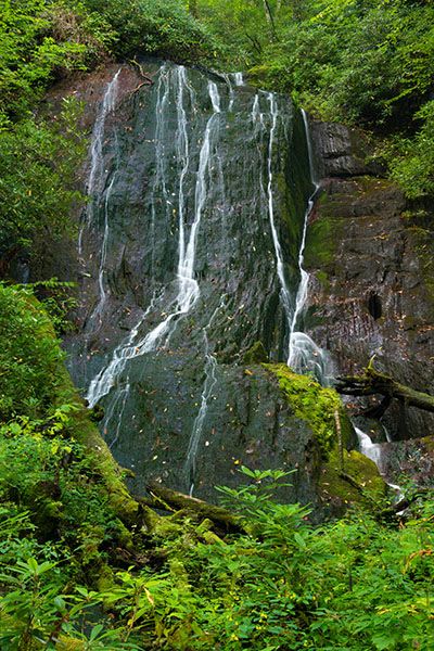
Burgan Creek Falls
!
You know what they say: The fourth time’s a charm. Well, it was for me. My first three visits to this waterfall were not very rewarding. I hiked in from below, which requires bushwhacking, and I wasn’t impressed with the falls. Did the hike influence my judgement, or was it something else? The fallen trees covering the falls on my 2015 visit are no longer there, so that surely helped.
At any rate, on my fourth visit in September of 2022 I had a much better experience, even though the water level was very low. Perhaps I was influenced by Patricia, who joined me on this hike and loved the falls, or perhaps it was because I finally found the new trail, but whatever the reason, I’ve changed my recommendation from “not worth it” to definitely recommended.
An aspect of the waterfall that I particularly like is the jet-black rock juxtaposed against the lush green foliage. A summer visit is best to realize the full effect of this.
(013A-209125)
Driving Directions
Open driving directions in map appFrom the junction of NC 143 and Business 143 in Robbinsville, follow Business 143 for 2.3 miles and turn left on Atoah Circle (SR 1114). Drive 1.15 miles and turn left on Atoah Road (SR1112). Follow Atoah Road for 2.4 miles and turn left onto an old forest road. Park at the gate. Note that Atoah Road changes to dirt at 2 miles and becomes a little rough in places. You can make it okay in a 2x2 if you go slow.
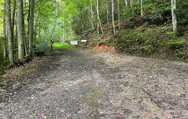
Trailhead parking area. (13A-209202)
Hiking Directions
The first three times I hiked to this falls, I approached it from below, off Long Creek Road. This is not the way to go! I knew about the new trail on the 3rd visit, but I mistakenly thought the trailhead for it was at Atoah Gap, farther up Atoah Road. After hiking a short distance on a heavily overgrown route, I gave up.
Sometime later I contacted Marshall McClung, retired forestry technician for Nantahala National Forest. Marshall is the got-to person for all things in Graham County, and in fact it was he who flagged and cleared the route for the new trail. He guided me to the correct trailhead.
Quick Glance
Follow old road from gate for 0.1 miles and turn right at the fork. Go a short distance and turn right at old fuel tank. The remainder of the route should be easily followed and may be flagged.
Detailed Look
From the gate, it is a gentle ascent along the old road for 0.1 miles to a fork. Turn right and hike 25 yards to an old rusty beat-up fuel tank. The trail turns to the right here and climbs a few feet to pick up an old road, then goes 26 yards, where it swings around to the right and climbs the bank.
Now you must climb steeply for 0.3 miles to the top of a ridge, then descend a little over 100 yards to Burgan Creek. Head upstream a short distance to the crossing. Climb the bank on the other side and follow the creek upstream for a quarter mile to the next crossing. (Both crossings are easy.)
From the second crossing it is less than 0.2 miles to the falls. There is a good view on the river-right side a short distance downstream. If you want to get right at the base, you’ll need to scramble up the creekbed.
| Accessibility: | Hiking trail |
| County: | Graham |
| River Basin: | Little Tennessee |
| Watercourse: | Burgan Creek |
| Watershed: | Very small |
| Type and Height: | Near-vertical slide, 65 feet high Height measured with rangefinder. |
| Landowner: | Nantahala NF, Cheoah RD |
| Beauty Rating: | 6 Patricia gives it an 8. |
| Elevation: | 3200 feet |
| USGS Map: | Robbinsville |
| Hike Difficulty: | Moderate+ |
| Hike Distance: | Slightly less than 1 mile |
| Waterfall GPS: | 35.264861, -83.839952 |
| Trailhead GPS: | 35.271502, -83.844014 |
Photo Gallery
Click a photo to enlarge.