
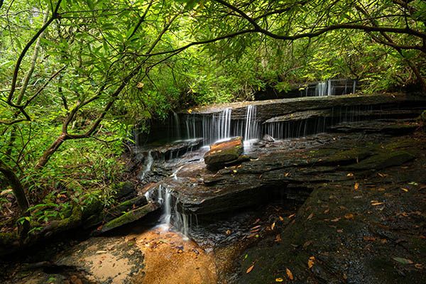
Cannon Creek Falls
!
It’s little and on a very small stream, but it has a lot of character and it’s relatively easy to get to. After a good rain, it’s a fine little waterfall.
(030M-207787)
Driving Directions
Open driving directions in map appFrom US 276 in Cedar Mountain, south of Brevard, turn north on Rich Mountain Road and drive 1.8 miles to a pullout on the right, in the outside of a sharp left curve. This is the trailhead for Wilkie Trail.
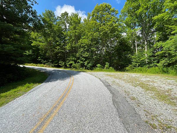
Pullout at trailhead. (030M-207647)
Hiking Directions
Quick Glance
Follow Wilkie Trail about a quarter mile to an obvious side path on the right. Descend the side path to the falls.
Detailed Look
Follow Wilkie Trail on an old road for less than 0.2 miles to a not-so-obvious side path on the right. This path descends to the falls. If you continue Wilkie Trail for another 130 feet you’ll see a second, more obvious side path, that also descends to the falls. This path is a little longer but easier.
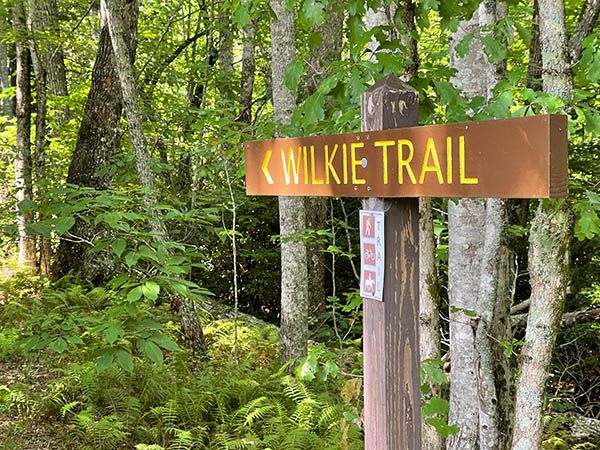
Trail sign at trailhead. (030M-207649)
| Accessibility: | Hiking trail |
| County: | Transylvania |
| River Basin: | French Broad |
| Watercourse: | Cannon Creek |
| Watershed: | Very small |
| Type and Height: | 15-foot-high multilevel falls Height estimated. |
| Landowner: | DuPont State Recreational Forest |
| Beauty Rating: | 4 |
| Elevation: | 2980 feet |
| USGS Map: | Brevard NC/SC |
| Hike Difficulty: | Easy/moderate |
| Hike Distance: | About 0.25 miles |
| Waterfall GPS: | 35.172809, -82.664302 |
| Parking GPS: | 35.17095, -82.662649 |