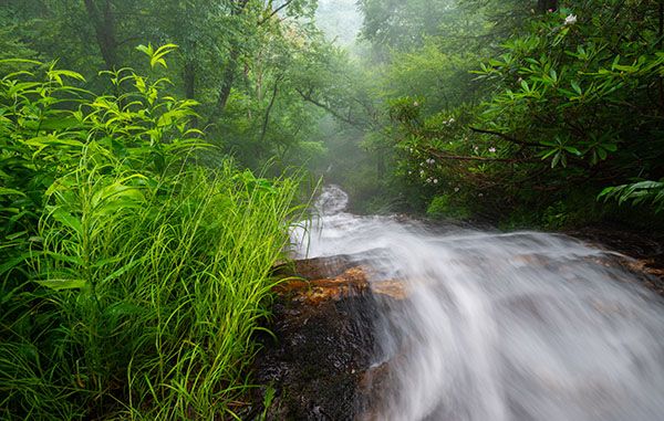
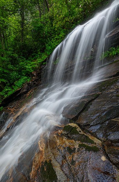
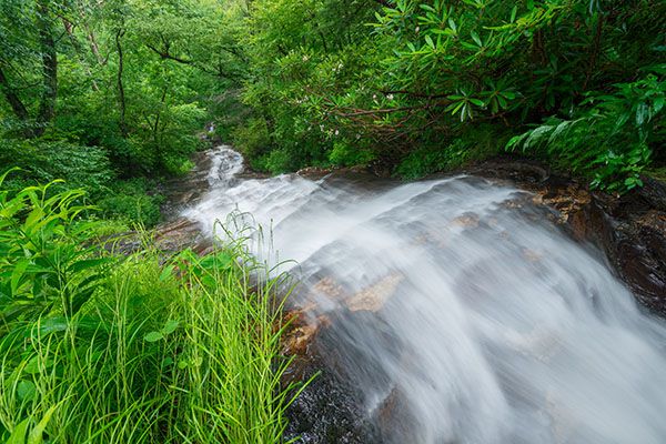
Cascade Falls
Cascades
!
Cascade Falls is part of E. B. Jeffress Park, which features historical structures and a picnic area and is among the most popular stops along the Blue Ridge Parkway. The easy hike to the waterfall makes a great family outing and is a perfect complement to a picnic stop. In spring and summer, numerous wildflower species grow on the banks surrounding the falls, as well as along the trail.
(016A-122364)
Driving Directions
Open driving directions in map appA well-signed parking area is located at Milepost 271.9 of Blue Ridge Parkway, 4.4 miles north of the US 421 underpass at Deep Gap. Deep Gap is about 15 miles east of Boone.
Hiking Directions
Quick Glance
The trail begins in front of restrooms and is easily followed to the falls.
Detailed Look
The interpretive nature trail begins at the north end of the parking area in front of the restrooms. After 250 feet, the trail forks; it’s a loop, so take your pick. To the right, the trail runs along the edge of the escarpment and descends to a footlog over Fall Creek at 0.35 miles. The left part of the loop rejoins the trail just beyond this crossing. Head downstream and descend the stone steps to reach the upper viewpoint of the falls at 0.4 miles. The path continues a couple hundred feet to a lower viewpoint.
| Accessibility: | Hiking trail |
| County: | Wilkes |
| River Basin: | Yadkin-Pee Dee |
| Watercourse: | Fall Creek |
| Watershed: | Very small |
| Type and Height: | Long, sliding cascade with a freefalling section near the top |
| Landowner: | Blue Ridge Parkway |
| Beauty Rating: | 6 |
| Elevation: | 3400 feet |
| USGS Map: | Maple Springs |
| Hike Difficulty: | Easy The trail is easy, but there are steps. |
| Hike Distance: | 0.4 miles |
| Waterfall GPS: | 36.24948, -81.45523 This is from the upper viewpoint. |
| Trailhead GPS: | 36.2456, -84.45805 |
Photo Gallery
Click a photo to enlarge.