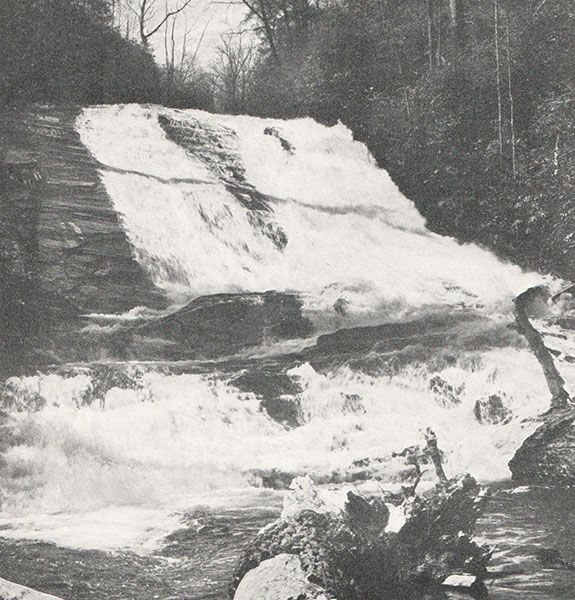
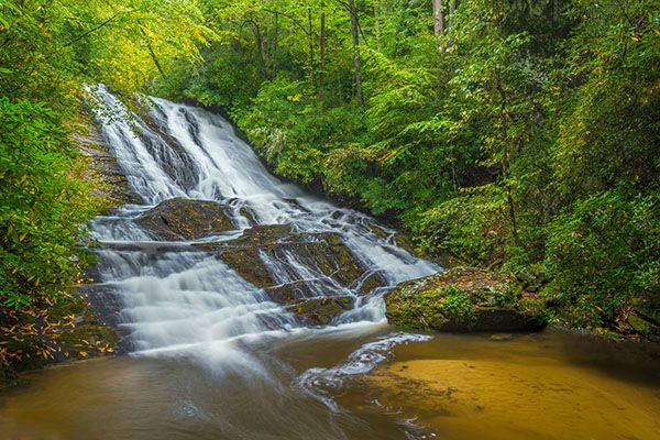
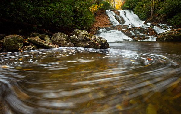
Catheys Creek Falls
!
Catheys Creek Falls is close to the road, but reaching the base requires hiking a steepish path and a little scrambling. And for the best view, you may need to wade the pool depending on the current arrangement of fallen trees, which seems to change after every flood. It’s a nice falls that I highly recommend.
(018A-125999)
Driving Directions
Open driving directions in map appIf you’re in the Davidson River vicinity, drive to Gloucester Gap, which is on FS 475 some 6.05 miles from US 276. From the gap, turn left on FS 471 (Catheys Creek Road) and drive 4.8 miles to a tiny pullout on the left, 0.2 mile beyond where the road crosses Catheys Creek. You’ll pass Upper Shoals and the trailhead for Kuykendall Falls on the way.
To get here from downtown Brevard, drive 3.3 miles west on US 64 and turn right at the sign for Kuykendall Group Camp. After turning, make an immediate left on Catheys Creek Road and drive 3.2 miles to the pullout. Catheys Creek Road becomes unpaved after 0.7 miles.
Hiking Directions
Quick Glance
Follow the obvious path to the falls.
Detailed Look
Follow the obvious path to the falls. You may have to do a little scrambling as you near the base and to get an open view of the falls you’ll need to wade into the pool. Sometimes there are fallen trees on the downstream end of the pool you can use to cross over to the other side.
| Accessibility: | Hiking trail |
| County: | Transylvania |
| River Basin: | French Broad |
| Watercourse: | Catheys Creek |
| Watershed: | Small |
| Type and Height: | Long, steep sliding cascade into large pool approx. 80 feet high Height estimated. |
| Landowner: | Pisgah NF, Pisgah RD |
| Beauty Rating: | 7 |
| Elevation: | 2560 feet |
| USGS Map: | Rosman |
| Hike Difficulty: | Moderate+ |
| Hike Distance: | A little over 100 yards |
| Waterfall GPS: | 35.22617, -82.80245 |
| Trailhead GPS: | 35.22563, -82.80253 |
Photo Gallery
Click a photo to enlarge.
Historical Gallery
Click a photo to enlarge.