Cedar Falls
!
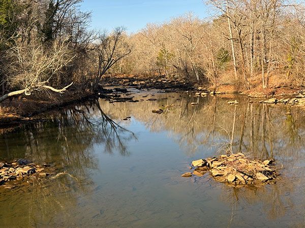
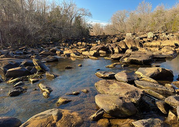
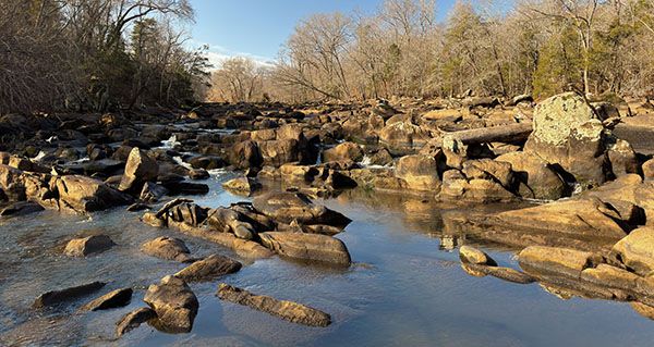
My favorite named waterfall on Deep River, Cedar Falls has an impressive rock garden that looks more like something from the western part of the state than the Piedmont. But don’t come here expecting to find any freefalling waterfalls. Like all named falls on Deep River, Cedar Falls is mainly just a rapid, although at the right water level I’d call it more a cascade.
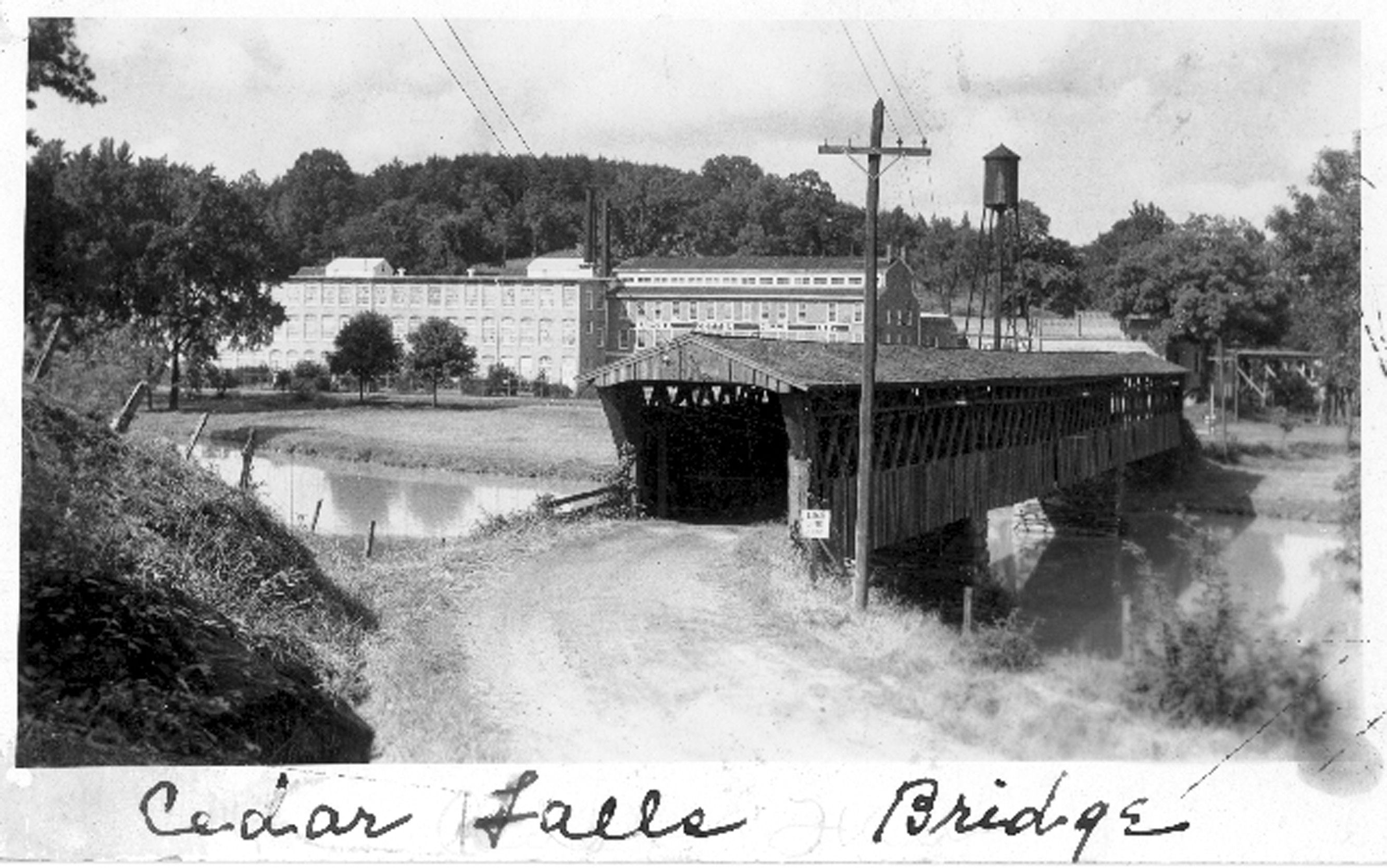
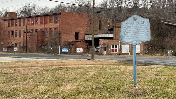
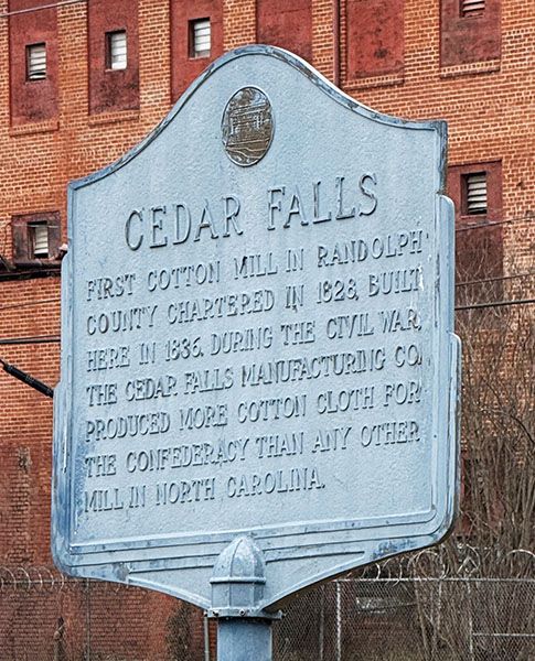
History buffs will have a blast here. Cedar Falls powered an early cotton mill that supplied fabric for Confederate soldiers during the Civil war. Unlike so many of North Carolina’s 19th century textile mills, the Cedar Falls Manufacturing Company mill is still standing, or at least part of it is.
The original mill opened in 1837 in a wood frame building. It was replaced with a brick building in 1846. Most of what you see today is from work done in the 1950s, although some of the original 1846 brickwork remains.127
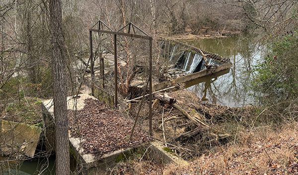
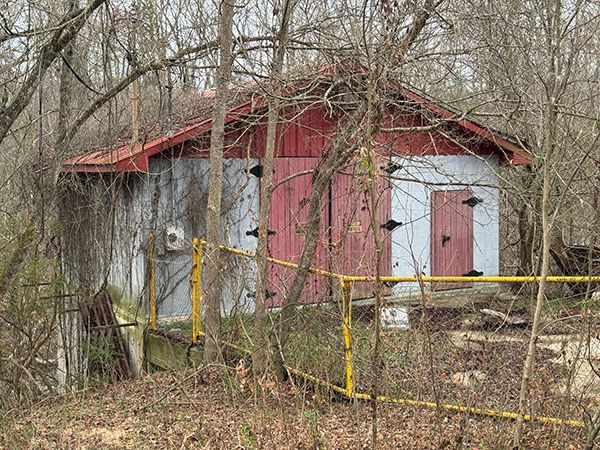
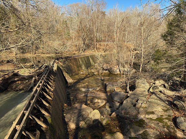
In addition to the mill building, you can walk up to the main dam and to the old powerhouse and smaller dam above it. The main dam isn’t very exciting, but the powerhouse is kinda cool. Cedar Island, the large island between the canal and river, is fun to explore.
For information about Deep River in general, including a table listing all the waterfalls on the river, visit the River Basins & Rivers page and click on the Cape Fear River Basin tab.
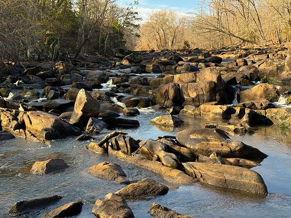
The rock garden at Cedar Falls during low water. (027C-269479)
Driving Directions
Open driving directions in map appThe mill and parking area are located at the intersection of Wicker Lovell Road, Cedar Falls Road, White’s Memorial Road, and Loflin Pond Road. It is about 2 miles from US 64/NC 49 on Loflin Pond Road.
Hiking Directions
Quick Glance
You can see some of the rapids from near the large parking area by the river, but to see the big rock garden and the dam, you must cross the canal to Cedar Island and follow the path upstream.
Detailed Look
To have the best experience here, you must cross the canal to Cedar Island. The old footbridge washed away during Hurricane Florence in 2018, so if the water is up, you’re gonna get wet. The best place to cross is at the upstream end of the large concrete parking lot.
Once on the island, you should find an obvious path that goes upstream. It’s about a half mile to the dam. You’ll pass the rock garden along the way. Depending on the water level, it could be just a jumble of mostly dry, big boulders, an area of really cool cascades, or a frightening Class IV rapid. Chances are, if it’s the latter, you probably wouldn’t cross the canal to the island because the water would be too deep.
There is no trail to the power plant and the small dam at it, but the woods here are pleasantly open and easy to walk through. The best option might be to walk up to the main dam, then follow the canal down to the powerhouse.
You can see the dam and powerhouse from Wicker Lovell Road, 0.35 miles from the intersection at the mill. However, it’s mostly overgrown and there is no good place to park along the road.
Randolph Heritage Conservancy owns an old steel bridge that they plan to install for access to the island, but they need funds to make this happen. Please consider making a donation.
| Accessibility: | Hiking trail |
| County: | Randolph |
| River Basin: | Cape Fear |
| Watercourse: | Deep River |
| Watershed: | Medium/large |
| Type and Height: | River rapid |
| Landowner: | Randolph Heritage Conservancy |
| Experience Rating: | Remarkable |
| Elevation: | — |
| USGS Map: | Grays Chapel |
| Hike Difficulty: | Easy/moderate |
| Hike Distance: | About 0.5 miles to dam |
| Waterfall GPS: | 35.75158, -79.73669 Reading made at the approximate midpoint of the rock garden. |
| Parking GPS: | 35.752299, -79.733081 This is the location on the parking lot where you can most easily cross the canal to Cedar Island. |
Photo Gallery
Click a photo to enlarge.

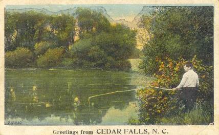
Historical Gallery
Click a photo to enlarge.