Chestnut Falls
!
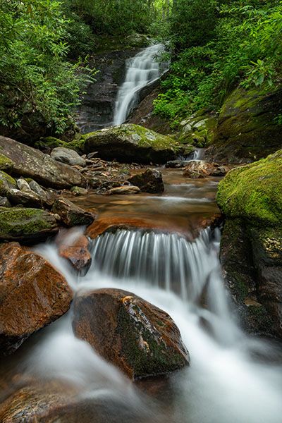
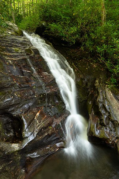
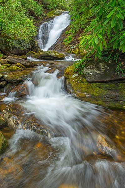
Chestnut Creek carved out the rock at Chestnut Falls, creating a cool micro canyon at the base. You’ll need to wade up to the base or scramble around on the river-right side to appreciate this waterfall fully.
(022C-100380)
Driving Directions
Open driving directions in map appThe trailhead is the same as Courthouse Falls and the upper waterfalls on Courthouse Creek, Cody Falls, and the lower waterfalls on Chestnut Creek. From Beech Gap on Blue Ridge Parkway, drive 6.65 miles south on NC 215 and turn left on the gravel FS 140 (Courthouse Creek Road). FS 140 is 10.4 miles north of US 64. Follow the road for 2.5 miles to the gate and park in the cleared area on the left. This trailhead is 0.2 miles farther on FS 140 than the trailhead for Kiesee Falls and Upper Kiesee Falls.
Note that as of this writing, FS 140 is closed indefinitely. If it is closed when you visit, you’ll have to park in the area beside NC 215, across from FS 140, and walk the road.
Hiking Directions
Quick Glance
Hike 0.1 miles on FS 140, turn right on FS 5031, hike 0.8 miles to a fork, take the path on the left that leads down to the falls.
Detailed Look
Walk past the gate on FS 140 and continue about 0.1 miles to FS 5031 (Kiesee Creek Road) on the right. Follow FR 5031 on a moderate uphill grade. Whenever you come to a fork or a road turning right, go left on the more obvious road. You’ll top out and begin a gradual descent along a narrow ridge. Continue staying to the left at any junctions. At a little over 0.8 miles from FR 140, you’ll come to a fork at a grassy area. Look for a path entering the woods on the left. It may be a little hard to find but look around and you should see it. The path leads several hundred feet to Chestnut Creek near the waterfall. The path is overgrown and has several fallen trees over it.
| Accessibility: | Hiking trail |
| County: | Transylvania |
| River Basin: | French Broad |
| Watercourse: | Chestnut Creek |
| Watershed: | Small |
| Type and Height: | Cascading falls about 20 feet high Height estimated. |
| Landowner: | Pisgah NF, Pisgah RD |
| Beauty Rating: | 5 |
| Elevation: | 3720 feet |
| USGS Map: | Sam Knob |
| Hike Difficulty: | Moderate Class I bushwhack |
| Hike Distance: | A little over 1 mile |
| Waterfall GPS: | 35.27882, -82.88733 |
| Trailhead GPS: | 35.269447, -82.8891 |
Photo Gallery
Click a photo to enlarge.