Courthouse Falls
!
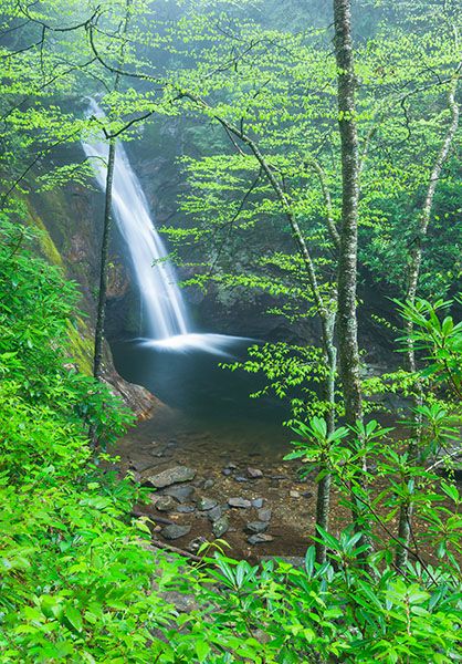
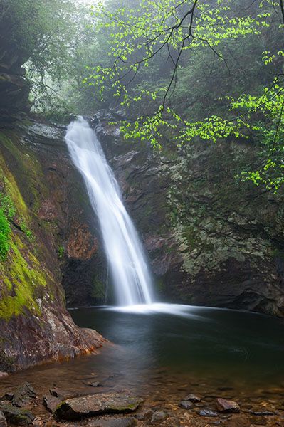
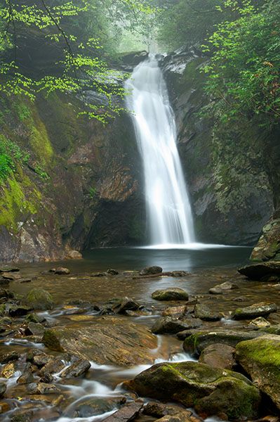
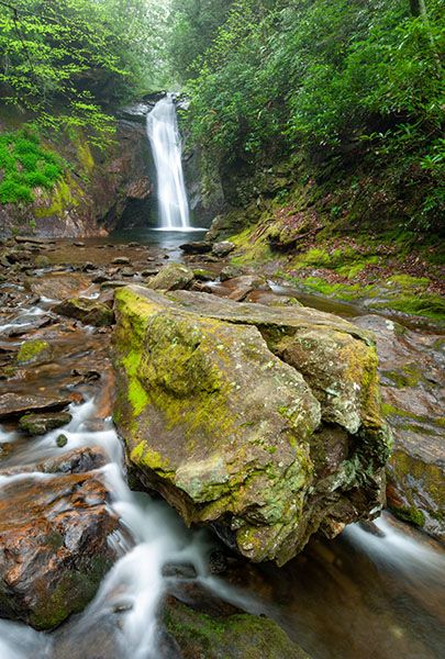
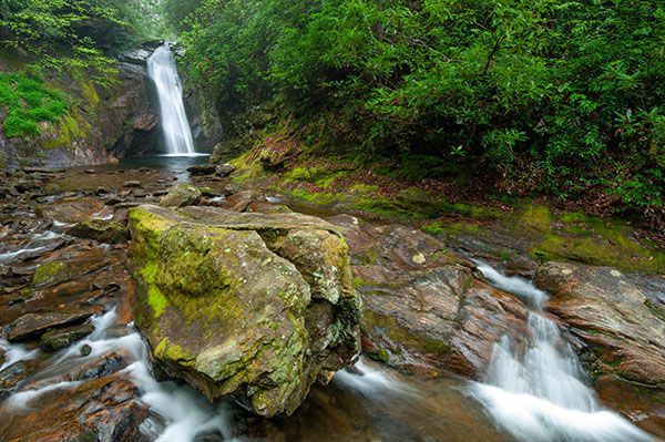
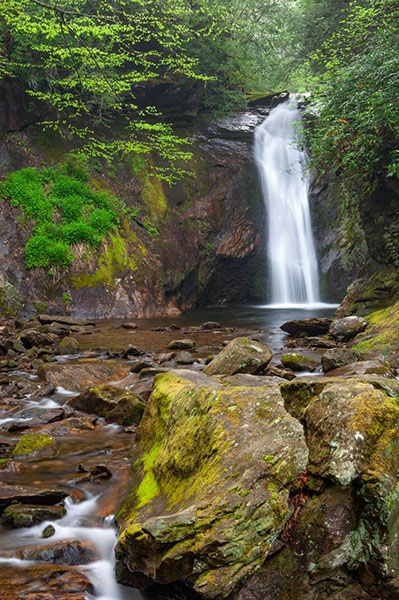
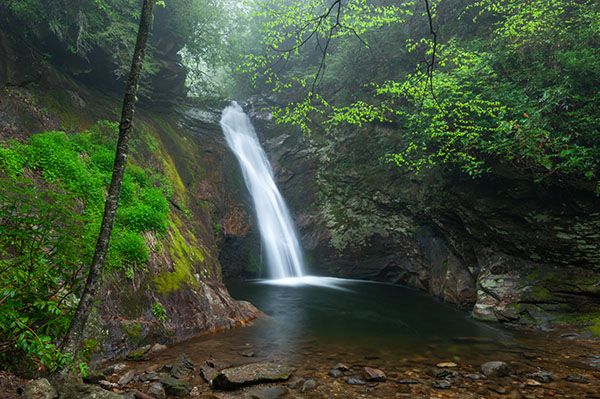
Courthouse Falls has always been among my favorites. Courthouse Creek descends a narrow chute at the head of a small amphitheater carved out of solid rock surrounding a deep plunge pool.
(022A-15740)
Driving Directions
Open driving directions in map appThe trailhead is the same as Chestnut Falls. From Beech Gap on Blue Ridge Parkway, drive 6.65 miles south on NC 215 and turn left on the gravel FS 140 (Courthouse Creek Road). FS 140 is 10.4 miles north of US 64. Follow the road for 2.5 miles to the gate and park in the cleared area on the left. This trailhead is 0.2 miles farther on FS 140 than the trailhead for Kiesee Falls and Upper Kiesee Falls.
Note that as of this writing, FS 140 is closed indefinitely. If it is closed when you visit you’ll have to park in the area beside NC 215, across from FS 140, and walk the road.
Hiking Directions
Quick Glance
From the gate on FS 140, follow the road 0.5 miles to the bridge over Courthouse Creek. Hike the trail that follows the creek downstream for 0.3 mile and take the side path on the left that descends to falls.
Detailed Look
Hike or drive FS 140 for 2.5 miles to the gate, then continue another 0.5 miles to the bridge over Courthouse Creek. (You'll pass FS 5031, 0.1 miles from the gate. This is the access for Chestnut Falls and the waterfalls downstream from it.) Summey Cove Trail begins immediately beyond the bridge and follows the creek downstream. Follow it 0.3 miles to where it starts swinging to the right. An obvious side path is here on the left. This path descends to the base of the falls, passing by the side path to Cody Falls on the way.
| Accessibility: | Forest road and hiking trail |
| County: | Transylvania |
| River Basin: | French Broad |
| Watercourse: | Courthouse Creek |
| Watershed: | Small |
| Type and Height: | 35-foot high, steep slide into large, deep pool Height measured with rangefinder. |
| Landowner: | Pisgah NF, Pisgah RD |
| Beauty Rating: | 7 |
| Elevation: | 3360 feet |
| USGS Map: | Sam Knob |
| Hike Difficulty: | Moderate Class I bushwhack |
| Hike Distance: | 0.9 miles |
| Waterfall GPS: | 35.27157, -82.89431 |
| Trailhead GPS: | 35.269447, -82.8891 The trailhead on FS 140, 2.5 miles from NC 215. |
Photo Gallery
Click a photo to enlarge.