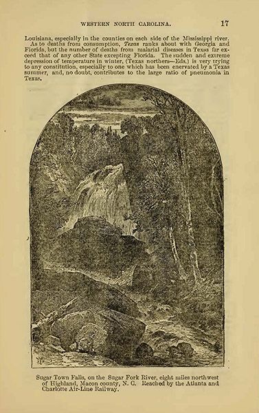
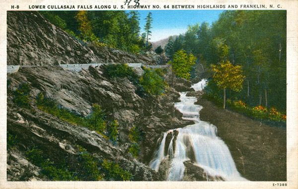
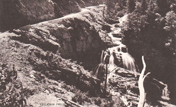
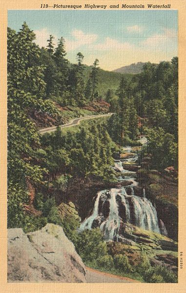
Cullasaja Falls
!
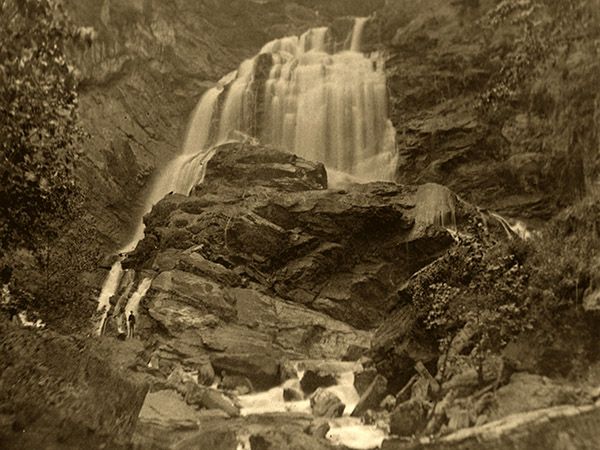
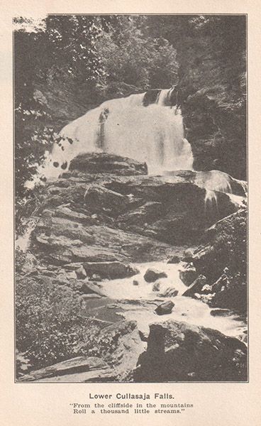
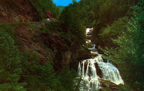
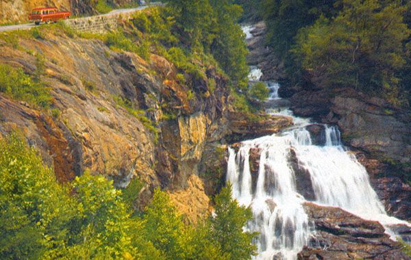
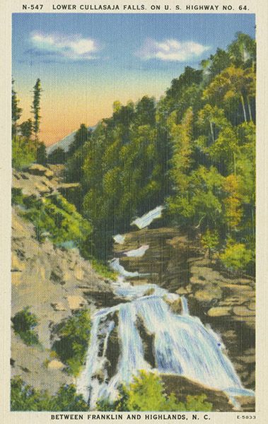
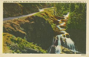
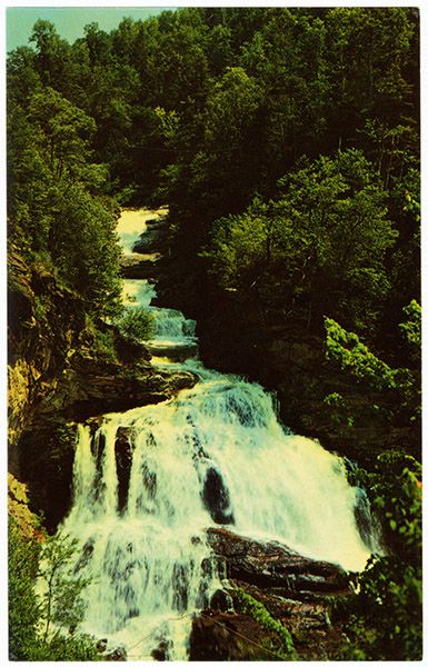
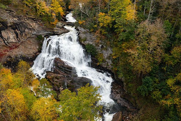
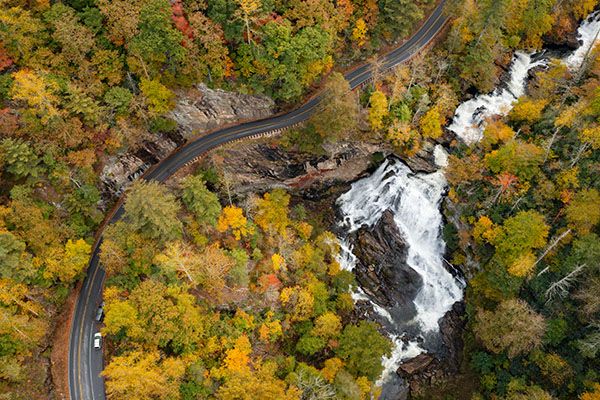
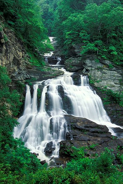
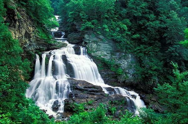
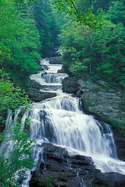
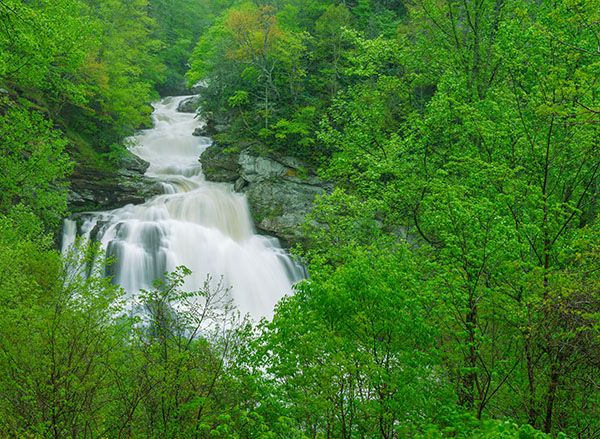
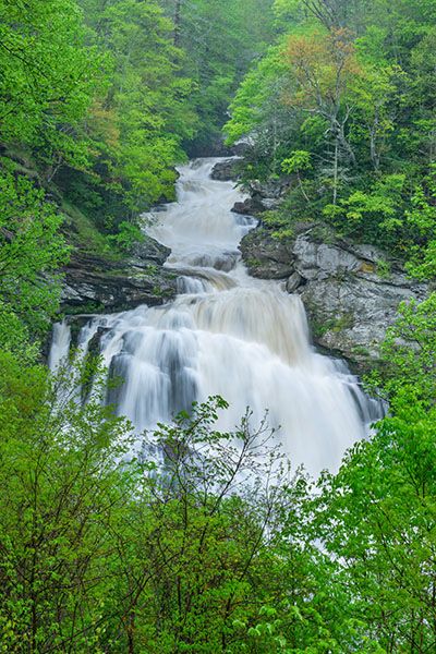
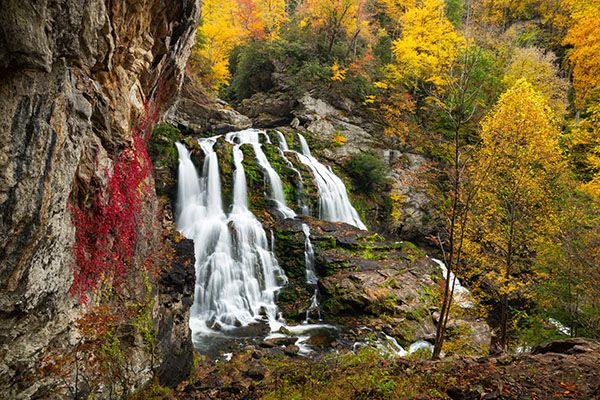
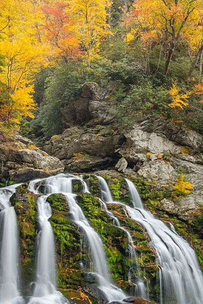
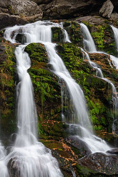
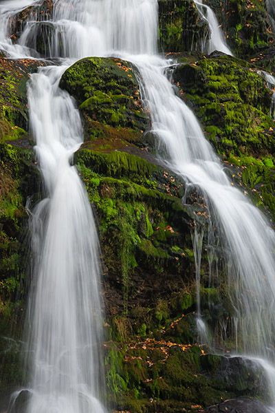
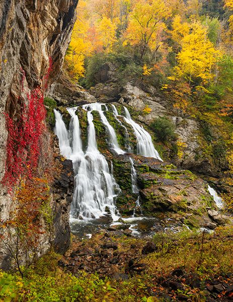
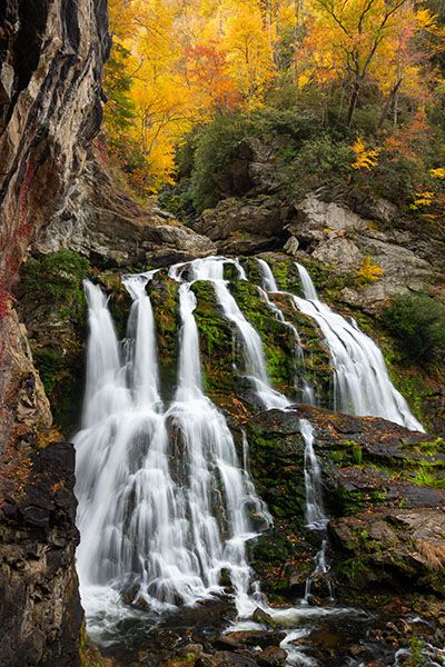
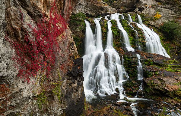
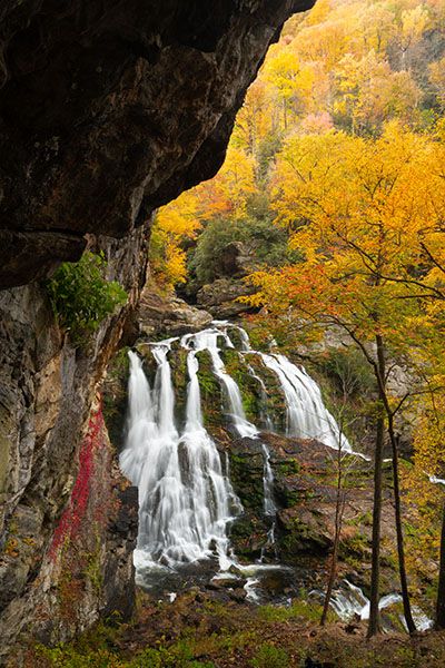
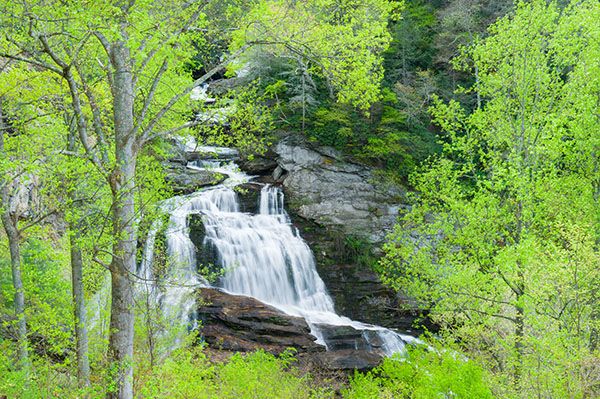
Cullasaja River makes a final plunge over Cullasaja Falls before leaving the gorge and calming down. What a final statement it makes! When the water is flowing well, this is about as good as it gets from a viewing and photography standpoint. Jane Corey, in Exploring the Waterfalls of North Carolina, calls Cullasaja Falls the “’blockbuster’ of six waterfalls along the Cullasaja River.”171 I agree, but I think Dry Falls is close on its heals.
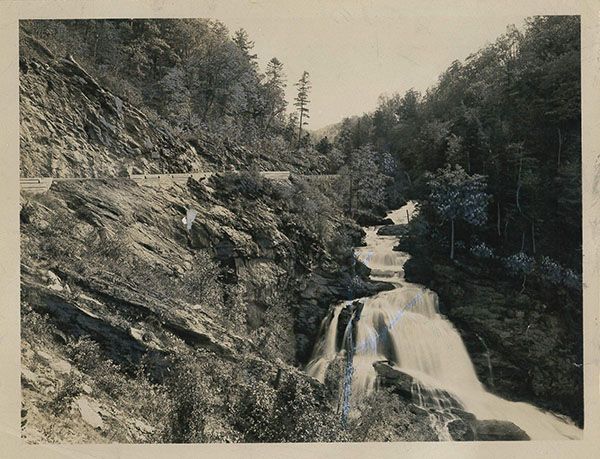
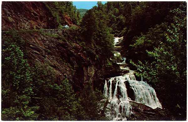
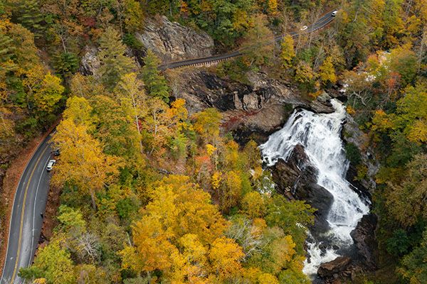
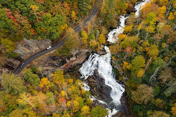
Unfortunately, viewing the waterfall is problematic. There is very little parking at the narrow pullout and trees now block the view from the road. Several years ago, after the Forest Service (I assume) cleared the trees, you had a spectacular view right from your car. Now, to get an open view, you must climb up the little knoll and then down the steep slope. Loose rocks make this a sketchy affair.
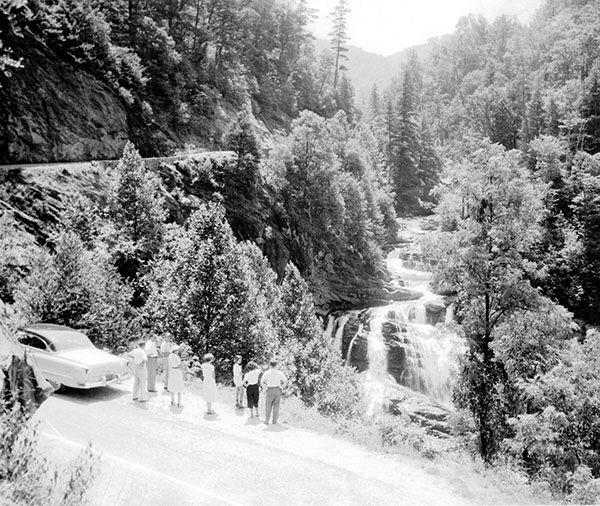
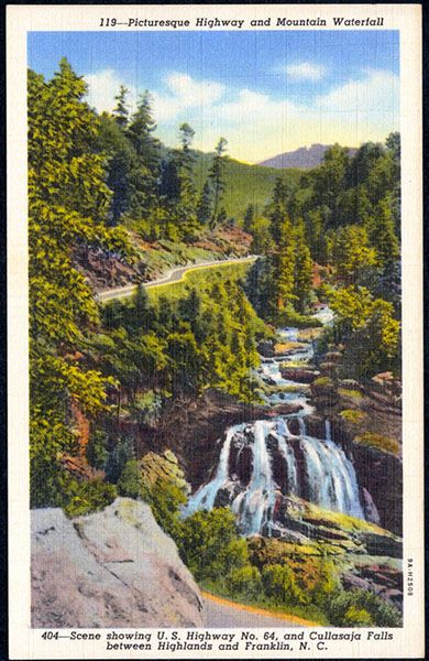
The section of US 64 near Cullasaja Falls is one of the more spine-tingling in the state, with the road literally carved out of the near-vertical mountainside. As one newspaper article stated, “Those who handle the drills hang to the side of the gorge in saddles swung from ropes fastened to iron pins set in holes drilled further up the mountain. A fall here would mean instant death. Across from the highway on the opposite side of the river rises a solid rock cliff more than 500 feet in height an ideal spot for Borglum to carve a memorial to the Cherokees.”153
Several years ago, the Forest Service had engineers study the feasibility of building a parking and viewing area suspended on piers, but as far as I know there are no plans to build such a structure.
Read the Cullasaja River section for an overview of the river and its waterfalls, including a list of landmarks with mile markers. You can find it by clicking the Little Tennessee River Basin button on the Rivers page.
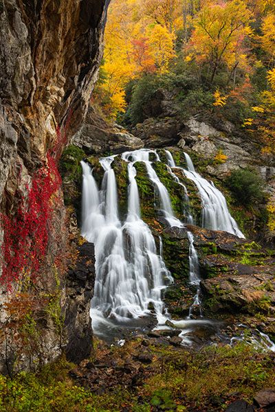
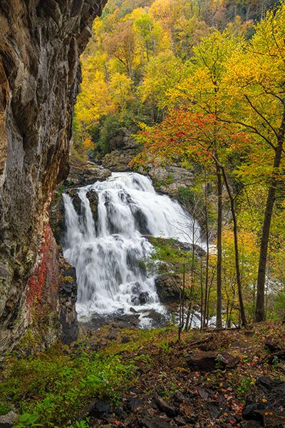
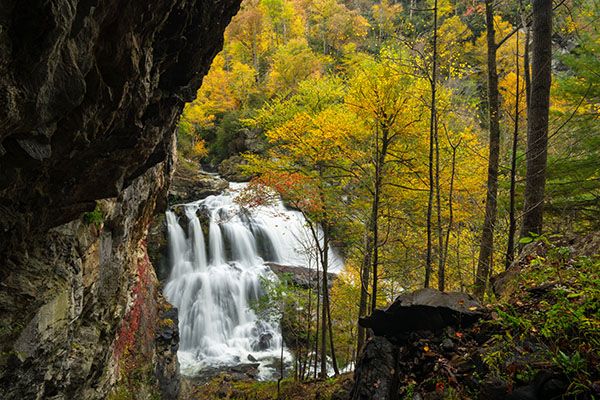
Autumn view of Cullasaja Falls. (025F-211266)
Driving Directions
From the junction of US 64 and NC 106 in Highlands, drive 8.8 miles west on US 64 to the narrow pullout on the left. This is 10.25 miles east of US 23/441 in Franklin.
If you’re driving from Highlands, I recommend that you drive past the pullout and turn around farther down the road at a safe spot and drive back to the pullout. That way, you’ll be able to enter and exit the pullout without having to cross traffic at this dangerous curve.
Hiking Directions
Quick Glance
Walk up the road a short distance, climb up on the little knoll, then descend until you get the view you want.
Detailed Look
The Quick Glance pretty much sums it up.
Other Hiking Options
From the lower end of the pullout there is a rough path that descends steeply to the base of the falls. Once you reach the river, you must do a lot of scrambling to get views of the waterfall. I’m not crazy about the view from down there, but I know others who like it.
| Accessibility: | Roadside view |
| County: | Macon |
| River Basin: | Little Tennessee |
| Watercourse: | Cullasaja River |
| Watershed: | Medium |
| Type and Height: | Steep, cascading falls about 180 feet high |
| Landowner: | Nantahala NF, Nantahala RD |
| Beauty Rating: | 10 |
| Elevation: | 2600 feet |
| USGS Map: | Scaly Mountain |
| Hike Difficulty: | View roadside You’ll need to do a little scrambling to get an open view. |
| Hike Distance: | — |
| Waterfall GPS: | 35.11782, -83.27071 This is for the roadside view of the waterfall. |
| Parking GPS: | — |
Photo Gallery
Click a photo to enlarge.
Historical Gallery
Click a photo to enlarge.