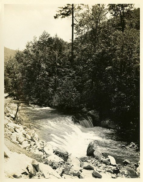
Waterfall 1 on Cullasaja River
!
Despite its location right beside US 64 and a short distance upstream from the well-known Quarry Falls, this waterfall is relatively unknown. I’ve known about it for decades but didn’t include it in the first two editions of North Carolina Waterfalls and gave it only a brief mention in the third edition. As with many other waterfalls, I’m finally given it its due on this website.
Read the Cullasaja River section for an overview of the river and its waterfalls, including a list of landmarks with mile markers. You can find it by clicking the Little Tennessee River Basin button on the Rivers page.
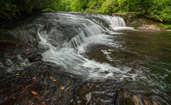
Waterfall on Cullasaja River above Quarry Falls. This is the upper section.(025E1-25681)
Driving Directions
Open driving directions in map appFrom the junction of US 64 and NC 106 in Highlands, drive 6.4 miles west on US 64 to the large parking area on the right. This is 10.35 miles east of US 23/441 in Franklin.
Hiking Directions
Quick Glance
Cross the road and walk upstream to the path leading down between the two sections.
Detailed Look
Cross US 64, step over the guardrail, and walk a little over 100 yards upstream on the path that runs by the guardrail. You’ll come to a short, steep scramble path that descends to the river between the upper and lower drop.
To view the lower drop from the base, you’ll need to climb down the bank at a point downstream and work your way up the river. You’ll probably need to cross the river for the best view, which will be difficult and dangerous if the water is up. Crossing the river between the two drops is not recommended for obvious reasons.
| Accessibility: | Bank scramble |
| County: | Macon |
| River Basin: | Little Tennessee |
| Watercourse: | Cullasaja River |
| Watershed: | Medium |
| Type and Height: | Two 9-foot drops about 100 feet apart Height measured with rangefinder. |
| Landowner: | Nantahala NF, Nantahala RD |
| Beauty Rating: | 4 |
| Elevation: | 2840 feet |
| USGS Map: | Scaly Mountain |
| Hike Difficulty: | Moderate/difficult |
| Hike Distance: | About 125 yards |
| Waterfall GPS: | 35.091836, -83.267946 |
| Trailhead GPS: | 35.092356, -83.267099 |
Historical Gallery
Click a photo to enlarge.