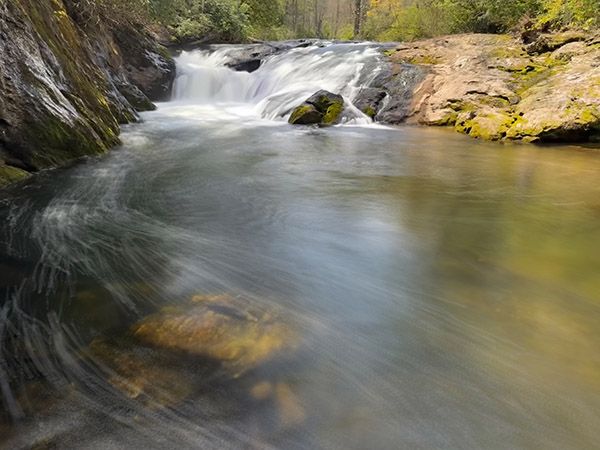
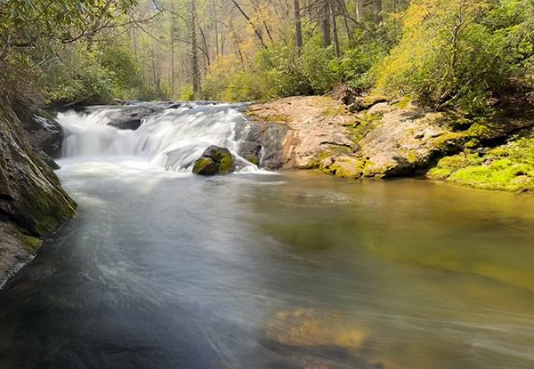
Waterfall 2 on Cullasaja River
!
Most folks who drive along US 64 between Franklin and Highlands have no idea this waterfall exists. I’ve known about it for as long as I’ve been waterfalling, but gave it only a cursory mention in my waterfall book. But don’t get too excited about a grand new waterfall to visit. This one isn’t on par with Cullasaja River’s other waterfalls and reaching a view of it requires an insanely steep scramble down the bank.
Read the Cullasaja River section for an overview of the river and its waterfalls, including a list of landmarks with mile markers. You can find it by clicking the Little Tennessee River Basin button on the Rivers page.
(025N-262763)
Driving Directions
Open driving directions in map appFrom the junction of US 64 and NC 106 in Highlands, drive 5 miles west on US 64 to a narrow, paved pullout on the left. This is 11.75 miles east of US 23/441 in Franklin.
Hiking Directions
Quick Glance
Walk a few yards downstream from the pullout, then take the path down the bank.
Detailed Look
Walk on road beside the guardrail for a few yards to the obvious scramble path. The descent will be easier (and safer) if you slide down on your butt. You’ll come out at the pool below the falls.
| Accessibility: | Bank scramble |
| County: | Macon |
| River Basin: | Little Tennessee |
| Watercourse: | Cullasaja River |
| Watershed: | Medium |
| Type and Height: | Cascading, sliding, and freefalling falls, 12 feet high |
| Landowner: | Nantahala NF, Nantahala RD |
| Beauty Rating: | 3 |
| Elevation: | 3200 feet |
| USGS Map: | Scaly Mountain |
| Hike Difficulty: | Difficult |
| Hike Distance: | Short bank scramble |
| Waterfall GPS: | 35.080627, -83.258404 |
| Trailhead GPS: | 35.080474, -83.258106 |
Photo Gallery
Click a photo to enlarge.