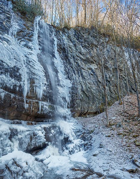
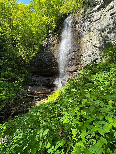
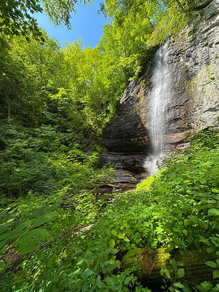
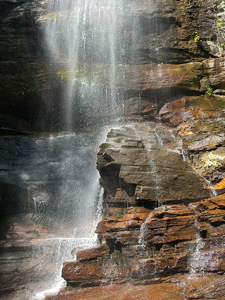
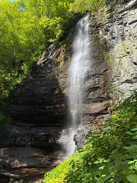
Cutler Falls
Justice FallsSpear Falls
!
Cutler Falls lies on the headwaters of Justice Creek, a tributary of North Toe River that springs from the northwest summit of Spear Tops, a prominent landmark seen by motorists traveling US 19E. Thanks go to Southern Appalachian Highlands Conservancy for facilitating the protection of the 260-acre tract that includes this beautiful waterfall.
A very special thanks goes to Laura Mitchell, who in 2012 sold the tract to SAHC instead of developers. The tract joins other nearby acquisitions made by SAHC, including a 7,500-acre donation made by philanthropist Tim Sweeney. Some 4,000 acres of the property comprises Yellow Mountain State Natural Area.
Downstream from Cutler Falls are two or three smaller waterfalls. In winter, they are plainly visible from the old road high above. When I hiked to Cutler in 2015 there were no paths down to them and I didn’t investigate up close. I had intended to check them out when I returned in July 2025 (bushwhacking down if there were still no paths) but the steep slopes were carpeted so thickly in wood nettle that I chose to wait until a winter hike.
(118H-265057)
Driving Directions
Open driving directions in map appFrom the junction of US 19E and NC 226 in Spruce Pine, drive east on US 19E for 10.6 miles and turn left onto the little grassy road on the left. Park to the side of the road without blocking the gate. (Just before the grassy road is an old store with a road beside it. The road you want is the entrance into a pasture and doesn’t look much like a road.)
Hiking Directions
Quick Glance
Follow the road beyond the gate through the pasture and continue following it upstream to the waterfall.
Detailed Look
Close the gate behind you and follow the grassy road through the pasture for less than 0.2 miles to another gate. If the road hasn’t been mowed recently, it will be overgrown but not as much as the pasture surrounding it.
Climb over the gate or take the side path on the left that leads a few feet down to Justice Creek, cross (easy rockhop) and swing back to the road. Continue on the old road for 0.4 miles to another creek crossing, also an easy rockhop. Fifty feet beyond the creek the road splits, with one going straight ahead and one turning left. Turn left and ascend beside the creek.
You’ll follow the old road upstream for a little over a half mile. There will be several side paths and overgrown roads branching off. Stay on the wider, more obvious road. Toward the bottom, the road swings away from the creek for a distance, then comes back to it. In summer, it is heavily overgrown in wood nettle.
When you get close to the falls the road makes a sharp right switchback, turning away from the creek, while a spur continues straight ahead and shortly ends in plain view of the waterfall. From here, a scramble path descends about 100 yards to the base of the falls.
If you’re hiking in summer, the road is so overgrown in wood nettle and other herbaceous plants that it’s easy to miss the switchback section on the way back (I did) and you could mistakenly go the wrong way. Just remember, on the way back it’s all downhill. If you go the wrong way at the switchback, you’ll start hiking uphill.
| Accessibility: | Forest road |
| County: | Avery |
| River Basin: | French Broad |
| Watercourse: | Justice Creek |
| Watershed: | Very small |
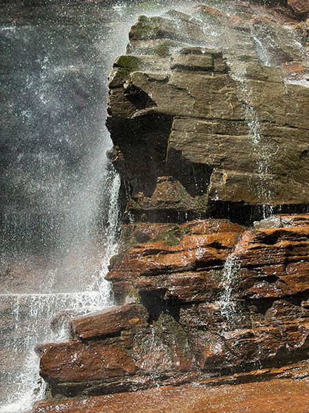
| Type and Height: | 94-foot high freefalling and rock-hugging steep drop over huge cliff Height measured with rangefinder. |
| Landowner: | Yellow Mountain State Natural Area |
| Beauty Rating: | 7 |
| Elevation: | 3819 feet |
| USGS Map: | Carvers Gap NC/TN |
| Hike Difficulty: | Moderate+ |
| Hike Distance: | 1.2 miles |
| Waterfall GPS: | 36.015902, -82.041354 |
| Trailhead GPS: | 36.019629, -82.023815 |
Photo Gallery
Click a photo to enlarge.