Dills Falls
!
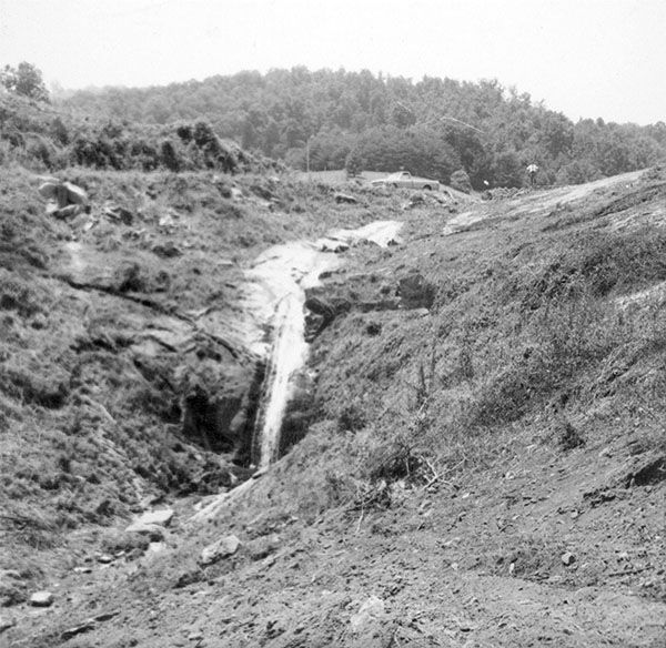
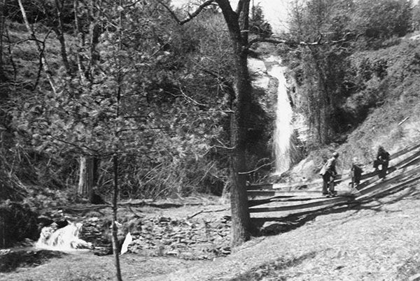
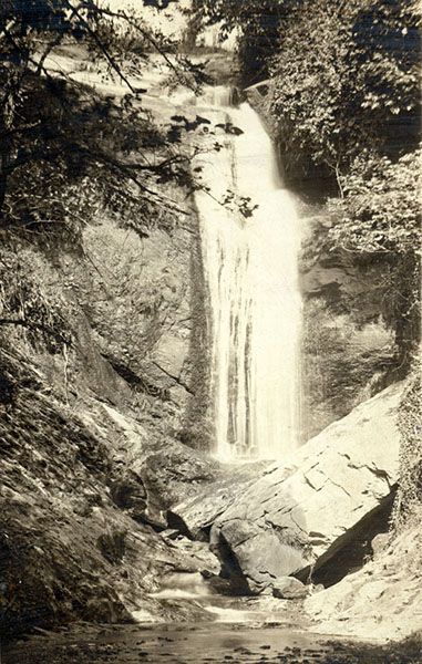
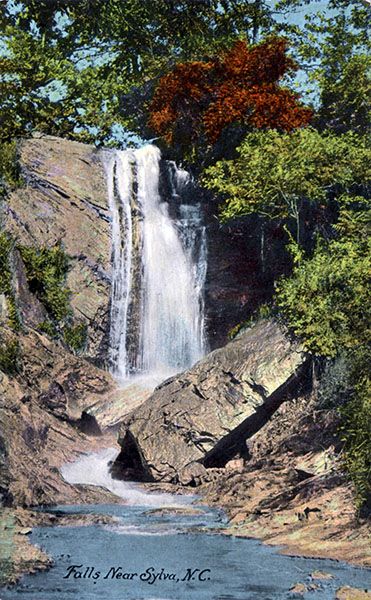
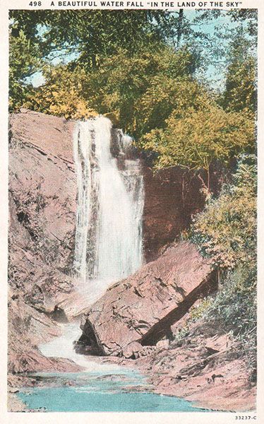
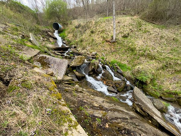
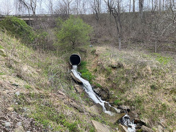
I’ve read many articles and blogs about this waterfall, all of them saying basically the same thing: Dills Falls was a waterfall within the corporate limits of Sylva (the only waterfall inside a city limits in the country) that was 249 feet high and was lost during construction of the US 74 bypass, which opened in 1974.
I have to admit, not much makes me more excited than sleuthing waterfall stuff like this and I’ve had a blast with this one. There’s a lot to unpack here, so let’s get started.
(085A-212641)
Driving Directions
Open driving directions in map appIt’s located beside Dills Cove Road Road in Sylva, right where the road goes under the US 74 bypass.
Hiking Directions
Quick Glance
Best bet is to make a quick glance from the road.
Detailed Look
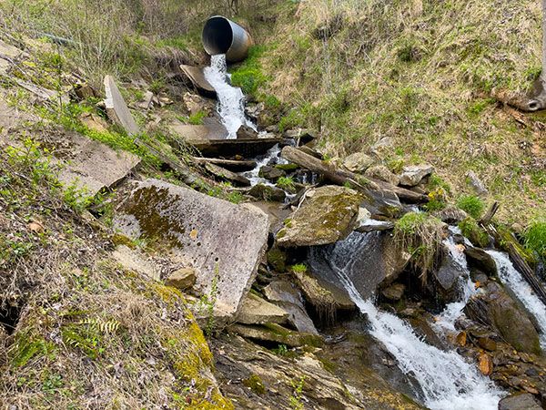
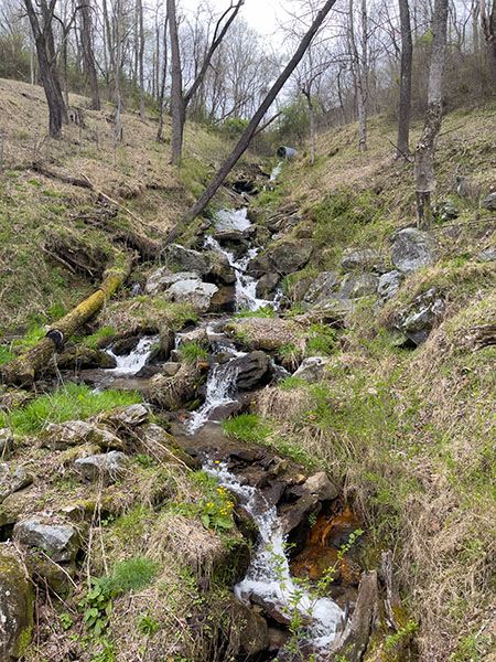
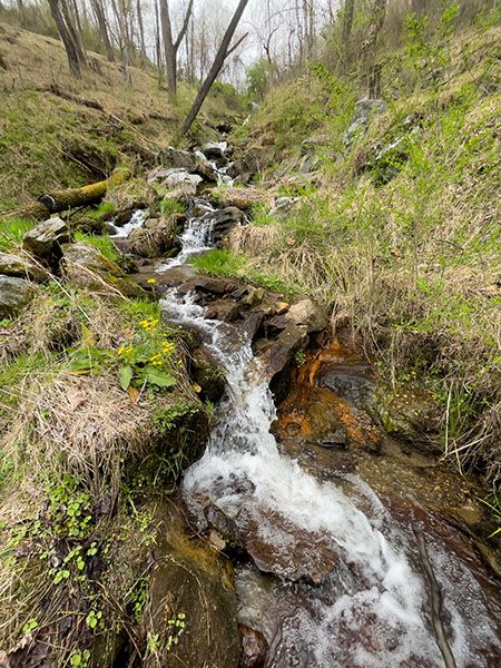
If you’re a waterfall sleuth like me, climb down the bank and see what you can figure out. Please let me know what you come up with.
| Accessibility: | Roadside view |
| County: | Jackson |
| River Basin: | Little Tennessee |
| Watercourse: | Roundbottom Creek |
| Watershed: | Very small |
| Type and Height: | Near vertical slide and freefall; no clue how high it was |
| Landowner: | State of North Carolina I believe the state owns US highway corridors. Dills Falls lies within the corridor of US 74. |
| Beauty Rating: | -1 |
| Elevation: | 2120 feet |
| USGS Map: | Sylva North |
| Hike Difficulty: | View roadside You can climb down the bank if you like, but unless you’re a waterfall sleuth like me, I don’t know why you would want to do that. |
| Hike Distance: | View roadside |
| Waterfall GPS: | 35.37974, -83.22863 This is a big fat guess. Okay, I'm sure the waterfall was within 100 feet of this point. |
| Trailhead GPS: | 35.379131, -87.228705 This is for a location on Dills Cove Road where you can see where the waterfall once existed. Or not. |
Photo Gallery
Click a photo to enlarge.
Historical Gallery
Click a photo to enlarge.