
Fairfield Falls
No trespassing: Private or restricted property.
Waterfallson this site and counting
!
Fairfield Falls is on Long Branch, the primary stream feeding Fairfield Lake. The waterfall practically drops into the lake. All the property around it, including the lake, is private, so you can’t see it unless you’re a guest of the resort area.
The waterfall is shown on the USGS topo map, as well as several other maps, so it’s not a secret. It’s just not open to the public.
Upstream from Fairfield Falls, and also shown on the USGS map, are Twin Falls and Maidenhair Falls. They are on private property as well.
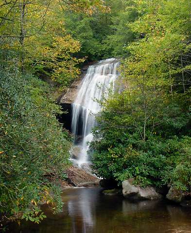
Photo of Fairfield Falls by Rich Stevenson.
SHOW MORE
| Accessibility: | — |
| County: | Jackson |
| River Basin: | Savannah |
| Watercourse: | Long Branch |
| Watershed: | — |
| Type and Height: | Small steep slide ending in freefall. |
| Landowner: | Private |
| Beauty Rating: | — |
| Elevation: | — |
| USGS Map: | Big Ridge |
| Hike Difficulty: | — |
| Hike Distance: | — |
| Waterfall GPS: | 35.13407, -83.04222 Reading taken from USGS map. |
| Parking GPS: | — |