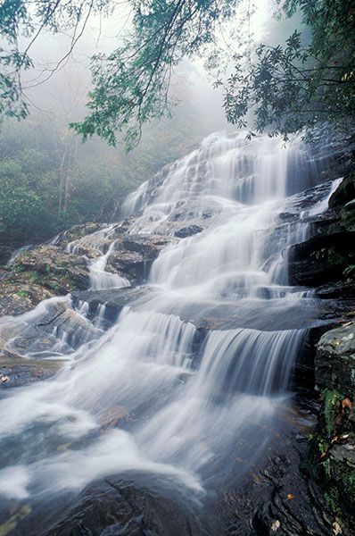
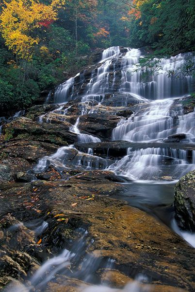
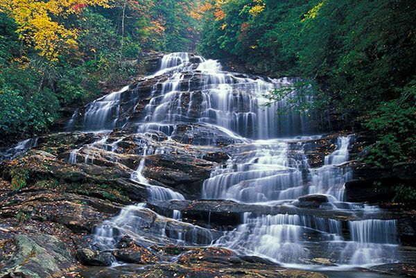
Glen Falls
!
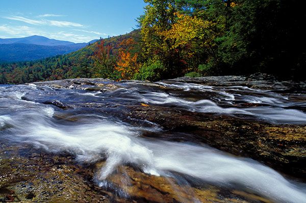
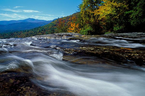
If you have time for only one waterfall hike in the Highlands area, Glen Falls is a good choice. For that matter, it’s a good choice if you see only one waterfall in western North Carolina. Here, you get many waterfalls in one since you can see only a portion of the waterfall from any single vantage point, of which there are many.
In the third edition of North Carolina Waterfalls, I gave Glen Falls a beauty rating of 9. After visiting several more times and exploring it more thoroughly, I’ve struggled with finding a reason for not giving it a 10. I don’t like struggling, so it’s a 10.
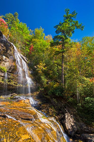
It’s hard to imagine there is 600 feet of falling water at Glen Falls, but if you include the entire run of waterfalls, it’s true. You might wonder why there aren’t separate names for what may seem like individual drops. These drops are sometimes referred to as the first, second, and third falls of Glen Falls, but they’re all considered Glen Falls.
Those designations were given because there are three distinct viewing points for the waterfall (actually, more), not because they are separate waterfalls, although it may seem as if there are. If you were to slide down the creek over all the waterfalls (not recommended) you would see that there is very little, if any, flat water between those three main sections. And the section considered the first falls is downstream from the true upper section.
I’m not gonna twist my brain on it. It’s all Glen Falls as far as I’m concerned.
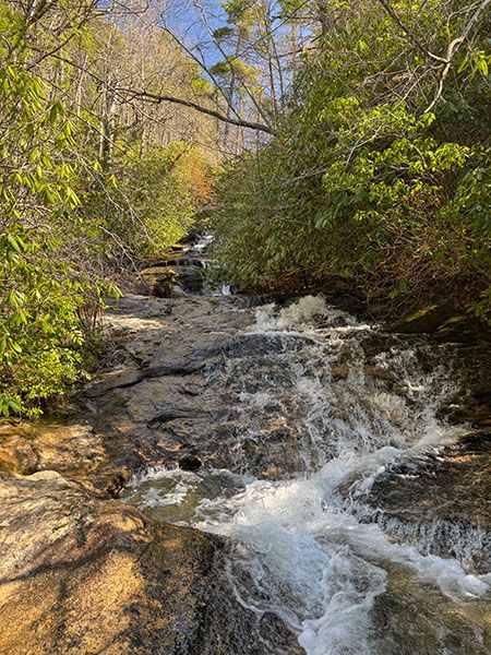
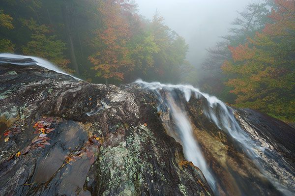
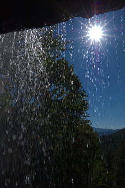
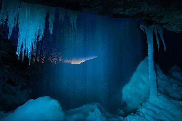
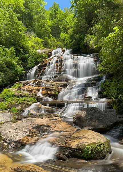
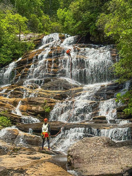
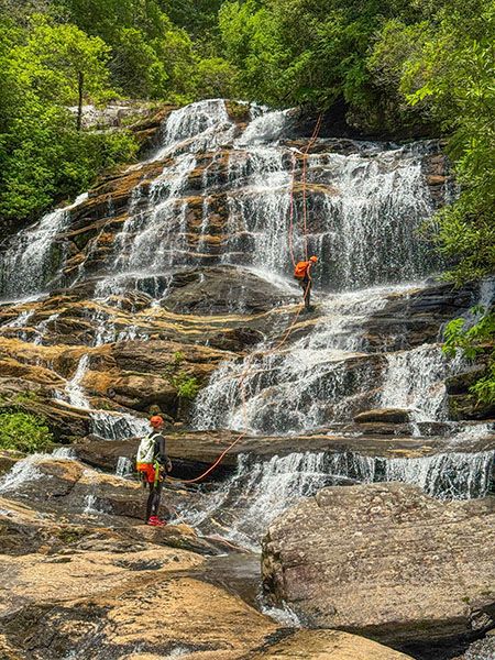
This is the section referred to as the second falls. (059A-116031)
Driving Directions
Open driving directions in map appFrom the junction of US 64 and NC 106 in Highlands, drive 1.75 miles south on NC 106 and bear left at the sign for Glen Falls. Don’t take Holt Road, which turns perpendicular to NC 106. Take the unpaved Glen Falls Road (SR 1618), which bears right, immediately after the turn off NC 106. Drive to the end of the road at 1.05 miles and park at the turnaround.
Hiking Directions
Quick Glance
Follow the trail down, taking all the trails that go right and left so you’ll see all the viewpoints. Best to turn around at the fenced viewpoint that has the pool at the base of the falls.
Detailed Look
Here’s a synopsis of the waterfall sections and viewpoints to help you get your bearings.
- The first viewpoint is at the upper cascading section.
- The next viewpoint is at the top of a big drop that has a free-falling section and is sometimes referred to as the first falls. But if you get out in the creek (not recommended) and look upstream from this point, you’ll see the base of the true first section of Glen Falls, the one you see at the first viewpoint.
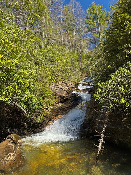
- The next viewpoint is at the base of the big falls with the freefalling section. Looking downstream, you can see the brink of what is sometimes called the second falls.
- This viewpoint is at the base of the second falls. This section is my favorite. It’s very high and the water spreads wide and flows over countless little ledges and crags. Gorgeous!
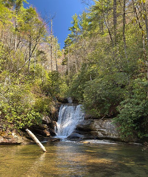
- The next viewpoint is at the base of what is sometimes called the third falls. It’s not as scenic as the upstream views. It’s the only one with a respectable pool.
- From the third falls viewpoint, there is an unofficial scramble path leading down to the base of another section. This path is sketchy, and you must wade the creek to view the falls.
- From the third falls viewpoint, if you head back out and take the trail that continues down the mountain (instead of heading back toward the trailhead) you’ll come close to the top of the lowermost section. It’s difficult and dangerous to see even a portion of this section.
Okay, now for the step-by-step description of the hike.
The trail starts to the right of the information kiosk. Chinquapin Mountain Trail turns right a few feet from the start. Stay straight on the level path. You’ll come to the former overlook of Blue Valley after about 400 feet. (The Forest Service has let trees reclaim the overlook.)
From the overlook, the trail descends steeply. Less than 0.2 miles from the trailhead is an overlook (#1) of the cascading creek, after which you’ll soon come to T junction. The path on the right leads to an overlook at the top of the first major falls (#2). Upstream is the cascading section seen at the #1 viewpoint.
Back at the T and heading left instead of right, it it is 0.15 mile to the base of the main upper falls and the top of the second falls (#3). The fenced viewing area was designed to keep visitors from walking into the creek bed. From there, it is 0.25 miles farther down to the base of the second main falls, which also has a fenced viewing area (#4).
From #4, it is 0.15 miles to a T junction. Turn right to reach the base of what is called the third falls of Glen Falls (#5). From this viewpoint you will see a path continuing downstream. It’s an unofficial path that leads down to the base of the next section. But to get there, you must descend a sketchy section of bare rock and to see the falls you must wade across the creek to the view (#6). This part is not suitable for most people. Definitely not appropriate for kids or dogs.
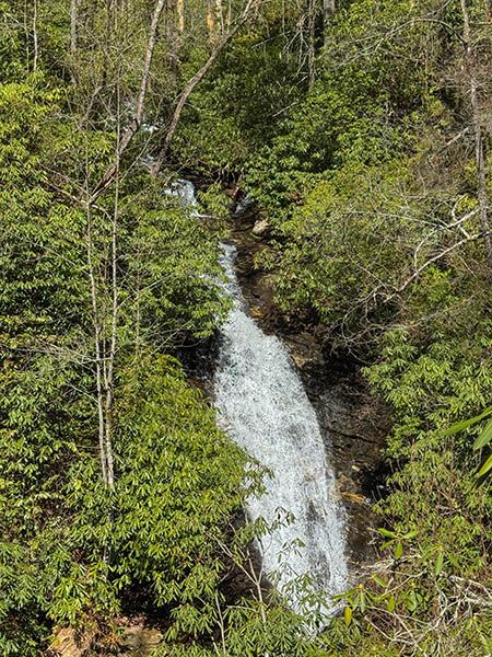
To see the lowermost section (#7), go back to the T and go straight. (If you’re hiking down from the trailhead, you would turn left at the T.) The trail swings away from the creek and uses a switchback to return to it at 0.2 miles from the T. The top of the lower section is here, but there is no good view of it. The trail follows the waterfall downstream, high above and mostly out of view, but you can glimpse it through the trees.
I found only one marginal view of a portion of this waterfall, but admittedly I didn’t spend a lot of time climbing around looking. The slopes near the creek are extremely steep and cliffy. Even if you could get down there safely, you wouldn’t be able to see anything.
The view I found is high above the creek looking out over what I assume is the main upper section of the falls. I walked a few hundred feet down the trail and headed down the slope at this point: 35.027848, -83.239212. It’s not far down to the view at 35.027831, -83.239407. There is an opening through the trees here, but there is only a couple square feet for you to stand, precariously perched at the edge of a cliff. Suffice it to say that I don’t recommend it!
The trail continues down the mountain to FS 79C. With two cars you could do this hike as a shuttle, but you’ll have to cross East Fork Overflow Creek at the end. Also, FS 79C is gated in winter.
| Accessibility: | Hiking trail |
| County: | Macon |
| River Basin: | Savannah |
| Watercourse: | East Fork Overflow Creek |
| Watershed: | Small |
| Type and Height: | Cascading, free-falling, and sliding falls approx. 600 feet high Height estimated from LiDAR map. |
| Landowner: | Nantahala NF, Nantahala RD |
| Beauty Rating: | 10 |
| Elevation: | 3400 feet |
| USGS Map: | Highlands NC/GA |
| Hike Difficulty: | Moderate/difficult Seeing any part of the lowermost section is a Class III bushwhack. |
| Hike Distance: | Most of the good stuff is within the first 0.75 miles |
| Waterfall GPS: | 35.03131, -83.23849 From the base of the big free-falling section. |
| Trailhead GPS: | 35.033288, -83.235795 |
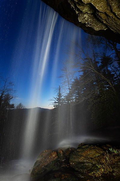
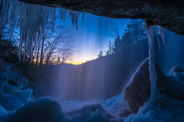
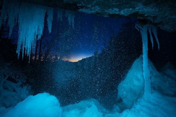
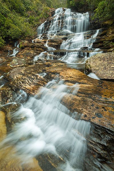
Photo Gallery
Click a photo to enlarge.