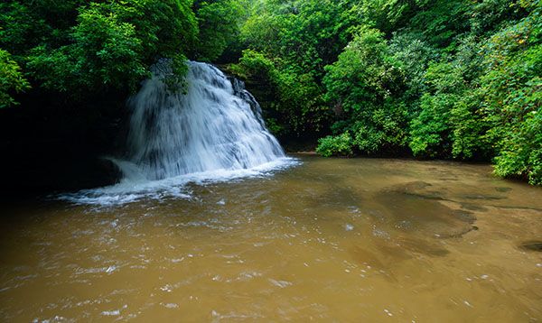
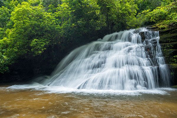
Gravley Falls
!
Gravley Falls is in Headwaters State Forest, one of the state’s newer public lands, opening in 2018. Scenic and easy to get to, it’s a good choice to visit on any waterfalling outing in the area.
(044D-109299)
Driving Directions
Open driving directions in map appFrom the Rosman area, turn off US 64 onto US 178. Drive south 1.6 miles (passing through Rosman) and turn left on East Fork Road (SR 1107). Drive 3.7 miles and turn right to remain on East Fork Road. Drive 1.3 miles and turn right on Glady Fork Road (SR1105). Drive 2.8 miles, passing Buttermilk Falls on the way, to the trailhead on the left.
Hiking Directions
Quick Glance
Cross the bridge, walk less than 0.1 miles, and turn right at the fork. Walk about 0.4 miles to the end of the road at the top of the falls. Follow the trail path down the river-left side to a steep path that leads down to the creek at the pool below the falls.
Detailed Look
The route to the top of the falls is along a mostly gentle old road. The path down the bank to the base is steep and difficult but thankfully short. You can view the falls from the trail if you don’t want to climb down the bank.
| Accessibility: | Forest road |
| County: | Transylvania |
| River Basin: | French Broad |
| Watercourse: | South Prong Glady Fork |
| Watershed: | Small |
| Type and Height: | Steep cascade about 20 feet high Height estimated. |
| Landowner: | Headwaters State Forest |
| Beauty Rating: | 6 |
| Elevation: | 2640 feet |
| USGS Map: | Eastatoe Gap SC/NC |
| Hike Difficulty: | Easy, with a short, steep climb down bank |
| Hike Distance: | A little over a half mile |
| Waterfall GPS: | 35.08909, -82.75659 |
| Trailhead GPS: | 35.088329, -82.76504 |
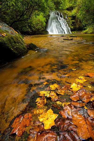
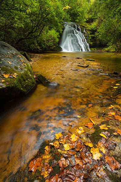
Photo Gallery
Click a photo to enlarge.