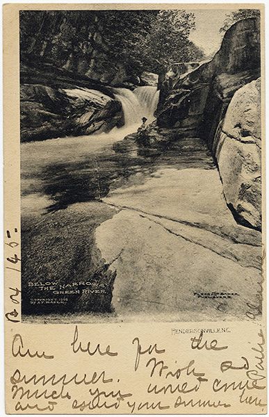
Green River Narrows
!
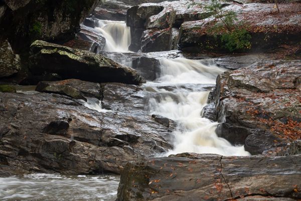
The “Holy Grail” of river runs for Southeast boaters, the Green River Narrows is hallowed territory. To a waterfaller, it might be just a really nice section of cascades and little falls, but the typical waterfaller doesn’t view their quarry over the bow of little plastic boats.
Don’t let the fact that the falling water of the Narrows is tame enough for whitewater kayaking dissuade you from visiting. This is a spectacular stretch of river that deserves a lot of camera time.
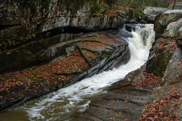
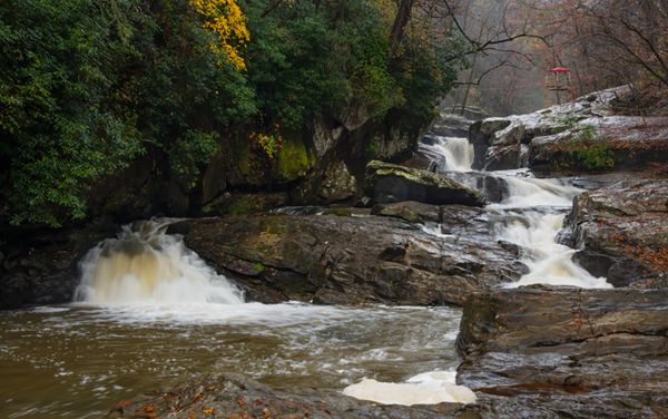
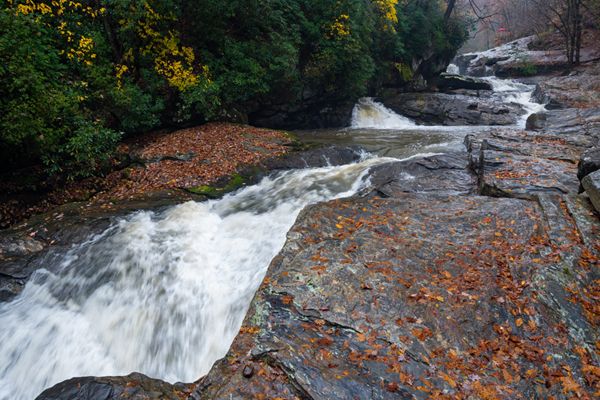
Gorrila Falls. (002C2-212002)
Driving Directions
Open driving directions in map appSouth of Hendersonville, take Exit 53 off I-26 onto Upward Road. Head east (away from Hendersonville) on Upward Road for 1.6 miles and turn right on Big Hungry Road (SR 1802). The road forks at 0.5 miles; stay left to remain on Big Hungry Road. Continue 0.25 miles to another fork and bear right. From this fork, drive 3.6 miles to a narrow pullout on the right. The pullout has room for maybe four cars if they’re packed tight. A utility pole is here.
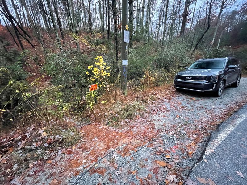
Trailhead for Green River Narrows. (002C-212142)
Hiking Directions
Quick Glance
Start trail at utility pole and hike 1.5 miles to side path on right. Descend side path 0.1 miles to Green River.
Detailed Look
Pulliam Creek Trail begins at the utility pole. Follow it a half mile to a side path cutting sharply back to the left. Continue ahead on Pulliam Creek trail for about a quarter mile to another side path on the right. Again, stay on Pulliam Creek Trail. In just under 0.4 miles from this side trail, you’ll cross Pulliam Creek. It’s rock hoppable in normal flows, but you may find it easier to wade across. After crossing, you’ll ascend steeply for about 0.1 miles, and in just under 0.5 miles from the creek, you’ll come to a side path on the right. The path descends extremely steeply to Green River in just over 0.1 miles.
Years ago, I measured this path using a rolling wheel. It measured exactly 666 feet, which is appropriate considering that this is exactly what happens when you let someone named Lucifer design a trail. There are ropes along much of the route, but you should be careful about using them to make sure they are secure and not rotten.
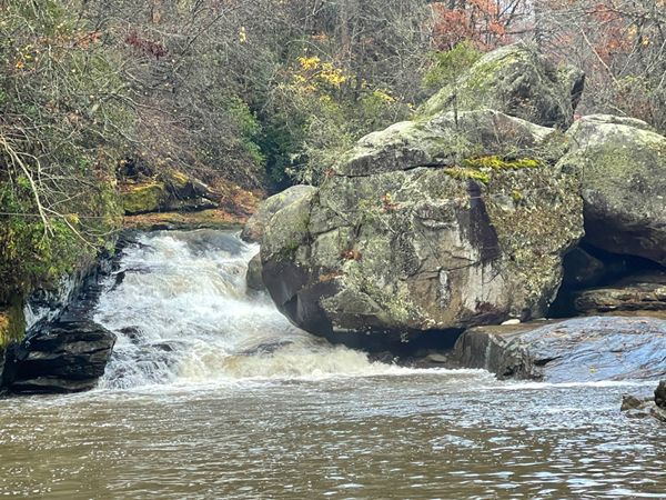
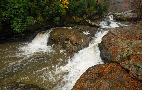
The path comes out at Pulliam Creek, right where it joins Green River at Sunshine Falls. Upstream on the creek is Pulliam Creek Falls. To see all of the Narrows, you must cross Pulliam Creek and work your way upstream on Green River. On my last visit, there was a plank spanning the creek, but it looked sketchy, so I hopped the 3-4 feet distance instead.
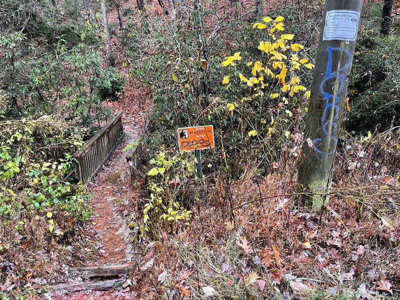
Beginning of trail to Green River Narrows. (002C-212144)
| Accessibility: | Hiking trail, sort of |
| County: | Polk |
| River Basin: | Broad |
| Watercourse: | Green River |
| Watershed: | Medium/large |
| Type and Height: | — |
| Landowner: | Green River Game Land |
| Beauty Rating: | 6 |
| Elevation: | 1400 feet |
| USGS Map: | Cliffield Mountain |
| Hike Difficulty: | Difficult |
| Hike Distance: | 1.6 miles |
| Waterfall GPS: | 35.278999, -82.344636 Reading taken from the base of Gorilla. |
| Trailhead GPS: | 35.291024, -83.328745 |
Photo Gallery
Click a photo to enlarge.
Historical Gallery
Click a photo to enlarge.