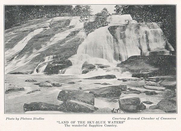
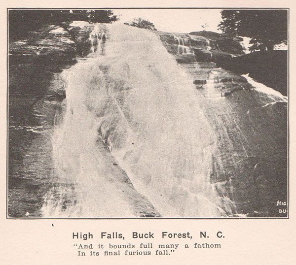
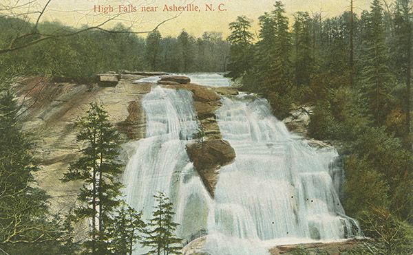
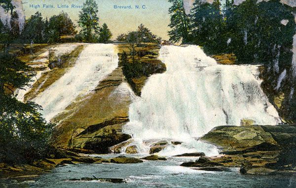
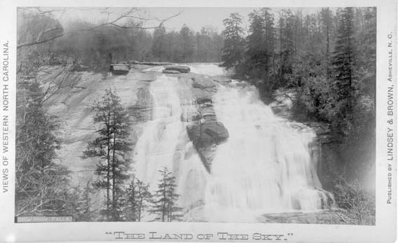
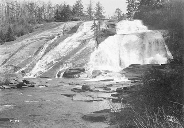
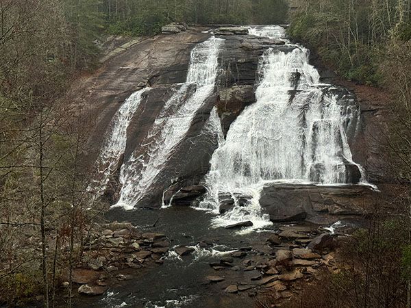
High Falls (Little River)
!
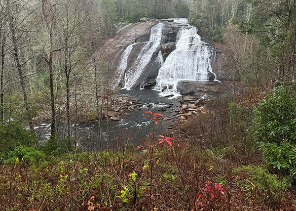
To many people, High Falls is the most beautiful of the series of waterfalls along Little River. To be sure, I think it’s an impressive waterfall. But to me, the bridge above the falls and the swath cut out of the bank to view it spoil the experience. For those not averse to such human intrusions, High Falls no doubt ranks higher than the 8 I give it. Don’t let my biases keep you from visiting. Come and draw your own conclusions.
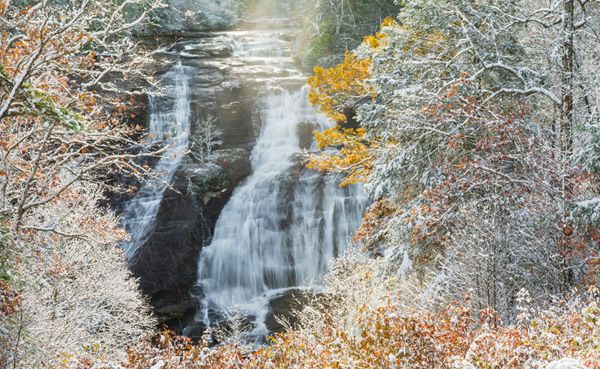
Early snowfall at High Falls. (030C-113170R)
Driving Directions
Open driving directions in map appDuPont State Recreation Forest can be accessed easily from Hendersonville, Pisgah Forest, Brevard, and Cedar Mountain. Use the trailhead GPS coordinates to find the best route.
If you’re coming from the junction of US 64, US 276, and NC 280 near Brevard, drive 3.5 miles east on US 64 and turn right on Crab Creek Road (SR 1528). Go 4.2 miles and turn right on DuPont Road (SR 1259), which becomes Staton Road when it crosses from Henderson County into Transylvania County. Drive 4 miles on this road to High Falls Access Area, on the left. A visitor center is located here. This trailhead is the shortest and easiest way to access High Falls.
You can also hike to the falls from Hooker Falls Access Area, which is on the right, 0.9 mile before reaching High Falls Access Area if coming from Crab Creek Road. GPS for it is 35.203199, -82.618810.
Both High Falls Access Area and Hooker Falls Access Area have restrooms.
Hiking Directions
Quick Glance
From High Falls Access Area, study the trailhead kiosk and follow the well-signed route to the falls.
Detailed Look
From High Falls Access Area, take High Falls Loop Trail, which begins at the end of the parking area. At 0.3 miles, you’ll come to a junction where a sharp left leads to Triple Falls, a left leads to high Falls, and a right leads less than 100 feet to Buck Forest Road. (You can walk the road instead of the trail if you want.)
Take the not-sharp left and in 50 yards you’ll come to Covered Bridge Trail, on the right. Continue straight and in 300 yards, High Falls Look Trail turns right, while another trail continues straight. Both trails lead to views of the falls.
Hiking straight brings you easily to a shelter and a terrific view of the falls from high up the bank. The trail to the right descends to a lower view of the falls at a split rail fence. Just before this view there is a set of stairs on the left leading to a path that ascends via switchbacks up the slope to the open view at the shelter.
From the split rail fence, you can continue the trail to a fork and take the right fork to reach the base of the falls. I think the views from the fence and shelter are much better than at the base. Plus, from the base, you must scramble around the riverbank or cross the river to get a decent view.
The trailhead at Hooker Falls Access Area serves Hooker Falls, Triple Falls, and High Falls. For High and Triple, begin at the kiosk and cross Little River on the footbridge. Pass under the road and follow along the river on a level course for a quarter-mile. The final 0.1 miles is a steepish ascent that brings you to a fence and view of Triple Falls.
The trail continues a few yards from the fence to a set of stairs, on the left. These stairs used to be the access for Triple Falls, but it’s now closed for safety reasons. At the top of the stairs is a trail junction. Turn left and ascend less than 0.1 miles to a fork. Turn left again and hike 0.35 miles to another fork. To the left, along the river, the path leads to the base of High Falls. A right turn ascends less than a quarter-mile to the split rail fence and view of the falls.
| Accessibility: | Hiking trail |
| County: | Transylvania |
| River Basin: | French Broad |
| Watercourse: | Little River (tributary of French Broad River) |
| Watershed: | Medium/large |
| Type and Height: | Large, steep, sliding and cascading falls about 110 feet high Height measured with rangefinder. |
| Landowner: | DuPont State Recreational Forest |
| Beauty Rating: | 8 |
| Elevation: | 2480 feet |
| USGS Map: | Standing Stone Mtn NC/SC |
| Hike Difficulty: | Easy/moderate |
| Hike Distance: | Just under a mile |
| Waterfall GPS: | 35.19371, -82.61505 |
| Trailhead GPS: | 35.191761, -82.621697 |
Photo Gallery
Click a photo to enlarge.
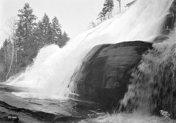
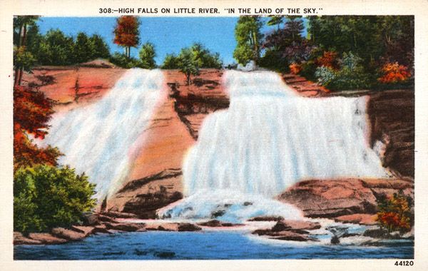
Historical Gallery
Click a photo to enlarge.