Highlands Falls
!
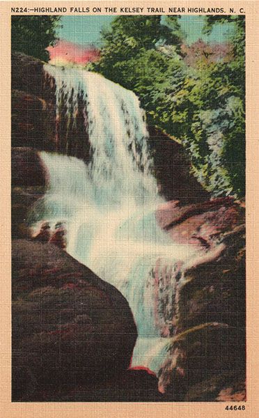
On a “Waterfalls for the Well-heeled” list, Highlands Falls would claim top prize. To see it up close, you must own property in or be a member of Highlands Falls Country Club, a private community outside Highlands. The waterfall creates the scenic backdrop for the golf course’s 15th hole. The club’s website says, “It is this hole, #15, that Ron Whitten, Golf Digest Senior Editor of Architecture, described as ‘the most memorable par three in golf.’”
To create the green, a considerable amount of blasting occurred at the base of the falls, upsetting people who felt the beloved waterfall should not be sacrificed for a golf course. If you’re a bigger fan of golf courses than waterfalls, you’ll probably love it. Personally, I have a difficult time looking at contemporary photos of Highlands Falls.
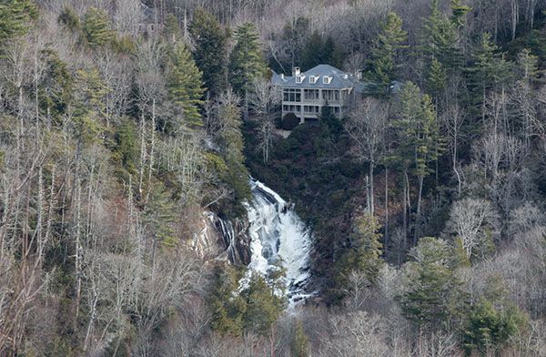
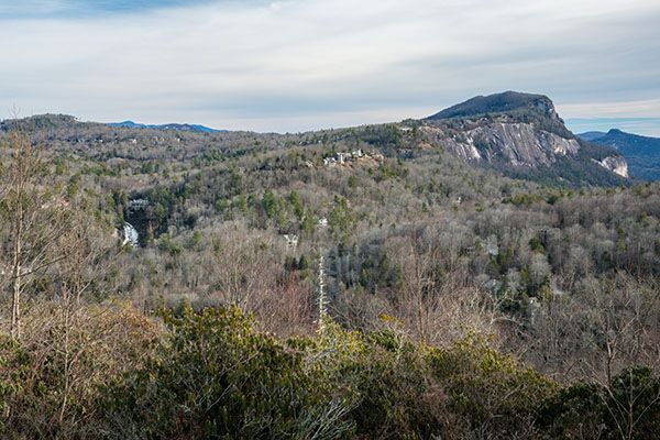
Those of us with thinner wallets can view the upper portion of Highlands Falls from a distance atop Bearpen Mountain. The view from Bearpen will spare you from seeing the 15th green at the base of the falls, but the megamansion at the top won’t escape view. See Driving Directions for details.
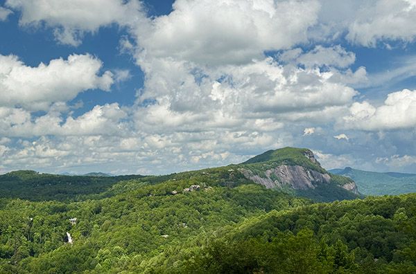
View of Highlands Falls from Bearpen Mountain. Whiteside Mountain is in the distance. (059B-264305)
Driving Directions
Open driving directions in map appYou can view the waterfall from the top of Bearpen Mountain, about 1.2 crow miles away. From Main Street in Highlands, drive 0.3 mile east on US 64 and turn right on Chestnut Street (SR 1602). Drive 0.4 mile and bear left on Big Bear Pen Road (still SR 1602). Climb the mountain on this road, which changes to gravel, and at 1.1 miles you’ll come to the beginning of a loop that encircles the top of the mountain. Turn left and go 0.1 mile to an open view on the left. A sign here calls this Highlands Falls View Wildflower Preserve. Although you can recognize the waterfall easily in winter, you’ll need binoculars to see it well, since it’s so far away.
The road name is Big Bearpen, but the mountain is spelled Big Bearpen on USGS topo maps.
| Accessibility: | Not accessible for the public |
| County: | Macon |
| River Basin: | Little Tennessee |
| Watercourse: | Cullasaja River |
| Watershed: | Small/medium |
| Type and Height: | Sliding, freefalling, and cascading falls approx. 100 feet high Height approximated from USGS topo map. |
| Landowner: | Private |
| Beauty Rating: | I have difficulty choosing a rating for this one |
| Elevation: | 3839 feet |
| USGS Map: | Highlands NC/GA |
| Hike Difficulty: | — |
| Hike Distance: | View roadside from a distance |
| Waterfall GPS: | 35.07007, -83.17435 |
| Parking GPS: | 35.062095, -83.182922 Parking for the view from Bearpen Mountain. |
Photo Gallery
Click a photo to enlarge.
Historical Gallery
Click a photo to enlarge.