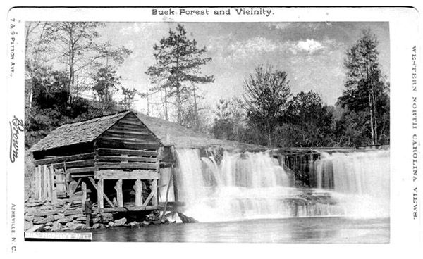
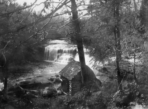
Hooker Falls
!
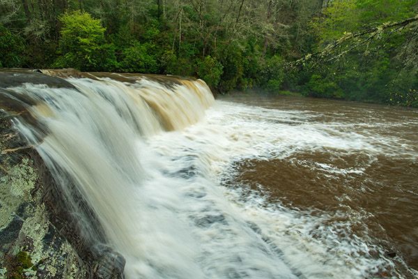
Thirteen feet is not high for a waterfall, but what Hooker Falls lacks in height, it more than makes up for in width, water volume, and character. This is an impressive waterfall! It’s popular, too. During summer, you’ll find the huge pool below the falls filled with people.
When DuPont State Forest was established in 1996, the access to Hooker Falls was a short path following the river downstream to the falls. A lot has changed since then. A large, new parking area with restrooms was built to accommodate the hordes of visitors to the forest, and the trail was rerouted to swing away from the river and avoid the top of the falls. And in 2011, DuPont State Forest became Dupont State Recreational Forest, “to be managed primarily for natural resource conservation, scenic enjoyment and recreational purposes.”184
Hooker Falls. (030A-118-093)
Driving Directions
Open driving directions in map appDuPont State Recreation Forest can be accessed easily from Hendersonville, Pisgah Forest, Brevard, and Cedar Mountain. Use the trailhead GPS coordinates to find the best route.
If you’re coming from the junction of US 64, US 276, and NC 280 near Brevard, drive 3.5 miles east on US 64 and turn right on Crab Creek Road (SR 1528). Go 4.2 miles and turn right on DuPont Road (SR 1259), which becomes Staton Road when it crosses from Henderson County into Transylvania County. Drive 3.1 miles on this road to Hooker Falls Access Area, on the right, just before crossing Little River.
Hiking Directions
Quick Glance
Follow Hooker Falls Trail to the falls.
Detailed Look
Two trails start at the parking area. Triple Falls Trail crosses Little River on the footbridge and heads upstream. You want to take Hooker Falls Trail, which begins on the upper side of the parking lot, beside the restroom building. The trail is wide and well graded and brings you to the base of the falls.
| Accessibility: | Hiking trail |
| County: | Transylvania |
| River Basin: | French Broad |
| Watercourse: | Little River (tributary of French Broad River) |
| Watershed: | Medium/large |
| Type and Height: | River-wide falls, 13 feet high Height measured with rangefinder. |
| Landowner: | DuPont State Recreational Forest |
| Beauty Rating: | 7 |
| Elevation: | 2220 feet |
| USGS Map: | Standing Stone Mtn NC/SC |
| Hike Difficulty: | Moderate Class I bushwhack |
| Hike Distance: | 0.4 miles |
| Waterfall GPS: | 35.20211, -82.62373 |
| Trailhead GPS: | 35.203199, -82.61881 |
Historical Gallery
Click a photo to enlarge.