Hungry River Falls
Big Hungry River Falls
!
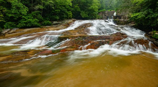
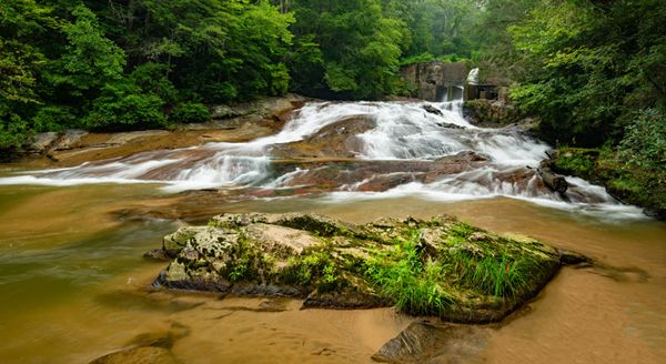
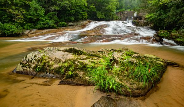
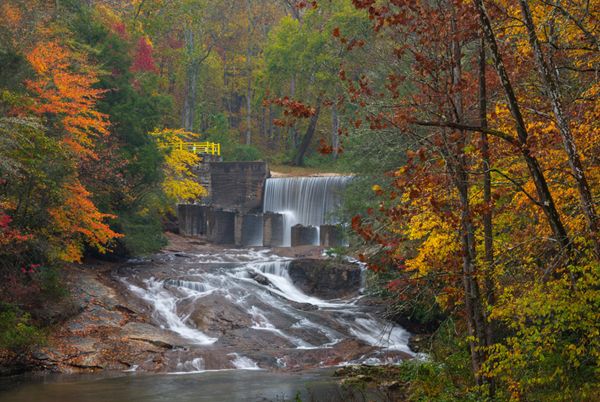
Although an old dam sits on top of this waterfall, it’s still a scenic spot and is very easy to reach. In fact, you don’t even have to get out of your car as it is visible from the downstream bridge. The best view is from near the base, accessed by a short, easy walk.
In 2009, the N.C. Department of Environment and Natural Resources determined that the dam was a hazard and needed repairs to meet safety standards. The department evaluated the cost of repairs and long-term maintenance and decided that full removal of the dam and restoration of the impacted section of the river was the best option.35
Removal was planned for 2014. I’m not certain what has caused the delay, or even if removal is still being planned. I know there is a big concern regarding the tons of sediment that has totally filled the lake. That must be removed before the dam can be taken out.36 Sometime between August of 2020 and November 2021, safety railing was installed and a large section of concrete removed to allow more water to wash over the dam. Does this mean the dam is going to remain? I’ll keep digging.
Hungry River Falls. (002I-202366)
Driving Directions
Open driving directions in map appSoutheast of Hendersonville, take Exit 53 off I-26 onto Upward Road. Head east (away from Hendersonville) on Upward Road for 1.6 miles and turn right on Big Hungry Road (SR 1802). The road forks at 0.5 mile; stay left to remain on Big Hungry Road. Continue 0.25 miles to another fork and bear right. From this fork, drive 1.5 miles to a pullout on the left, just before the bridge over Hungry River. A larger pullout is on the right, a little bit before the bridge.
Hiking Directions
Quick Glance
Follow the path closest to the river a short distance to the falls.
Detailed Look
Two paths lead from the pullout. The one closest to the river leads about 100 yards to the pool at the base of the falls. The one farther from the river leads to the waterfall, where you can walk down a sloping rock to reach the pool.
You can also view the waterfall from the bridge.
| Accessibility: | Hiking trail and roadside view |
| County: | Henderson |
| River Basin: | Broad |
| Watercourse: | Hungry River |
| Watershed: | Medium |
| Type and Height: | River-wide cascading slide about 15 feet high Height measured with rangefinder. |
| Landowner: | Green River Game Land |
| Beauty Rating: | 3 Would be much higher without the presence of dam and bridge. |
| Elevation: | 1740 feet |
| USGS Map: | Cliffield Mountain |
| Hike Difficulty: | Easy |
| Hike Distance: | About 100 yards |
| Waterfall GPS: | 35.299582, -82.350566 |
| Trailhead GPS: | 35.298661, -82.351009 |
Photo Gallery
Click a photo to enlarge.