
Jacks Cove Falls
!
This one is mainly for waterfall listers. Unless you catch it during flood conditions, the main reward is simply adding another waterfall to your life list. When I first visited in 2014, a faint path dropped from the forest road and made the bushwhack manageable, but that was no longer true on my latest hike in 2026.
That said, if you don’t mind bushwhacking, this is a relatively easy waterfall to add to your list. Most of the hike follows old forest roads, and during heavy rain the falls might actually be worth seeing. You do need to visit while it is raining, though, because the tiny watershed drains quickly.
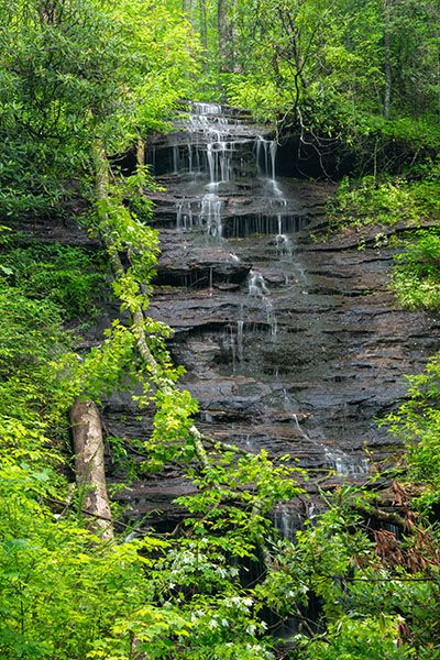
I made this image of Jacks Cove Falls in very wet conditions and it still doesn't have much water on it. (065T-274078)
Driving Directions
Open driving directions in map appThe trailhead is off FS 477. From Brevard, drive north on US 276 from the US 276/US 64/NC 280 intersection. After 11.1 miles, turn right onto FS 477. From Blue Ridge Parkway, drive 4.1 miles south on US 276 and turn left onto FS 477. Continue 2.3 miles on FS 477 to FS 5012 on the right, where there is a wide pullout.
Hiking Directions
Quick Glance
Follow the forest road past the gate, staying right at both forks. In 0.6 miles, where the road bends sharply right, leave it on the left and follow the drainage down to the falls.
Detailed Look
Follow FS 5012 beyond the gate. In 0.1 miles you’ll reach a fork. Bear right and hike a quarter mile to another fork. Bear right again and continue about 0.3 miles to a sharp right-hand bend around a broad ridge. The road is heavily overgrown in briers and weedy plants at this point.
At the sharp curve, leave the road on the left. The base of the falls is about 0.3 miles downhill. There are two routes you can take. In 2014, the best option was to gradually angle your down to the stream, pick up a faint path, follow it to a point above the falls, and then climb down the bank to the base. In 2026, I found remnants of this path, but not enough to make this route very easy.
A better option is probably to follow the broad ridge down to about 3,240 feet, then angle toward the falls. The ridge walk is by bushwhack standards. When you leave the ridge, stay close to the contour for a short distance before dropping toward the base of the falls.
Both routes become very steep near the falls. The ridge route is easier but a little longer.
There may be an easier route, but I haven’t checked it. At the second fork on the forest road, you could turn left and follow that road down about a quarter mile to where it curves left around a broad ridge, then bushwhack down to the falls. Based on the topo map, this looks like it could be the easiest option, and I’ll check it out if I ever go back (unlikely).
| Accessibility: | Forest road and bushwhack |
| County: | Transylvania |
| River Basin: | French Broad |
| Watercourse: | Tributary of Looking Glass Creek |
| Watershed: | Very small |
| Type and Height: | 60 feet high with lots of little ledges and freefalls Height measured with rangefinder. |
| Landowner: | Pisgah NF, Pisgah RD |
| Beauty Rating: | 2 |
| Elevation: | 3120 feet |
| USGS Map: | Shining Rock |
| Hike Difficulty: | Easy road walk plus Class II bushwhack |
| Hike Distance: | 0.9 miles |
| Waterfall GPS: | 35.321115, -82.783784 |
| Trailhead GPS: | 35.321721, -82.775418 |