Leatherwood Falls
!
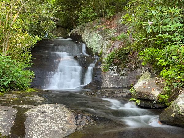
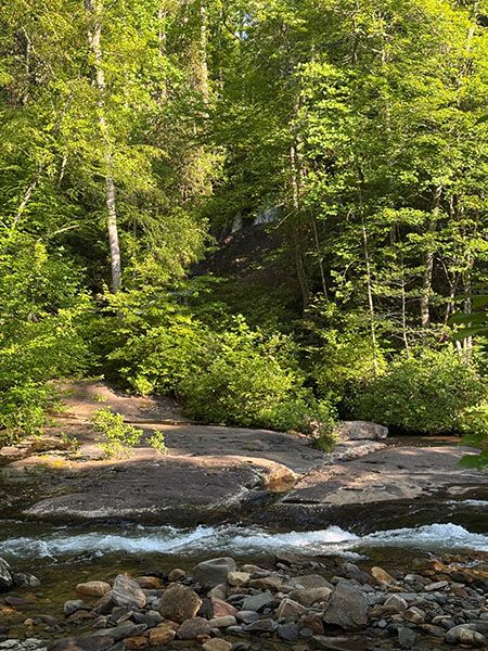
If you catch it with decent flow, Leatherwood Falls presents a nice view from the base. Most people see it from a distance on the opposite shore of Fires Creek, which Leatherwood Branch flows into. That view is not fully open, so you can only see a part of the waterfall. To reach the base, you must wade Fires Creek (not safe when the water is up) or cross a footbridge a short distance upstream and scramble along the bank.
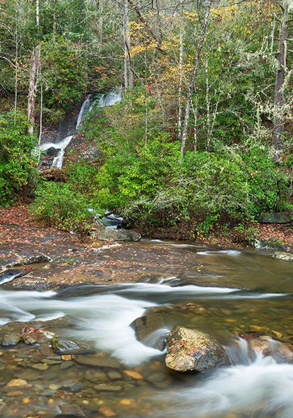
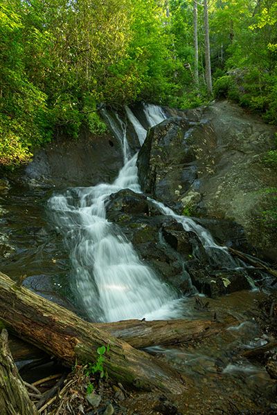
From the base you can only see the main lower section, which is 31 feet high. Upstream are several more levels that you can see from the trail beginning at the footbridge.
The waterfall is at the very popular Fires Creek Picnic Area. In warm weather, expect to find a crowd sunning on the bank and playing in the creek. A pit toilet is here. Hold your breath and hope for the best.
(034A-264544)
Driving Directions
Open driving directions in map appFrom the junction of NC 69 and US 64 in Hayesville, drive 4.8 miles west on US 64 and turn right on Fires Creek Road (SR 1300). Drive 3.9 miles and turn left on Fires Creek Wildlife Road (SR 1344) at the sign for Nantahala National Forest, Fires Creek Picnic Area. Fires Creek Wildlife Road changes to gravel at 1.7 miles, where it becomes FR 340. Continue 0.1 miles to the picnic area, on the left.
Hiking Directions
Quick Glance
Walk down to the edge of Fires Creek and look across to the waterfall.
Detailed Look
If the water level is safe to wade, cross Fires Creek a little bit upstream from the creek bend so you don’t have to walk on the smooth, slippery rock. If you don’t wish to wade, you can cross farther upstream on the footbridge and then work your way along the bank back to the falls.
The footbridge provides access to more picnicking across the creek, and also to Trail #72, #73, and #74. Trail #72 and #74 swing around and climb up to the top of Leatherwood Falls and then follow the creek upstream to a footbridge. This gives you a good look at all the falling water in the upper section of the waterfall.
| Accessibility: | Creek wade |
| County: | Clay |
| River Basin: | Hiwassee |
| Watercourse: | Leatherwood Branch |
| Watershed: | Small |
| Type and Height: | Multilevel Falls with a main lower section of 31 feet Height measured with rangefinder. |
| Landowner: | Nantahala NF, Tusquitee RD |
| Beauty Rating: | 4 |
| Elevation: | 1960 feet |
| USGS Map: | Hayesville |
| Hike Difficulty: | Moderate/difficult Once you wade Fires Creek, it’s an easy walk up to the falls. If you cross on the footbridge, the bank scramble will be moderate to difficult. |
| Hike Distance: | A few hundred feet |
| Waterfall GPS: | 35.096199, -83.859127 |
| Trailhead GPS: | 35.095905, -83.858602 |
Photo Gallery
Click a photo to enlarge.