Little Bradley Falls
!
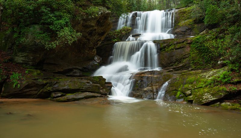
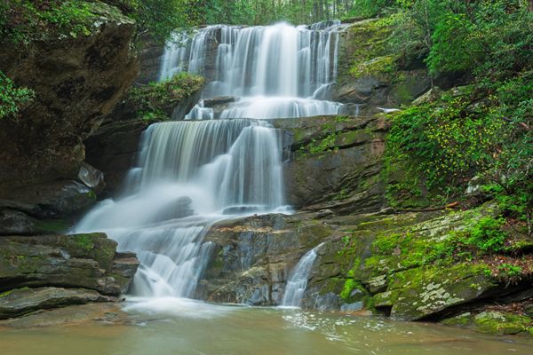
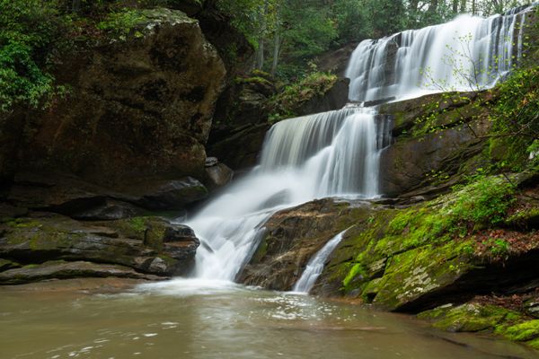
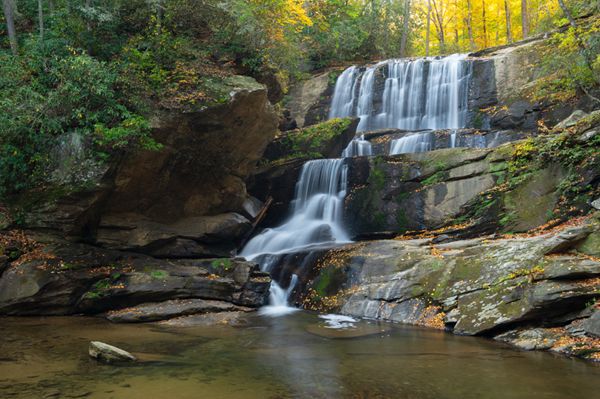
Little Bradley Falls plunges in three drops (four, if you separate the lower level) into a large pool at the head of an S-curve in Cove Creek. Some people consider this falls prettier than the larger Bradley Falls downstream, especially during low flows. However, during a good flow, Bradley Falls is tough to beat in my book.
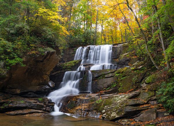
Little Bradley Falls. (002B-202377)
Driving Directions
Open driving directions in map appThe main trailhead is the same as Bradley Falls. Take the Saluda exit (Exit 59) off I-26 and head east on Holbert Cove Road (SR 1142), away from Saluda. It is 3.1 miles to a pullout on the left just before the road crosses Cove Creek.
The secondary trailhead is also located on Holbert Cove Road, 2.2 miles from I-26. Look for an obvious pullout on the right (south) side of the road.
Hiking Directions
Quick Glance
From the main trailhead, walk the road across the creek and take the trail on the right that climbs bank and then goes upstream. Stay on the most obvious route to the falls.
From the secondary trailhead, take the obvious path that leads from the pullout.
Detailed Look
From the main trailhead, walk the road across the creek. Immediately beyond the bridge is a path on the right that follows the creek upstream. Don’t take it. Instead, take the path to the left of it that climbs the bank and follows the creek higher up. In about 0.3 miles, the trail comes close to creek. Descend and crosses the creek, which could be a wade in high water.
After crossing, follow the path to Cove Creek and begin following it upstream. In 0.2 miles you’ll come to a crossing, which will likely be a wade unless the water is low. Once across, follow the easy grade for 0.4 miles to a small stream. Little Bradley Falls is a short distance beyond the crossing. There is one short section where you must scramble a little over boulders, but it’s not difficult.
From the secondary trailhead, follow the obvious path leading from the pullout. It makes a slight ascent to a rock outcrop, then descends very steeply. At places it is just a cleared spot on the ground, with no grading whatsoever. You’ll come to an old railroad grade beside a stream and then reach an easy crossing at a little over 0.1 miles from the trailhead. Upstream from the crossing is Waterfall on Cove Creek Trib.
From the falls, the trail follows the creek downstream to another easy crossing in a little over 0.1 mile. Continue less than 0.1 miles to a 3rd crossing, this one also easy. After crossing, the path leads a short distance to a campsite, from which you can see the falls. Turn right at the fire ring and follow path that swings to the left and comes to base of falls.
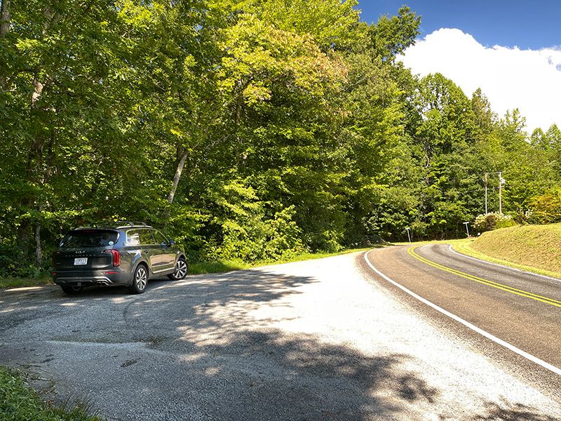
Secondary trailhead for Little Bradley Falls. (002Z5-252903)
Note: In my NC Waterfalls book, I mention a route that involves climbing down the bank from the road. I no longer recommend this route as parking is not allowed along the road at this point.
| Accessibility: | Hiking Trail |
| County: | Polk |
| River Basin: | Broad |
| Watercourse: | Cove Creek |
| Watershed: | Small |
| Type and Height: | Multilevel falls nearly 50 feet high Height measured with rangefinder. |
| Landowner: | Green River Game Land |
| Beauty Rating: | 9 |
| Elevation: | 1650 feet |
| USGS Map: | Cliffield Mountain |
| Hike Difficulty: | Easy/moderate for the main trail; moderate/difficult for the secondary trail |
| Hike Distance: | About 1 mile or 0.4 miles |
| Waterfall GPS: | 35.25447, -82.29507 Reading taken at downstream edge of pool. |
| Trailhead GPS 1 & 2: | 35.26199, -82.28428 The main TH, which also serves Bradley Falls. |
Photo Gallery
Click a photo to enlarge.