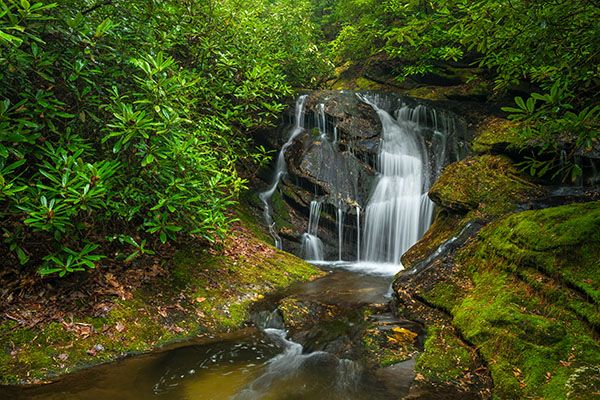
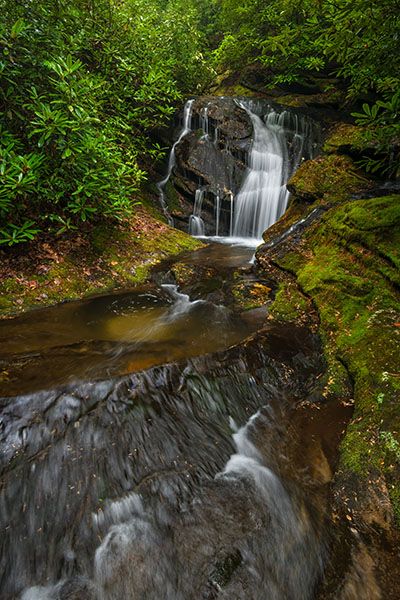
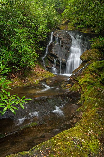
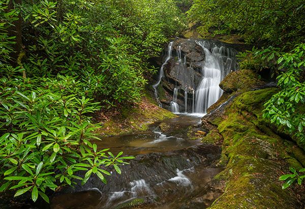
Little Creek Falls
!
The part you see from the base is small, but it’s scenic and highly photogenic. It lies in a mini canyon with an amphitheater-like setting and is draped in rhododendron.
(003E-213175)
Driving Directions
Open driving directions in map appFrom Horse Cove, drive 1.7 miles on the unpaved FS 401 (Rich Gap Road) to FS 4622, which veers off on the right. From NC 28, drive 2.3 miles on Rich Gap Road to FS 4622. Coming from this direction, the road becomes unpaved at 1.4 miles.
Hiking Directions
Quick Glance
Ascend 0.3 miles to a sharp right switchback. Enter woods on the outside of switchback and descend to falls.
Detailed Look
Ascend moderately on the grassy FS 4622. In 0.3 miles, the road makes a sharp right-hand switchback. GPS for this spot is 35.024927, -83.177499.
It’s only about 0.1 miles to the falls from this point, but there are several mini-cliffs between the road and the creek. To avoid them, it’s best to strike out through the woods from the uphill side of the switchback on an overgrown road for a short distance before heading down. Mountain laurel is thick here, but it’s easier to work around them than the cliffs.
Plug the waterfall GPS in your phone so you can head more directly to the lower drop of the falls. If you come to sliding water, you’re too far upstream and will need to work your way downstream.
The hike from the road is very steep. When you get close to the falls, you’ll need to scramble down the bank, which is even steeper.
| Accessibility: | Forest road and bushwhack |
| County: | Macon |
| River Basin: | Savannah |
| Watercourse: | Little Creek |
| Watershed: | Small |
| Type and Height: | Long, sliding falls culminating in steep 12-foot falls Impossible to determine overall height accurately. It’s somewhere around 120 feet. |
| Landowner: | Nantahala NF, Nantahala RD |
| Beauty Rating: | 7 |
| Elevation: | 3120 feet This is a guess. |
| USGS Map: | Highlands NC/GA |
| Hike Difficulty: | Difficult |
| Hike Distance: | Approx. 0.4 miles |
| Waterfall GPS: | 35.023902, -83.177585 |
| Trailhead GPS: | 35.02546, -85.173761 |
Photo Gallery
Click a photo to enlarge.