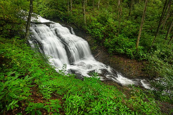
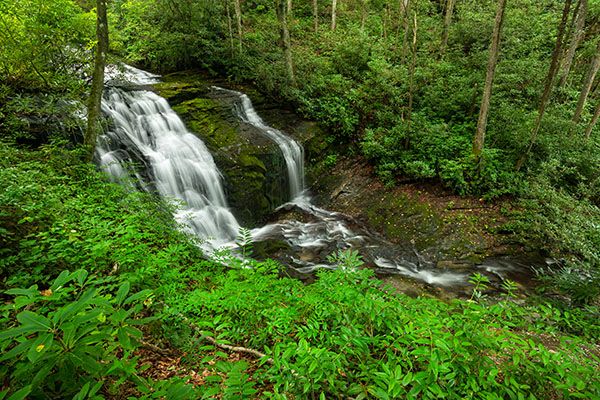
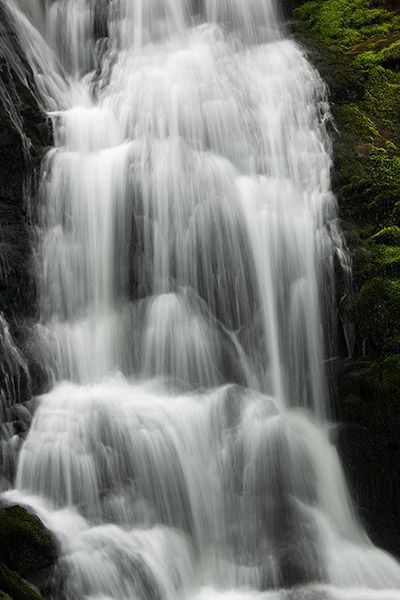
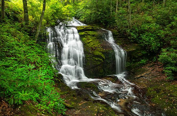
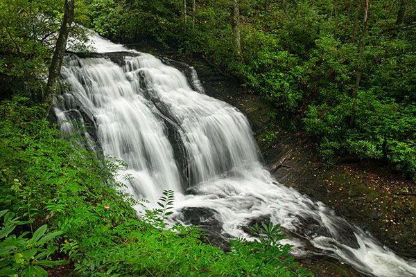
Merry Falls
!
Despite being right beside the road and very scenic, Merry Falls escapes the suffocating crowds experienced by the other nearby waterfalls in DuPont State Recreational Forest. It’s a good thing, too, as there’s barely enough room for a single car to pull off the gravel road by the falls.
In 2016, when I published the third edition of North Carolina Waterfalls, Merry Falls was on private property, so you couldn’t leave the road right-of-way for a closer view. Since then, the state of North Carolina acquired the property and it is now part of the recreational forest.
(030E-209101)
Driving Directions
Open driving directions in map appFrom Cedar Mountain on US 276, south of Brevard, turn on Cascade Lake Road at the sign for DuPont State Recreational Forest. Drive 2.5 miles to where Staton Road turns right. Don’t turn; continue straight on Cascade Lake Road, which soon becomes unpaved, 1.8 miles to the falls, on the left. There is barely enough room to pull over on the right side of the road, opposite the falls.
Hiking Directions
Quick Glance
You can view the falls from the road.
Detailed Look
A path descends to a middle viewing area, then continues descending steeply to the base of the falls.
| Accessibility: | Roadside view |
| County: | Transylvania |
| River Basin: | French Broad |
| Watercourse: | East Fork Laurel Creek |
| Watershed: | Small |
| Type and Height: | Steep cascading and freefalling falls about 31 feet high for the main section. |
| Landowner: | DuPont State Recreational Forest |
| Beauty Rating: | 6 |
| Elevation: | 2400 feet |
| USGS Map: | Brevard NC/SC |
| Hike Difficulty: | View roadside |
| Hike Distance: | — |
| Waterfall GPS: | 35.2006, -82.64368 |
| Parking GPS: | 35.200767, -82.643597 |
Photo Gallery
Click a photo to enlarge.