Mingus Mill waterfall
!
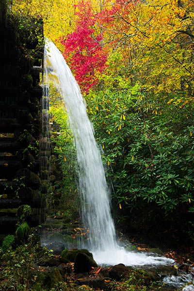
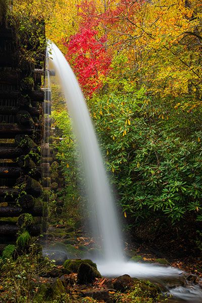
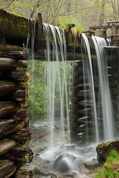
Yes, gristmills can have waterfalls. Many of them have overflow dams to create the height (called the “head”) needed for the water to have sufficient force to power the equipment. And if you read Classifying Waterfalls, you know that I consider a waterfall as simply water flowing over a precipice. So, dams back up water, which then flows over the top (precipice). Voilà. Waterfall!
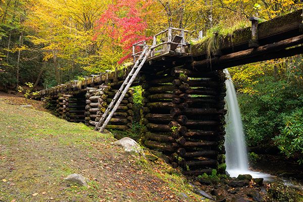
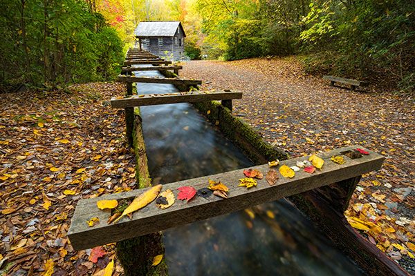
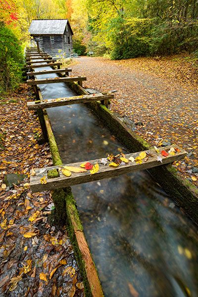
But wait, Mingus Mill has no dam, so where’s the waterfall coming from? I call it a “millrace waterfall” because it’s created by water dropping off the millrace before it reaches the mill. When the mill operates, water flows through the race, or sluice, to the mill’s penstock and turbine. When it’s time to shut down, the miller closes a sluice gate, forcing the water off the race, which creates a unique and very pretty waterfall.
Whatever you call it—and even if you think I’m bat-guano crazy for including it on the website—you have to admit it’s a cool sight.
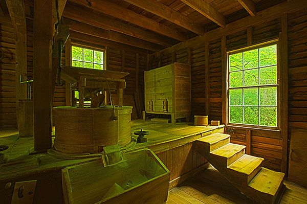
The first mill at this location was built by the Mingus family, who moved to the area in the 1790s. In 1886, Dr. John Mingus hired Sion T. Early to build the present structure, which has gone through several rehabilitations over the years, as it is currently.223
(15-09-145625)
Driving Directions
Open driving directions in map appThe parking area for Mingus Mill is located off Newfound Gap Road (US 441), 0.4 miles north of Oconaluftee Visitor Center.
Hiking Directions
Quick Glance
Follow the obvious path to the mill.
Detailed Look
To make this a loop hike, you can follow the millrace up to Mingus Creek and cross over to get on Mingus Creek Trail, then hike it back to the parking area. If the water’s running high, this could be a wet creek crossing.
| Accessibility: | Walking path |
| County: | Swain |
| River Basin: | Little Tennessee |
| Watercourse: | Mingus Creek |
| Watershed: | Small |
| Type and Height: | Approx. 14 feet Height measured with measuring tape. |
| Landowner: | Great Smoky Mountains NP |
| Experience Rating: | Superb |
| Elevation: | — |
| USGS Map: | Smokemont |
| Hike Difficulty: | Easy |
| Hike Distance: | Less About 0.1 mile |
| Waterfall GPS: | 35.519921, -83.309889 |
| Trailhead GPS: | 35.52095, -83.30907 |
Photo Gallery
Click a photo to enlarge.