Moosejaw Falls
!
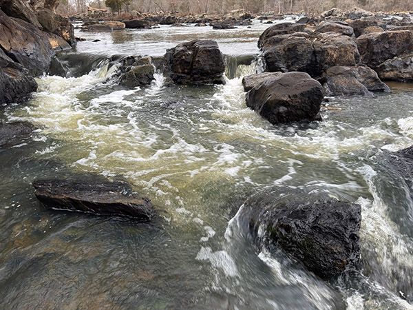
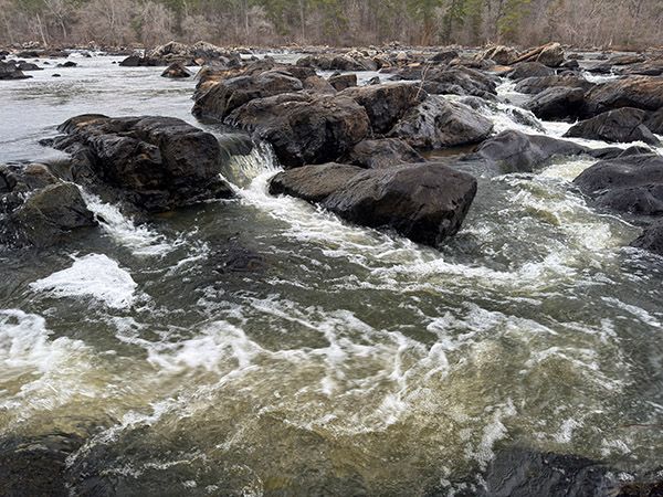
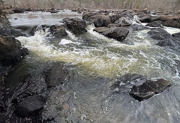
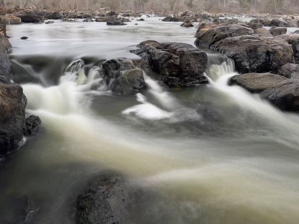
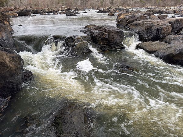
Moosejaw Falls is a Class III rapid on Haw River. Those who define waterfalls as having X amount of vertical drop won’t bother with it, but they’ll miss out on a delightful hike along a very scenic river.
As you probably know and have heard me say many times, whitewater boaters name practically every disturbance on a waterway. Most of them don’t have “Falls” in the name and those that do need to stand the test of time before I’ll acknowledge them as legitimate names. The Moosejaw Falls name has become well established. Lots of other rapids on this stretch of the Haw have boater monikers, including a few with Falls it the name.
If you hike to Moosejaw from the put-in at US 64, you’ll pass Three Foot Falls. I’m not sure exactly where it is. The American Whitewater website says it’s on the far river-right side, but I can tell you there’s no point looking for a three-foot vertical drop.
In her terrific book, Down Along the Haw, The History of a North Carolina River, Anne Melyn Cassebaum mentions Seven Island Falls, about a mile downstream from US 64. That would put it very near Robeson Creek Canoe Launch. This is the only reference with this name I’ve come across and I don’t have any clue where it is exactly. I guess you could try to find seven islands and look for a rapid nearby, but good luck with that. There are rapids all over the place and the river here is so wide the only way to distinguish all the little islands is from the air. And I’m sure the number of islands changes depending on water level.
All the rapids on this river are worth seeing, including the ones without Falls in the name, even if you don’t always know which one you’re looking at. The trail along the river provides the perfect vantage point. One should enjoy this river as a whole and not worry about the names for every little disturbance. We can spend our time identifying the wildflowers, trees, birds, and all the other living things you’ll see along this river. (The whitewater crowd needs a method for distinguishing rapids. I get that. Waterfallers and general nature and outdoor enthusiasts, on the other hand, don’t.)
Some may take exception with the Superb Experience Rating. But my experience walking through the forest along this river was superb, so there you go.
Go to Learning>River Basins & Rivers>Cape Fear River Basin>Haw River for a listing of all the water sites along Haw River.
(120C-262183)
Driving Directions
Open driving directions in map appThe upper access is at 348 River Access Road, Pittsboro. GPS is 35.730892, -79.107318.
The lower access is Robeson Creek Canoe Launch off Hanks Chapel Road. GPS is 35.716495, -79.096412.
Hiking Directions
Quick Glance
Hike downstream from the upper access. Hike upstream from the lower access.
Detailed Look
From the upstream access at US 64: This is the most scenic route, but it requires you to climb up and around the steep rocks at the river by the falls.
The path begins on the downstream end of the parking area. You must immediately cross a small branch, which will be easier from the upper corner. Once across the branch, the hike is a simple matter of following the path all the way to the rock cliffs. You’ll walk over patches of soft sand and lots of roots and rocks. The river will be your constant companion, providing great views.
The path comes to the steep rock at Gabriels Bend rapid. Here, you must climb up and then descend back to the river little way downstream from the falls. There is a makeshift path you can follow, but really, it’s just a matter of following the easiest route. The forest here is open, so this isn’t like a mountain rhododendron bushwhack. Once back at the river, you’ll need to scramble a little bit on the large rocks to reach the falls.
From the downstream access at the canoe launch: A small stream, that you must cross, enters the lake beside the parking area. (In fact, the canoe launch is on this stream, not the lake.) To cross it without getting wet, walk back up the road about 100 feet to find a path descending to the creek where you can easily cross.
After crossing the creek, work your toward the river and pick up the obvious path that goes upstream. As you near the falls, the path dwindles and you’ll need to scramble a bit on the rocks to reach the best view.
For experienced scramblers only: If the river flow is at normal levels, it’s possible to stay close to the river and not have to swing up around the rock cliff. The problem is that these rocks are covered in poison ivy. I managed to get through unscathed on a winter hike, but I wouldn’t consider it when the leaves are out.
| Accessibility: | Hiking trail and rock scramble |
| County: | Chatham |
| River Basin: | Cape Fear |
| Watercourse: | Haw River |
| Watershed: | Large |
| Type and Height: | Class III rapid |
| Landowner: | US Army Corps of Engineers |
| Experience Rating: | Superb |
| Elevation: | 240 feet |
| USGS Map: | Merry Oaks |
| Hike Difficulty: | Easy/moderate |
| Hike Distance: | About 0.7 miles This is for the upper access; 0.5 miles for lower access. |
| Waterfall GPS: | 35.72366, -79.09918 Forgot to take on-site reading, so got it from a map. I believe it’s very close. |
| Trailhead GPS 1 & 2: | 35.730892, -81.107318 Access at US 64. Robeson Creek Canoe Access. |
Photo Gallery
Click a photo to enlarge.