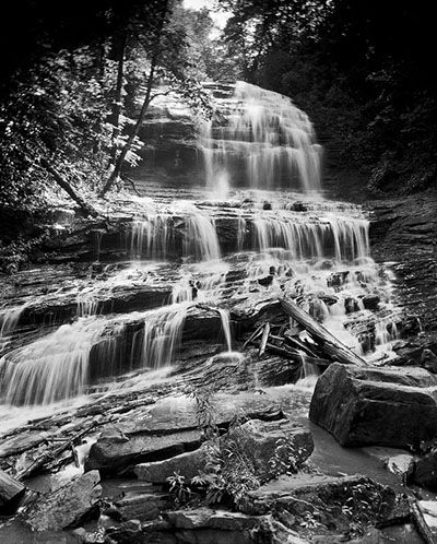
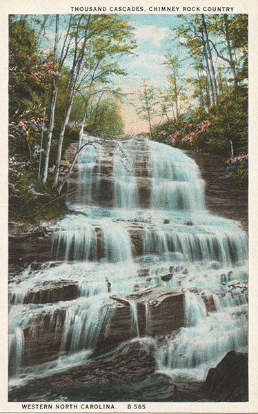
Pearsons Falls
Pearson Falls
!
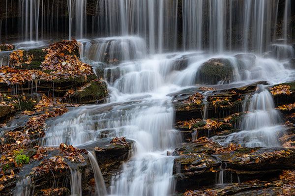
As in a cathedral nave where one may admire the art of centuries, so one goes reverently up the glen called Pearson’s Falls, where scenes from the story of life on earth are painted upon the cavern walls and green windows.Donald Culross Peattie
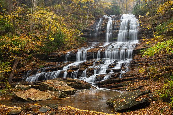
One of North Carolina’s waterfall treasures, Pearsons Falls is also one of the state’s oldest tourist attractions. It has welcomed visitors since the Tryon Garden Club acquired the property in 1931.
Pearsons Falls is beautiful, but North Carolina has many beautiful waterfalls. What sets this one apart is its preservation story and the rich biological setting that surrounds it. Read on for the full story.
(076A-202782)
Driving Directions
Open driving directions in map appFrom Saluda, you have two options. You can drive about 3 miles south on NC 176 toward Tryon, turn right on Pearson Falls Road, and continue 0.9 miles to the entrance.
You can also approach from the other end of Pearson Falls Road, which begins in Saluda. From that direction, the drive is 2.7 miles on an unpaved road.
Hiking Directions
Quick Glance
The attendant will point you in the right direction. You can’t get lost on the hike.
Detailed Look
You don’t need details for this one. Just head upstream.
| Accessibility: | Hiking trail |
| County: | Polk |
| River Basin: | Broad |
| Watercourse: | Colt Creek |
| Watershed: | Small |
| Type and Height: | Multi-ledge waterfall about 100 feet high Height estimated from LiDAR map. |
| Landowner: | Tryon Garden Club |
| Beauty Rating: | 8 |
| Elevation: | 1780 feet |
| USGS Map: | Saluda NC/SC |
| Hike Difficulty: | Easy/moderate |
| Hike Distance: | A little over a quarter mile |
| Waterfall GPS: | 35.21511, -82.33557 |
| Trailhead GPS: | 35.21924, -82.33195 Reading at the entrance gate. |
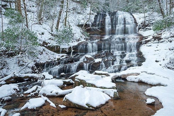
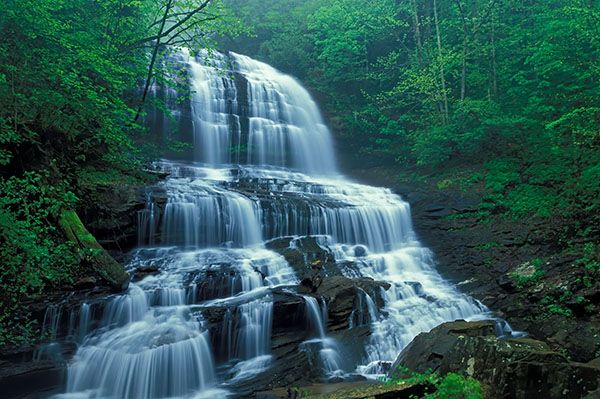
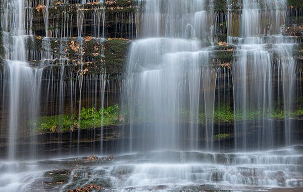
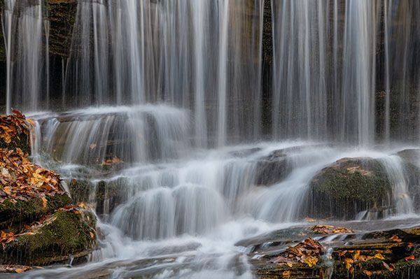
Photo Gallery
Click a photo to enlarge.
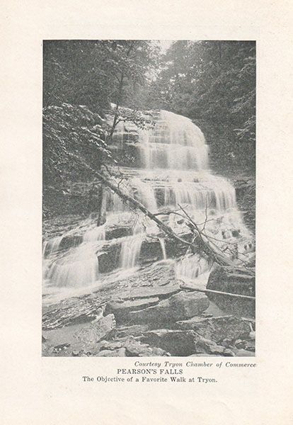
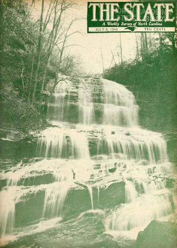
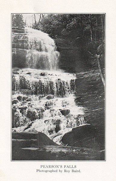
Historical Gallery
Click a photo to enlarge.