Pot Branch Falls
The Pots
!
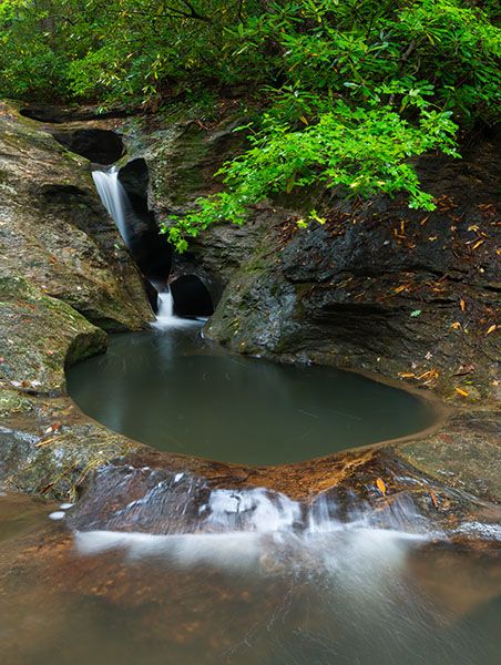
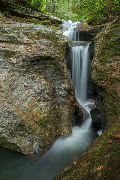
I like this waterfall! It’s not high and it’s on a small stream, but it has a lot of charm, falling through a narrow chasm of water-sculpted rock. Although it isn’t close to anything, don’t be surprised if you encounter other people. The waterfall is a popular summer hangout.
(008H-125978)
Driving Directions
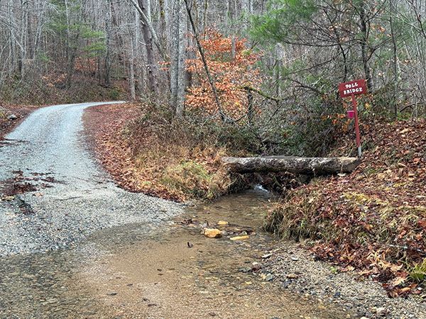
Open driving directions in map appFrom the junction of US 64 and I-40 in Morganton, drive west on US 64 for about 15 miles and take the NC 226 exit. Turn left at the top of the ramp and drive east for 7.2 miles, then turn left on Jonestown Road (SR 1733). Drive 1 mile and turn left on Melton Road (SR 1732). After 0.6 miles on Melton Road, you’ll come to a fork. Go right on the unpaved Old CCC Road (SR 1731). This road is rough in places and has a creek ford.
From the point where the pavement ends, it is just over 3 miles to a large clearing that has two gated roads leading from it. Park near the gate to the right. Note that there is another gate less than 0.1 miles before the clearing. It has been open every time I’ve been here, but if it’s closed, you’ll have to walk from it.
Hiking Directions
Quick Glance
From the gate on the right, follow old road to creek crossing. After crossing, don’t take any left turns. After 0.1 miles, turn right on obvious path, cross branch, and continue 0.1 miles to cross Pot Branch. Waterfall is 100 yards downstream.
Detailed Look
You’ll follow an old road on an easy grade for 0.2 miles to a small creek crossing. Beyond the crossing, don’t take anything to the left. After a little over 0.1 miles, turn right on the obvious path and cross a small branch. After another 0.1 miles, you’ll cross Pot Branch, which should be easy except in high water. You’ll arrive at the top of the waterfall, 100 yards from the crossing. To reach the base, you’ll have to scramble down the bank.
| Accessibility: | Hiking trail |
| County: | Rutherford |
| River Basin: | Catawba |
| Watercourse: | Pot Branch |
| Watershed: | Very small |
| Type and Height: | Series of slides, drops, and potholes, about 25 feet high Height estimated. |
| Landowner: | NC Wildlife Resources Commission |
| Beauty Rating: | 6 |
| Elevation: | 1379 feet |
| USGS Map: | Benn Knob |
| Hike Difficulty: | Easy/moderate |
| Hike Distance: | Approx. 0.5 miles |
| Waterfall GPS: | 35.56105, -81.71701 |
| Trailhead GPS: | 35.5637, -81.72227 |
Photo Gallery
Click a photo to enlarge.