
Poundingmill Branch Falls
!
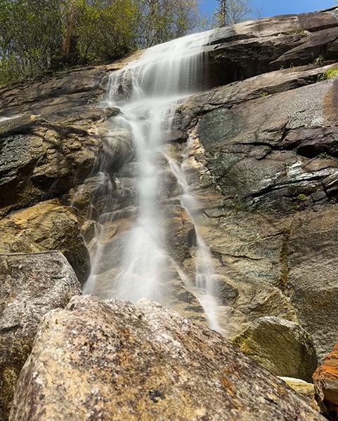
Poundingmill Branch Falls is one of four significant waterfalls, plus several smaller falls, that you can see in a half-day outing from the same trailhead. I don’t consider any of them remarkable, but this one is definitely my favorite, flowing over a massive rock face. Unfortunately, the viewing point is so close to the base that you can’t see the upper part of the falls.
(065O-262705)
Driving Directions
Open driving directions in map appFrom the junction of US 64, US 276, and NC 80 in Brevard, drive north on US 276 for 10.3 miles (passing Looking Glass Falls on the way) and turn left on the unpaved FS 475B (Headwaters Road). From Blue Ridge Parkway, it is 4.7 miles south on US 276 to this point. Drive 0.15 miles on FS 475B and park on the left, just before the bridge.
Hiking Directions
There are two routes to Poundingmill Branch Falls. You would choose the longer route if you’re including Cherry Cove Falls and/or Bennett Cove Falls on the hike. I’ll describe both in the Detailed Look section. The Quick Glance is for the shortest route.
Quick Glance
Start on FS 5032, which is across the road from the parking area. In 80 yards you’ll come to a gate. Right before the gate is a side path on the right. Take this path and ascend to rejoin FS 5032. Turn right on the road and follow it to the end, then continue on the obvious path to the falls.
Detailed Look
Start on FS 5032, which is across the road from the parking area. In 80 yards you’ll come to a gate. Right before the gate is a side path on the right. Take this path and ascend a little over 0.25 miles to rejoin FS 5032 farther up the mountain.
The trail joins FS 5032 at a wildlife clearing. If you were hiking to No Name Cove Falls, you would walk up through the clearing and pick up the trail leading into the woods. For Poundingmill Branch Falls, you need to turn right on the road and follow it about 0.4 miles to the end at another wildlife clearing. Walk through the clearing and pick up the obvious path. This path leads about 0.2 miles to the falls.
If you hike to Cherry Cove Falls/Bennett Cove Falls first, when you get back to FS 5032, turn left on the road and swing around the sharp switchback. It is 1 mile to the end of the road.
| Accessibility: | Forest road and hiking trail |
| County: | Transylvania |
| River Basin: | French Broad |
| Watercourse: | Poundingmill Branch |
| Watershed: | Very small |
| Type and Height: | High falls dropping off massive rock face; overall height estimated around 80 feet |
| Landowner: | Pisgah NF, Pisgah RD |
| Beauty Rating: | 5 |
| Elevation: | 3600 feet |
| USGS Map: | Shining Rock |
| Hike Difficulty: | Moderate Class I bushwhack |
| Hike Distance: | 0.9 miles |
| Waterfall GPS: | 35.349139, -82.7898 |
| Trailhead GPS: | 35.3391, -85.792 |