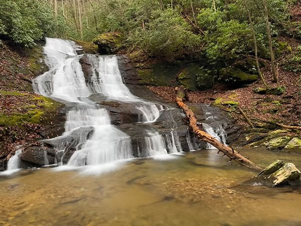
Sally Queen Falls
!
It’s too bad this pretty waterfall is so difficult to reach, but at least that adds to its charm. You are pretty much assured to have it all to yourself and you can take pride in the fact that you are among a small number of people who have visited this falls.
Actually, as bushwhacks go, it’s not too difficult. Experienced off-trail hikers will have no trouble. Others should give this one a pass, as the possibility of wandering around off course is high.
(008F-253551)
Driving Directions
Open driving directions in map appFrom the junction of US 64 and I-40 in Morganton, drive west on US 64 for about 15 miles and take the NC 226 exit. Turn left at the top of the ramp and drive east for 7.2 miles, then turn left on Jonestown Road (SR 1733). Drive 1 mile and turn left on Melton Road (SR 1732). After 0.6 miles on Melton Road, you’ll come to a fork. Go right on the unpaved Old CCC Road (SR 1731). This road is rough in places and has a creek ford.
From the point where the pavement ends, it is 2.25 miles to a gap where the road crosses over a ridge. (This is 2.9 miles from Jonestown Road.) An old dirt road with an orange gate is on the left. Park here, without blocking the gate.
Hiking Directions
Quick Glance
Follow old forest roads to the ridgeline of Richland Mountain, descend to cross a tributary, then climb over a hump to reach Sally Queen Creek near the 1600-foot elevation. The waterfall is a short distance upstream.
Detailed Look
I’m not providing a play-by-play and I recommend that you do not attempt this hike without using a map app such as Gaia or AllTrails. The route is not shown on these apps, but you can use them to show where you are in relation to the waterfall. Beginning at the orange gate, you can follow a combination of old forest roads up to the ridgeline of Richland mountain at about the 2200 elevation. From there, descend the steep slope on a course generally toward the waterfall. You’ll cross a tributary, climb up and over a hump, then descend to Sally Queen Creek. You want to reach the creek around the 1600-foot elevation. Cross the creek and work your way upstream to the falls. Plan to get your feet wet.
| Accessibility: | Class II bushwhack |
| County: | Rutherford |
| River Basin: | Catawba |
| Watercourse: | North Fork Sally Queen Creek |
| Watershed: | Small/medium |
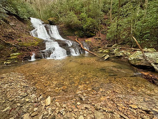
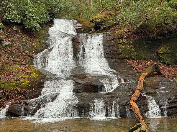
| Type and Height: | Steep, sliding and cascading falls, 36 feet high |
| Landowner: | NC Wildlife Resources Commission |
| Beauty Rating: | 6 |
| Elevation: | 1680 feet |
| USGS Map: | Benn Knob |
| Hike Difficulty: | Difficult |
| Hike Distance: | Approx. 1.5 miles |
| Waterfall GPS: | 35.578158, -81.740404 |
| Trailhead GPS: | 35.561876, -81.733331 |
Photo Gallery
Click a photo to enlarge.