Sam Branch Falls
!
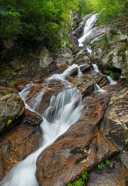
Sam Branch Falls is part of a select group of North Carolina waterfalls that have achieved cult status among serious waterfallers. Many consider it a holy grail waterfall, the feeling being that no waterfall list is complete until this one is checked off.
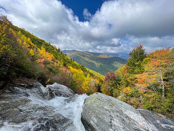
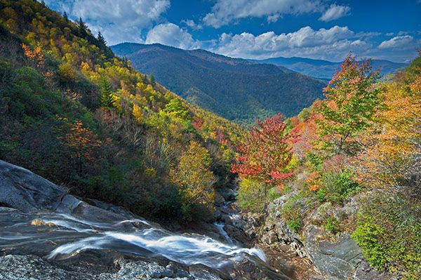
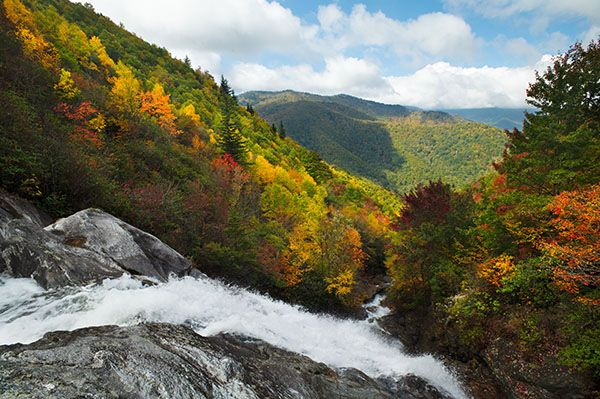
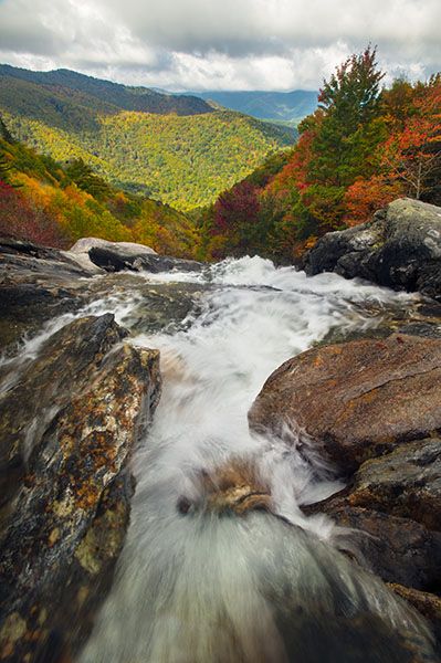
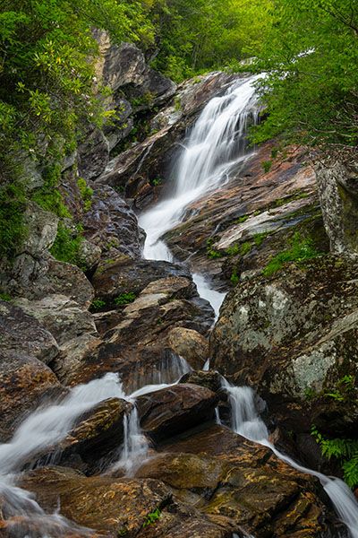
Does it live up to its reputation? Yes and no. The view from above looking out over the Sam Branch drainage is spectacular, and the hike from above and below is challenging enough to warrant special status, but the waterfall itself is rather unassuming. The sheer cliff on the river-right side helps, but don’t be surprised if you feel a little disappointed when viewing the waterfall from below.
You can see the waterfall at a distance from NC 215 at a point about 4.5 miles north of Blue Ridge Parkway or 13.4 miles south of US 276. In winter, it's visible through the trees, but binoculars offer a better view. Don’t bother trying to find it in summer. You can also see it from about 5 crow miles away at Haywood-Jackson Overlook at Milepost 431 on the parkway. With binoculars, it's visible in winter and spring, but mostly obscured once the leaves appear.
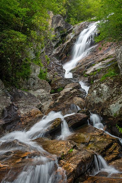
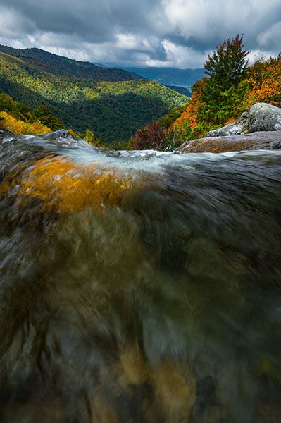
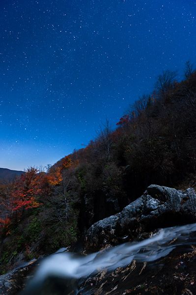
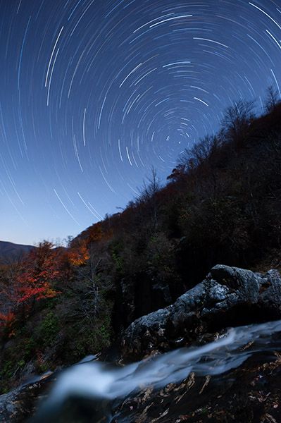
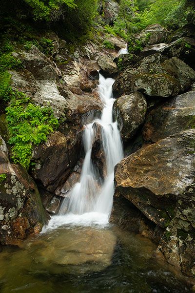
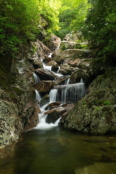
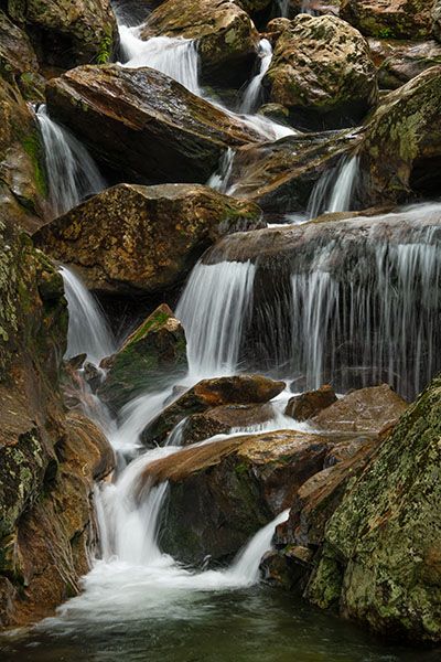
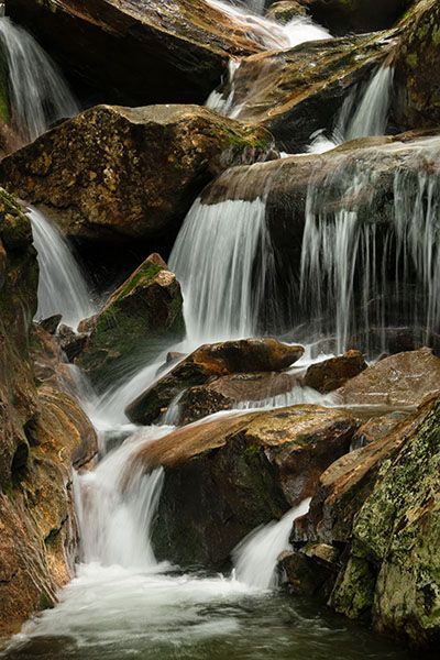
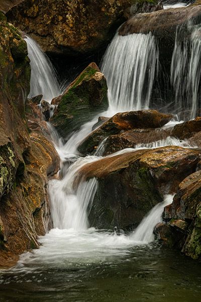
If you hike in from below, you’ll pass by other individual waterfalls on the way, or you’ll pass by all the lower smaller sections that are part of Sam Branch Falls. Which one depends on your point of view. I’m not going to spend any time trying to determine what is or what isn’t an independent waterfall on this creek, and I’m not going to entertain any other opinions on the matter because it is simply too subjective. I’ve included a few photos of other sections of the creek in the image gallery. (See "Measuring" for more about this.)
(101H-264975)
Driving Directions
Open driving directions in map appLower access, Trailhead #1
From the junction of NC 215 and Blue Ridge Parkway at Beech Gap, drive north on NC 215 for 4.1 miles to where the road turns sharply left. Park along the shoulder here. If you cross the river a second time (at Sunburst Falls), you’ve gone too far. Turn around and drive back 0.2 miles to the curve. The curve is 13.8 miles south of US 276.
Upper access, Trailhead #2
From Milepost 420.2 of Blue Ridge Parkway (8.3 miles south of US 276 and 3.0 miles north of NC 215) turn onto FS 816 (Black Balsam Road) and drive 1.2 miles to where the road ends at a parking area.
Hiking Directions
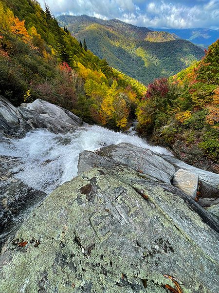
There are two ways to reach Sam Branch Falls. You can hike down from above or come in from below. The above route takes you to the top of the falls where there is a great view looking out over the Sam Branch drainage and Middle Prong Wilderness in the distance. But that view comes with a dangerous price tag, as you’re literally at the brink of the falls where you must be extremely careful. You can’t see much of the waterfall without getting into a perilous position.
Hiking in from below gives you a safer view (still no room for carelessness) and allows you to see most of the waterfall along with all the other falling water downstream. But the waterfall view is rather anticlimactic after the effort exerted to get there.
You can do both on a long shuttle hike. I’ve hiked to the top and bottom four times each, but have done the shuttle only once, in the early 2000s. The climb down from the brink to the base was unpleasant and I can’t imagine that it’s gotten any better.
Quick Glance
Nothing quick about this one.
Detailed Look—Hike From Bottom
This hike should be undertaken only by waterfallers who have a lot of experience with creekwalking and bushwhacking in very rough terrain.
The first part of the hike is the same as the hike to Lower Sam Branch Falls and Wash Hollow Falls. From Trailhead #1, walk south (uphill) along the outside of the curve to the end of the guardrail and climb the steep bank on the scramble path to pick up the old logging railroad grade. Turn left at the top of the bank and follow the obvious path 0.2 miles to the big landslide that occurred during Tropical Storm Helene in September 2024. Cross the landslide and pick up the path on the other side. The path leads a short distance to Sam Branch at Lower Sam Branch Falls.
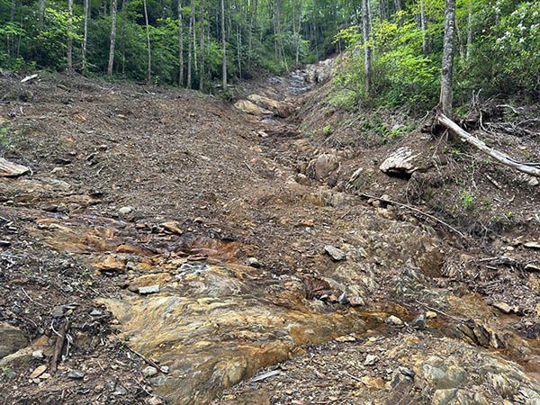
The large landslide you must cross on the hike to Sam Branch Falls. (101F-264917)
You need to cross the creek here, which will require a little scrambling and possible wading. The two lower drops of the waterfall are immediately downstream, so be careful and don’t hesitate to turn back if the water is up. (If it is, it’s not safe to hike to Sam Branch Falls even if you do make it across at this point.)
The trail to Wash Hollow Falls continues on the other side, but don’t take it for Sam Branch Falls. For Sam Branch, you must climb the steep, sloping rock to the right of the trail, the rock that slopes down right to the creek. There is no trail; it’s just a climb up the rock and you’ll swear it can’t be right. Look at the Wash Hollow trail on your left and the upper section of Lower Sam Branch Falls on your right. Between the two is the rock you must climb. If you have any hesitation, turn around now as it doesn’t get any better.
Once you get above the rock, you’ll be hiking a goat path on a wide parallel of Sam Branch. It’s narrow, very steep, muddy, cliffy, and ungraded. After crossing over a little hump, the path descends close to the creek, then continues ascending more closely with the creek for a bit before turning away and climbing very steeply once again.
Pay attention here. This path ascends to Victory Wall, a popular rock-climbing spot. You need to turn away from it and head back to the creek. Look for a large mossy boulder on the right side of the path. At the top side of this boulder is where you need to leave the path and angle upstream to the creek. Years ago there was an obvious path to the creek, but on my last visit in July 2025 I couldn’t find any trace of it, so it was a full bushwhack. GPS for the boulder and spot to start the bushwhack is 35. 340037, -82.896098.
Once you reach the creek it’s just a matter of crossing to the river-left side and heading upstream. But to make it as easy as possible, you want to cross the creek at this point: 35.339659, -82.895969. There is a small falls immediately upstream and a little side stream flows into Sam Branch on the river-left side. Don’t count on seeing the side branch, though, as it could be dry.
After crossing, head upstream along the creek by the route of least resistance. Enough people have hiked this route to create a faint goat path nearly the entire way to the falls, but don’t count on being able to follow it. This is only a notch above a full-fledged bushwhack.
You should stay on the river-left side until you get close to the falls. On river right, Victory Wall extends nearly all the way down to the creek making it exceedingly difficult on that side. You can see the wall looming over the creek at several points. Once you get close to the falls the goat path descends to the creek, where you need to rockhop upstream a little bit before getting in the woods on river right for a short distance. Then you’ll cross again and work your way up to falls. To see the falls well, you’ll have to climb up on a large boulder near the base or make a dicey climb up on the river-right side. Regardless of the view you get, your reaction may be one of disappointment.
Detailed Look—Hike From Top
The hike from the top at Trailhead #2 is easier and safer than it is from the bottom, but once you reach the falls the danger factor goes up significantly. Think it over carefully.
There are two approaches worth considering. The easiest way to make sure you stay on course is to simply drop down on the north side of the parking area and follow the drainage all the way down to the falls. You’ll pass through a weedy area, pick up little branchlets that flow into large ones that eventually flow into Sam Branch, which you will follow downstream, sometimes creekwalking, sometimes hiking in the woods. As bushwhacks and creekwalks go, it’s relatively easy. But it’s a long hike.
The other option utilizes Sam Knob Summit Trail #617 and Sam Knob Trail #617A for part of the hike, reducing the amount of bushwhacking, and there is no creekwalking involved.
Sam Knob Summit Trail begins at the upper end of the parking area to the right of the pit toilets. Follow it about 0.6 miles to the junction, right, with Sam Knob Trail in a large open meadow. Take Sam Knob Trail and ascend to the first switchback. Leave the trail here and head northwest along the contour line until you reach the broad ridge, then descend 800 feet on it to the falls. You’ll need to consult a map app to make sure you stay on course as the ridge is broad and it’s easy to get off track. The ridge comes out directly at the top of the waterfall.
| Accessibility: | Hiking trail, bushwhack, creekwalk |
| County: | Haywood |
| River Basin: | French Broad |
| Watercourse: | Sam Branch |
| Watershed: | Small |
| Type and Height: | A wild waterfall with a main drop of about 110 feet. Height measured with rangefinder. |
| Landowner: | Pisgah NF, Pisgah RD |
| Beauty Rating: | 10 Rating is considering everything about this waterfall and the surroundings, including the upper vantage point. If viewed from only the base, I'd rate it 7. |
| Elevation: | 5039 feet |
| USGS Map: | Sam Knob |
| Hike Difficulty: | About as hard as it gets! |
| Hike Distance: | Less than a mile from the lower trailhead. Approx. 1.5 miles from upper trailhead by ridge route. You will swear it’s longer than this! |
| Waterfall GPS: | 35.338876, -82.891954 |
| Trailhead GPS 1 & 2: | 35.339619, -82.90114 This is for the lower access, Trailhead #1. This is for the upper access, Trailhead #2. |
Photo Gallery
Click a photo to enlarge.