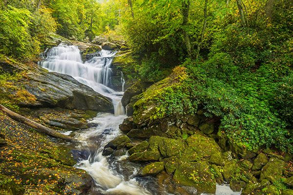
Scadin Falls
!
Most people traveling through Cullasaja River Gorge have no idea this waterfall exists, and that’s probably just as well. The trail is steep, the waterfall viewpoint is dangerous, and there is very limited parking at the trailhead. But those who go despite these issues will find a delightful and photogenic waterfall.
Read the Cullasaja River section for an overview of the river and its waterfalls, including a list of landmarks with mile markers. You can find it by clicking the Little Tennessee River Basin button on the Rivers page.
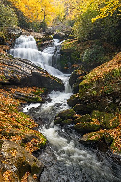
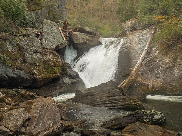
The lower drop of Scadin Falls. (025J-211367)
Driving Directions
Open driving directions in map appFrom the junction of US 64 and NC 106 in Highlands, drive 5.8 miles west on US 64 to the tiny, paved pullout on the right. This is 10.95 miles east of US 23/441 in Franklin.
Hiking Directions
Quick Glance
Cross the road and climb down the steep path.
Detailed Look
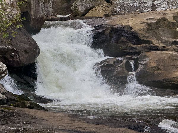
The path begins opposite the pullout. Descend steeply to a split. Go right to reach the cliff overlook of the main lower section. Go left to explore the upper two sections. You’ll need to do some rock scrambling to see everything upstream from the lower section, but it’s not much more difficult than the path down to the cliff view.
| Accessibility: | Steep path |
| County: | Macon |
| River Basin: | Little Tennessee |
| Watercourse: | Cullasaja River |
| Watershed: | Medium |
| Type and Height: | Multilevel falls 103 feet high. Height measured with rangefinder. See Measuring for details. |
| Landowner: | Nantahala NF, Nantahala RD |
| Beauty Rating: | 7 |
| Elevation: | 3040 feet |
| USGS Map: | Scaly Mountain |
| Hike Difficulty: | Difficult |
| Hike Distance: | A few hundred feet to the lower viewpoint |
| Waterfall GPS: | 35.084887, -83.267492 |
| Trailhead GPS: | 35.085374, -83.267179 |
Photo Gallery
Click a photo to enlarge.