Short Creek Falls and waterfalls on Short Creek
!
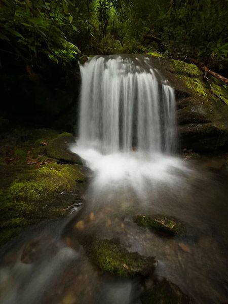
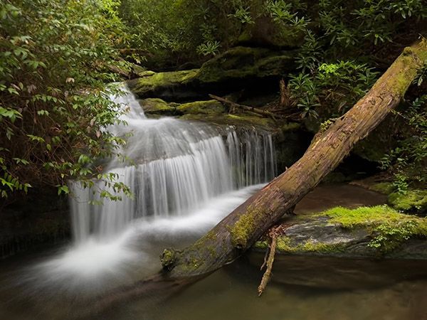
Short Creek is a small rhododendron-clad stream that flows into Cullasaja River a short distance downstream from Quarry Falls. There are three little, scenic waterfalls on the creek within a half mile upstream of US 64, plus several smaller cascades. Reaching them requires a Class II bushwhack along the stream.
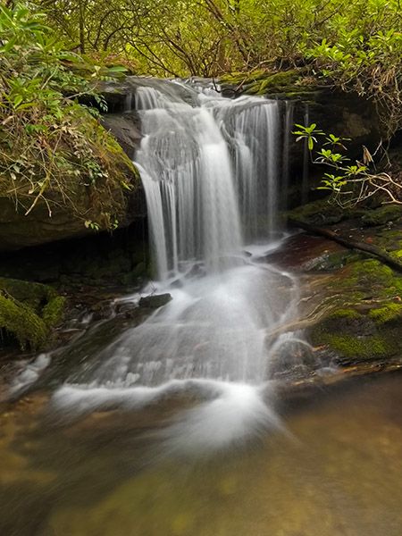
The main photo and info block is for the larger and farthest upstream of the three falls, which I'll designate as Waterfall 3. The first one upstream from US 64, Waterfall 1, is at 35.094582, -83.261884. The next one up, Waterfall 2, is at 35.093465, -83.260437.
Although these waterfalls are very small, they are pretty and photogenic and the bushwhack to them is not too bad. Waterfallers who don’t mind getting off trail will be rewarded nicely with this short trek to these practically unknown waterfalls.
George Masa, the well-known photographer from Asheville who photographed in the region during the 1920s and early 1930s knew about Short Creek. He made several photographs in Cullasaja River Gorge, including one he captioned Short Creek Falls N.C. 28. I’ve no doubt that the photo of his on this page is a waterfall on this creek, but try as I might, I can’t identify the falls he shot. Believe me, I’ve tried, making several field trips and exhaustively studying photographs.
I suspect Masa photographed one of the upper two falls and possibly did so from a high vantage point. An early road ran alongside and crossed Short Creek and would have provided access for Masa. FS 57A, which you can hike today, follows portions of this old road. I wonder if Masa made his photo from it. The road is overgrown, making it impossible to view the falls from it to determine anything with certainty.
FS 57A crosses Short Creek a short distance upstream from the upper waterfall listed here, and then crosses it two more times before swinging away from the drainage. I have not explored this upper section of the creek as there doesn't appear to be any significant waterfalls according to the LiDAR map.
Read the Cullasaja River section for an overview of the river and its waterfalls, including a list of landmarks with mile markers. You can find it by clicking the Little Tennessee River Basin button on the Rivers page.
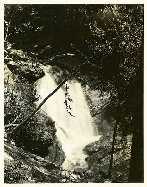
George Masa photo of Short Creek Falls. Is this one of the waterfalls descussed here? (025M-01)
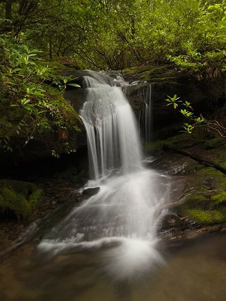
Waterfall 3, The most upstream waterfall on the lower section of Short Creek. Is this the falls Masa shot? (025M1-263289)
Driving Directions
Open driving directions in map appFrom the junction of US 64 and NC 106 in Highlands, drive 6.7 miles west on US 64 to the small, paved pullout on the left (Cullasaja River) side of the road. This is 10.05 miles east of US 23/441 in Franklin.
Hiking Directions
Quick Glance
Short Creek flows under US 64 at the pullout. Follow it upstream to the falls.
Detailed Look
To see all three waterfalls, the best option is to follow the creek upstream from US 64. The river-right side is relatively easy as bushwhacks go.
The other option is to use FS 57A to reach the falls or follow it on the return. That old road starts from US 64 at 35.100144, -83.262923 and ascends to cross Short Creek a short distance above the most upstream falls. However, I don’t recommend getting on the road there because it is horribly overgrown. It’s much better to walk farther along US 64 (toward Short Creek) and climb up the bank to reach the road. The point at which I left US 64 is 35.099067, -83.2625242. From here it is a short climb up to FS 57A.
FS 57A is somewhat overgrown and is infested with poison ivy, but it’s easy to walk along. It swings into the Short Creek drainage and reaches a poor view of the upper falls at 35.093414, -83.259857. Is this the point from which Masa made his photo? You can climb down to the falls from here, and this would be the easiest way to reach the falls. However, if you want to see the other two falls you’ll have to bushwack along the creek, anyway. For me, the best option is to follow the creek upstream to the upper falls, passing the two lower falls on the way, and use FS 57A for the route back.
| Accessibility: | Class II bushwhack |
| County: | Macon |
| River Basin: | Little Tennessee |
| Watercourse: | Short Creek |
| Watershed: | Very small |
| Type and Height: | Sliding and freefalling falls, about 12 feet high Height estimated. |
| Landowner: | Nantahala NF, Nantahala RD |
| Beauty Rating: | 5 |
| Elevation: | 3000 feet |
| USGS Map: | Scaly Mountain |
| Hike Difficulty: | Moderate/difficult |
| Hike Distance: | Approx 0.3 miles |
| Waterfall GPS: | 35.093086, -83.259799 |
| Trailhead GPS: | 35.096029, -83.2635 |
Photo Gallery
Click a photo to enlarge.