Shut-In Falls
!
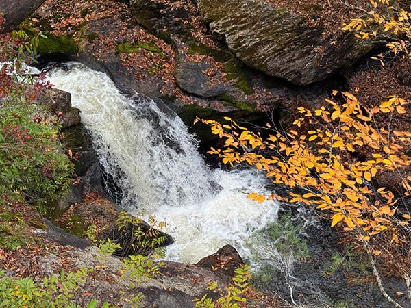
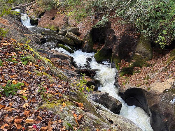
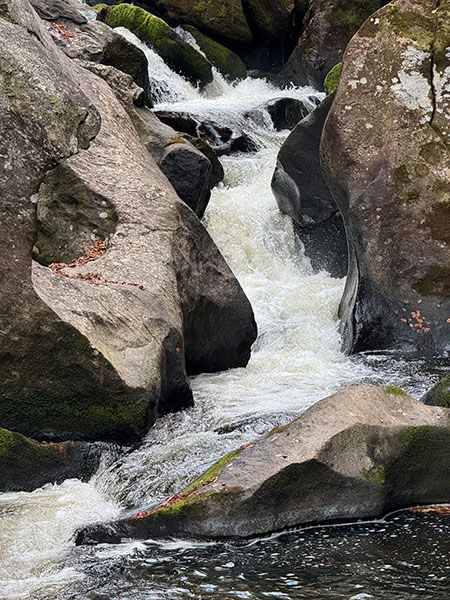
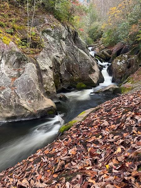
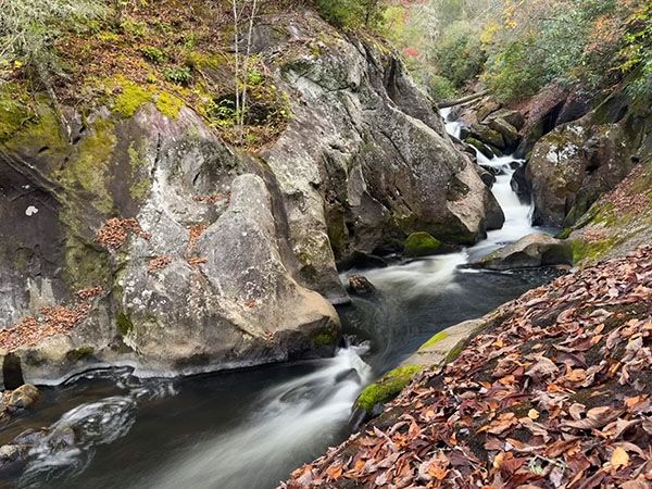
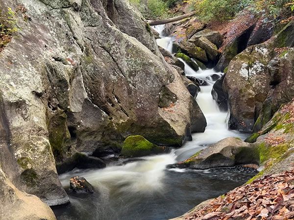
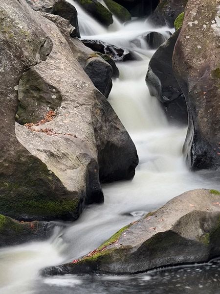
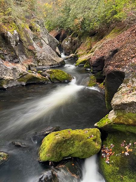
Hundreds of significant waterfalls remain unknown to most waterfallers in North Carolina, but it isn’t very likely for one to be discovered beside a heavily traveled national highway. Yet mere feet from US 64, on a stretch of road well known for waterfalls, lies a notable fall that few people have any clue of. It’s not a high falls, but it’s an exciting one, the full force of Cullasaja River squeezed into a rock-sculpted mini slot canyon less than six feet wide.
Unfortunately, you cannot access the falls safely. Most people will want to ignore it altogether, while those who can’t sleep until they’ve seen every waterfall on the planet will want to tread very carefully.
Read the Cullasaja River section for an overview of the river and its waterfalls, including a list of landmarks with mile markers. You can find it by clicking the Little Tennessee River Basin button on the Rivers page.
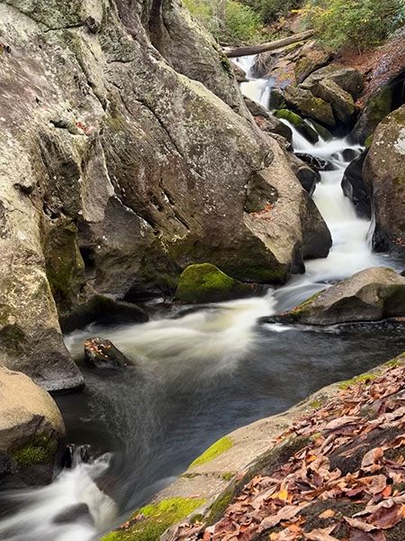
The slot canyon at Shut-In Falls. (025U-268767)
Driving Directions
Open driving directions in map appFrom the junction of US 64 and NC 106 in Highlands, drive 5.45 miles west on US 64 to a sharp right curve. From US 23/441 in Franklin, drive 10.25 miles east on US 64 to a sharp left curve.
There is no place to park at the curve. You’ll need to drive past it and park at the first pullout. There is a small pullout 0.2 miles west and a tiny pullout (the trailhead for Scadin Falls) 0.35 miles east.
Hiking Directions
You can see the upper section of the falls fairly well from the road, but you’re viewing it from a sharp curve and there is very little room on the side of the road to stand. To make matters worse, you’re standing at a sheer drop-off.
You can climb down the bank and grab a view from the river-right side, but you can see only a portion of the falls and the viewpoint is at the edge of a cliff.
To get a decent frontal view of the falls, you need to climb down at a point farther downstream where you can avoid the cliffs and cross the river. There is a large rock from which you can get a good view of most of the waterfall, looking upstream and downstream. But you can’t see the upper section from here. To see it, you’ll need to climb up the steep sloping rock on the river-left side. I strongly caution against doing this.
My advice for Shut-In Falls for those who are insistent upon checking it off their list is to ride shotgun with someone very early on a Sunday morning. Drive west, toward highlands, so you’ll be on the river side of the road. When you get to the curve and provided there are no cars behind you, have the driver stop, jump out and snap a quick pic of the upper section, then move on and cross this sucker off the list.
| Accessibility: | — |
| County: | Macon |
| River Basin: | Little Tennessee |
| Watercourse: | Cullasaja River |
| Watershed: | Medium |
| Type and Height: | Long series of little falls through a slot canyon; overall height is approx. 40 feet Height estimated from LiDAR map. |
| Landowner: | Nantahala NF, Nantahala RD |
| Beauty Rating: | 6 |
| Elevation: | 3160 feet |
| USGS Map: | Scaly Mountain |
| Hike Difficulty: | Difficult |
| Hike Distance: | See directions |
| Waterfall GPS: | 35.081716, -83.263486 Reading taken from a point about midway on the falls, on the river-left bank. |
| Parking GPS: | 35.081816, -83.262825 This is the point on the road where you can see the upper section of the falls. There is no place to park here. |
Photo Gallery
Click a photo to enlarge.