Slick Stick Falls
!
The aptly named Slick Stick Falls won’t rank high on the experience rating for most people, but those who make the effort to fully explore this waterfall will be rewarded nicely.
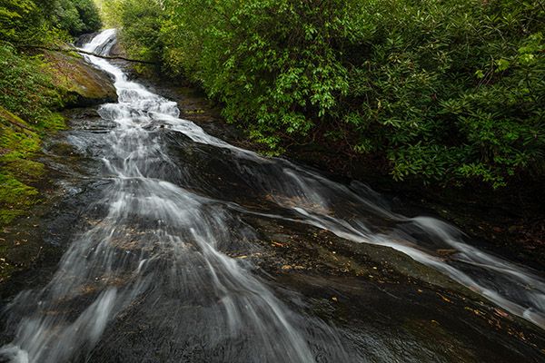
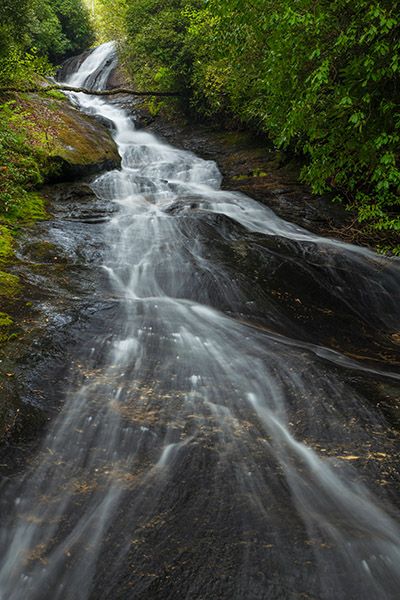
The vantage point about two-thirds up. (003B-213085)
Driving Directions
Open driving directions in map appFrom Horse Cove Road, drive 1.7 miles on the unpaved Walkingstick Road (SR1608) and park in the small pullout on the right side. This trailhead provides the best access to the falls in my opinion and lets you see Lower Stick Falls easily on the same hike.
You can also reach the waterfall from above. From NC 28, 4.1 miles south of Highlands, turn left onto Rich Gap Road and drive 1.1 miles to the gated FS 4567B on the right. GPS for this point is 35.016438, -83.171702.
Trailhead for Stick Falls, Upper Stick Falls, Lower Stick Falls, and the lower trailhead for Slick Stick Falls.
Hiking Directions
Quick Glance
Bushwhack down to the base of Lower Stick Falls (35.018928, -83.163981), then creekwalk upstream on Little Creek to Slick Stick Falls.
Detailed Look
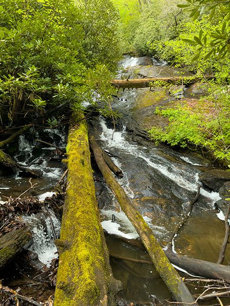
Four waterfalls—Upper Stick Falls, Stick Falls, Lower Stick Falls, Slick Stick Falls— are accessed from the lower trailhead, all of them fairly close and all of them gnarly and potentially confusing to reach. I’ll give info for all four, as it’s hard to isolate them.
The usual suggestion to follow the sound of falling water works here, but you’ll likely not know which waterfall you come to first and won’t know whether to go upstream or down for the others.
Slick Stick Falls from the lower trailhead.
If you only want to see Slick Stick Falls, strike out through the woods in a direction of approximately 220 degrees. As you get close to the creek, if the terrain gets really gnarly, you might be headed toward Stick Falls instead of Lower Stick Falls, the one you want. Shift downstream and hopefully you’ll come out near the base of Lower Stick.
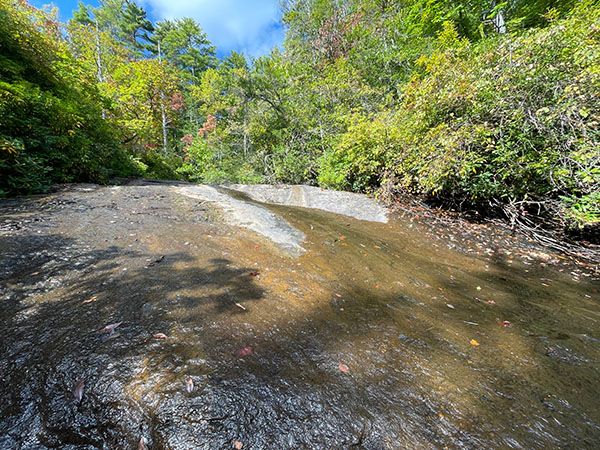
Cross the creek on the downstream end of the pool and follow Little Creek upstream. You’ll need to get into the woods briefly once or twice but stay with the creek as much as possible. I’ve done this hike several times, each time trying a different route, and the creek is definitely the easiest and fastest way for me.
It’s not far up to Slick Stick Falls. You’ll likely find a big mess at the base of the falls and wonder why I’m even mentioning it. If you just want to cross it off you’re list, you can turn around. To fully experience the falls, head upstream on the river-left side. You’ll have to crawl through the woods some to avoid the sketchy places. At one point, you can cross over to the river-right side and scoot up a little to the one vantage point where it’s safe to set up a tripod. (Actually, leave the tripod and big camera in the car and just bring your phone to this one.)
On the way back, you may be tempted to head down through the woods on the river-right side. Trust me and curb that thought. Backtracking is the way to go.
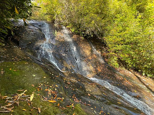
Slick Stick Falls from the upper trailhead.
I don’t recommend this route. It’s potentially easier, but it takes you only to the midpoint view of the falls—if you’re lucky. Theres a good chance you’ll end up bushwhacking all over the place trying to find this viewpoint. And you won’t get to see Lower Stick Falls on the hike. With that said, if you want to avoid the creekwalk, this would be the route to take.
Begin the hike on FS 4567B which quickly swings left and skirts a recently logged area. Enter the woods at about 0.1 miles continue on the relatively easy forest road. At about 0.4 miles from the trailhead, you’ll need to strike out through the woods on the left. There’s no landmark here, so use the GPS reading of 35.017518, -83.166916 as your marker.
The point you’re headed for is 35.018784, -83.166515. Good luck!
Back to the lower trailhead and the other waterfalls.
To view Upper Stick Falls, you’ll need to go straight to it. To view Stick Falls, you can go straight to it or swing around from Upper Stick and then descend to it. To view Lower Stick Falls, you can go straight to it, or swing around from Stick and descend to it. You cannot creekwalk the entire distance between all three falls, though you can creekwalk part of the way between Stick and Lower Stick.
Probably the easiest way to see all three falls on the same hike is to start with Upper Stick, then do Stick, and then Lower Stick. Upper Stick isn’t very remarkable and you won’t miss out on much if you skip it. But don’t miss Stick!
So, for all three, walk upstream (toward Horse Cove) along the road for a couple hundred feet to a point about halfway between two utility poles. Strike out through the woods at an angle of 300 degrees and try to stay on that heading. If you stray to the left, you’ll come out on the cliffs by the creek. Too far to the right is no big deal as you can just creekwalk downstream.
You want to come to the creek above the falls and then follow the creek downstream. It’s relatively easy to walk down the falls to the base.
To reach Stick Falls, which is only a few yards downstream, you’ll need to go back up the bank and swing around and find a break in the cliff that you can descend to the base of the falls. It’s not fun!
To reach Lower Stick Falls, climb back up from Stick Falls and swing around to avoid the cliff area before descending.
When you get back to your car, reach around and pat yourself on the back for a job well done in seeing these waterfalls that are so close to the road but so difficult to get to.
| Accessibility: | Bushwhack and creekwalk |
| County: | Macon |
| River Basin: | Savannah |
| Watercourse: | Little Creek (tributary to Big Creek) |
| Watershed: | Small |
| Type and Height: | Very long and steep slide about 200 feet high Height approximated from USGS topo map. |
| Landowner: | Nantahala NF, Nantahala RD |
| Beauty Rating: | 5 |
| Elevation: | 2840 feet |
| USGS Map: | Highlands NC/GA |
| Hike Difficulty: | Difficult (Class III bushwhack and Class II creekwalk) |
| Hike Distance: | Crow-fly distance is about 0.25 miles. If you can’t fly, it’s gonna seem a lot longer than 0.25 mile! |
| Waterfall GPS: | 35.018784, -83.166515 Reading taking from a point about two-thirds up on the falls. |
| Trailhead GPS 1 & 2: | 35.020342, -83.162999 This is for the main lower trailhead. This is for the alternative upper access. |
Photo Gallery
Click a photo to enlarge.