Summey Cove Falls
!
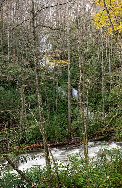
Summey Cove Falls is a high waterfall that drops into North Fork French Broad River. Although the waterfall is close to the road, the view is mostly hidden, even in winter. In summer, it’s barely visible.
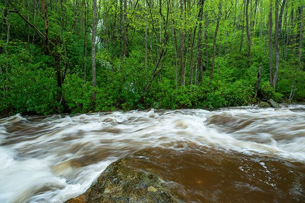
For an up-close view, you could scramble down the bank and wade across the river, but if the water level is high enough to make Summey Cove Falls worth that much effort, it is likely too high to safely wade North Fork French Broad River.
(022B-171328)
Driving Directions
Open driving directions in map appFrom Beech Gap on Blue Ridge Parkway, drive 6.65 miles south on NC 215 and turn left on the gravel FS 140 (Courthouse Creek Road). FS 140 is 10.4 miles north of US 64. Follow the road for 1.4 miles to a small pullout on the left.
Note that as of this writing, FS 140 is closed indefinitely. If it is closed when you visit, you’ll have to park in the area beside NC 215 across from FS 140, and walk the road. I don’t think it’s worth it for this waterfall, but if you’re hiking the road to see the other waterfalls farther along, you should stop to see Summey Cove Falls on the way.
Hiking Directions
Quick Glance
No hike needed.
Detailed Look
If the conditions are perfect—high water, no leaves on the trees—you might wish to scramble down the bank to the edge of North Fork French Broad River for a more open, though still restricted, view.
| Accessibility: | Roadside view |
| County: | Transylvania |
| River Basin: | French Broad |
| Watercourse: | Tributary of North Fork French Broad River |
| Watershed: | Very small |
| Type and Height: | Cascading and free-falling falls nearly 200 feet high Height measured by rangefinder. |
| Landowner: | Pisgah NF, Pisgah RD |
| Beauty Rating: | 1 If you see it in perfect conditions, it’s a 3. |
| Elevation: | 3280 feet |
| USGS Map: | Sam Knob |
| Hike Difficulty: | View roadside |
| Hike Distance: | View roadside |
| Waterfall GPS: | 35.26309, -82.88932 Coordinates are for the roadside viewpoint. |
| Parking GPS: | 35.26309, -82.88932 |
Photo Gallery
Click a photo to enlarge.