Triple Falls
!
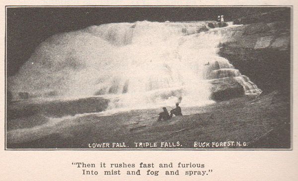
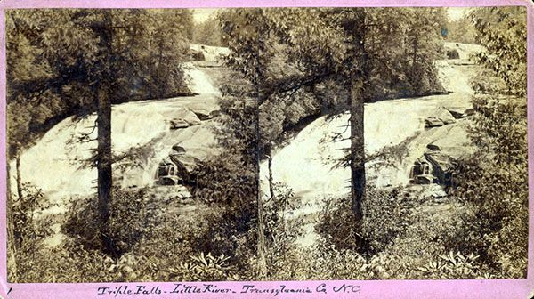
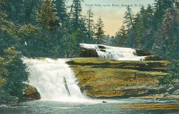
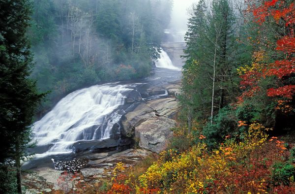
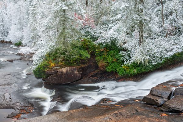
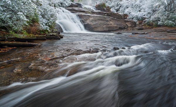
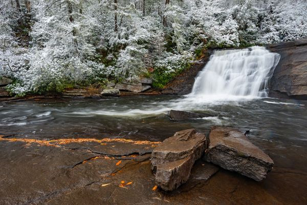
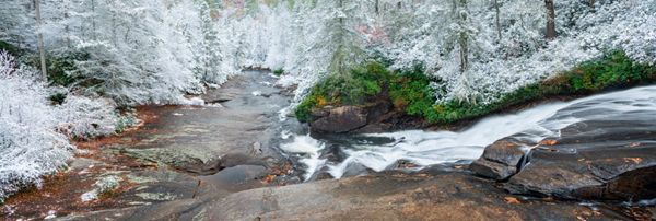
One thing’s for sure about Triple Falls. When you see it, you won’t question how it got its name. Two upper falls of about 30 and 25 feet, and a lower fall of about 40 feet make up this section of Little River.
The area between the middle and lower drops has lots of flat rock and used to be extremely popular among sun worshipers and waterfall lovers. Unfortunately, the stairs leading down to it are closed indefinitely because of safety concerns.
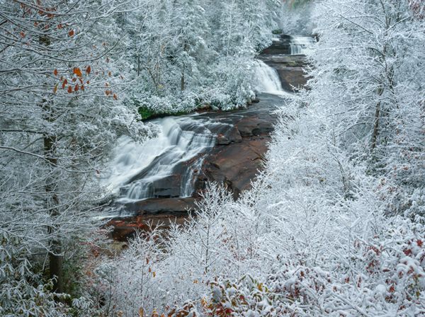
An early snow frames the view of Triple Falls from the trail. (030B-113130)
Driving Directions
Open driving directions in map appDuPont State Recreation Forest can be accessed easily from Hendersonville, Pisgah Forest, Brevard, and Cedar Mountain. Use the trailhead GPS coordinates to find the best route.
If you’re coming from the junction of US 64, US 276, and NC 280 near Brevard, drive 3.5 miles east on US 64 and turn right on Crab Creek Road (SR 1528). Go 4.2 miles and turn right on DuPont Road (SR 1259), which becomes Staton Road when it crosses from Henderson County into Transylvania County. Drive 3.1 miles on this road to Hooker Falls Access Area, on the right, just before crossing Little River.
Hiking Directions
The trailhead serves Hooker Falls, Triple Falls, and High Falls. For Triple and High, begin at the kiosk and cross Little River on the footbridge. Pass under the road and follow along the river on a level course for a quarter-mile. The final 0.1 miles is a steepish ascent that brings you to a fence and view of the falls. The view is good, but it unfortunately blocks off part of the upper and lower drop.
The trail continues a few yards to a set of stairs, on the left. These stairs used to be the access for the top of the lower drop of Triple Falls, but it’s now closed for safety reasons.
| Accessibility: | Hiking trail |
| County: | Transylvania |
| River Basin: | French Broad |
| Watercourse: | Little River (tributary of French Broad River) |
| Watershed: | Medium/large |
| Type and Height: | Three distinct levels falling about 100 feet Height approximated from LiDAR map. |
| Landowner: | DuPont State Recreational Forest |
| Beauty Rating: | 8 |
| Elevation: | 2360 feet |
| USGS Map: | Standing Stone Mtn NC/SC |
| Hike Difficulty: | Moderate Class I bushwhack |
| Hike Distance: | 0.35 miles |
| Waterfall GPS: | 35.19947, -82.61722 Reading taken from the top of lower drop. |
| Trailhead GPS: | 35.203199, -82.61881 |
Photo Gallery
Click a photo to enlarge.
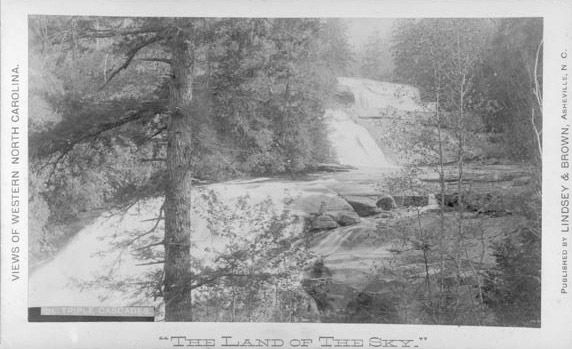
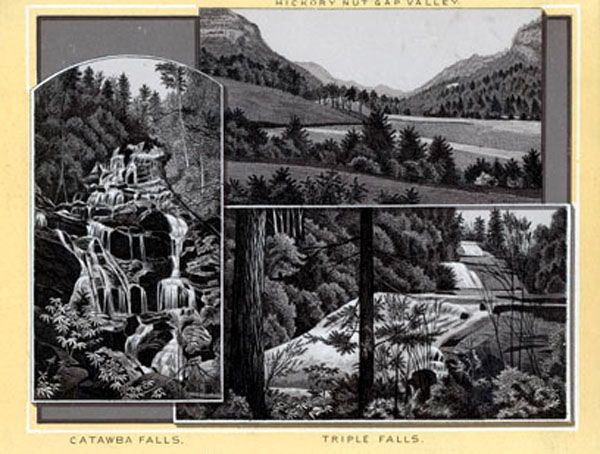
Historical Gallery
Click a photo to enlarge.