
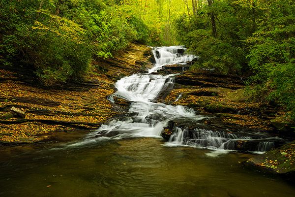
Tucker Creek Falls
!
Tucker Creek Falls is a rewarding sight for those willing and able to climb down the bank to the base, but that has not always been the case. Scroll down for more about that.
(006I-210492)
Driving Directions
Open driving directions in map appIn the Balsam Grove community, turn off NC 215 onto Tanasee Gap Road (SR 1324). (The turn is 8.3 miles south of Blue Ridge Parkway and 8.7 miles north of US 64.) Drive 1.45 miles on Tanasee Gap Road and turn left on the unpaved Pressley Fields Road (SR 1325). Drive 0.1 miles and park on the left side of the road.
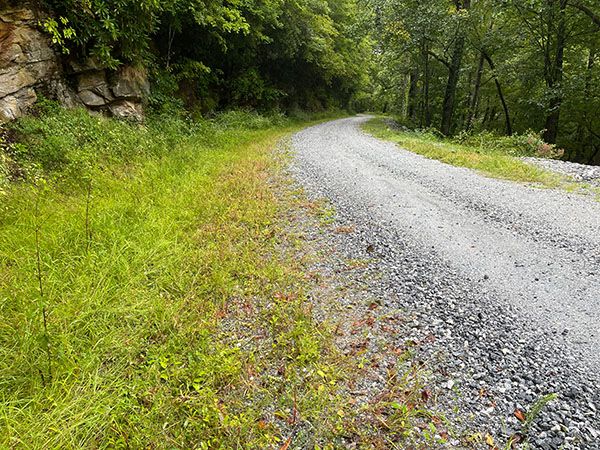
Trailhead for Tucker Creek Falls. (006I-209089)
Hiking Directions
Quick Glance
Climb down the back.
Detailed Look
Climb down the back to the creek and work your way up to the base of the falls. You’ll want to cross the creek at a distance downstream to avoid the thick tangle of rhododendron.
| Accessibility: | Bank scramble and bushwhack |
| County: | Transylvania |
| River Basin: | French Broad |
| Watercourse: | Tucker Creek |
| Watershed: | Small |
| Type and Height: | Steep, cascading falls approx. 35 feet high Height measured with rangefinder. |
| Landowner: | Pisgah NF, Pisgah RD |
| Beauty Rating: | 6 |
| Elevation: | 2820 feet |
| USGS Map: | Lake Toxaway |
| Hike Difficulty: | Difficult |
| Hike Distance: | Less than 0.1 miles |
| Waterfall GPS: | 35.217021, -82.88665 |
| Trailhead GPS: | 35.21742, -82.886019 |