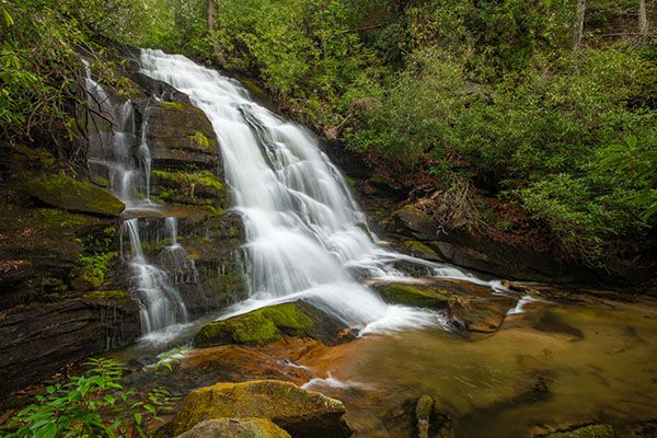
Upper Shoals
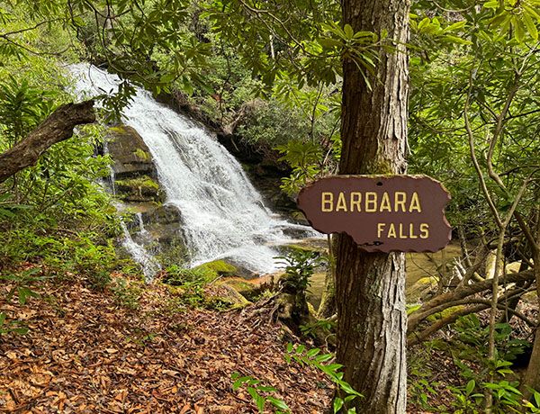
Barbara Falls
!
This scenic waterfall is located very close to the road, but reaching a good view of it requires a tough bushwhack down the bank. Also, the best view of the falls is from the river-right side, which is private property.
(018B-255469)
Driving Directions
Open driving directions in map appIf you’re in the Davidson River vicinity, drive to Gloucester Gap, which is on FS 475 some 6.05 miles from US 276. From the gap, turn left on FS 471 (Catheys Creek Road) and drive about 2.85 miles to a narrow pullout on the right.
To get here from downtown Brevard, drive 3.3 miles west on US 64 and turn right at the sign for Kuykendall Group Camp. After turning, make an immediate left on Catheys Creek Road and drive about 5.15 miles to the pullout on the left. You'll pass Catheys Creek Falls and the trailhead for Kuykendall Falls on the way. Catheys Creek Road becomes unpaved after 0.7 miles.
Hiking Directions
Quick Glance
Walk down road around the curve and bushwhack down the bank toward the sound of falling water.
Detailed Look
From the pullout, you can glimpse a small cascade. Upper Shoals is a few hundred feet downstream, so don’t head down toward the cascade. The river-left side of the falls is very cliffy and difficult to negotiate, with only a few channels where you can descend. It might be best to climb down a distance below the falls and then follow the creek back up. To keep from coming out at the cliffs, walk down the road around the curve before entering the woods. It’s going to be a tough hike no matter how you do it.
Keep in mind that the river-right side of the creek is private property.
| Accessibility: | Bushwhack and creekwalk |
| County: | Transylvania |
| River Basin: | French Broad |
| Watercourse: | Catheys Creek |
| Watershed: | Small |
| Type and Height: | Steep cascading falls about 40 feet high Height measured with rangefinder. This is for the main drop. There are more cascades below. |
| Landowner: | Pisgah NF, Pisgah RD |
| Beauty Rating: | 6 |
| Elevation: | 2960 feet |
| USGS Map: | Rosman |
| Hike Difficulty: | Difficult |
| Hike Distance: | A few hundred feet |
| Waterfall GPS: | 35.239514, -82.824956 |
| Trailhead GPS: | 35.240842, -82.82466 |
Photo Gallery
Click a photo to enlarge.