
Waterfall on Clark Creek
Disabled access: Suitable for all visitors.
Waterfallson this site and counting
!
This isn’t a destination waterfall, but it’s a decent one to plan your route for since it’s right beside the road. You don’t even have to get out of your car to see the upper section.
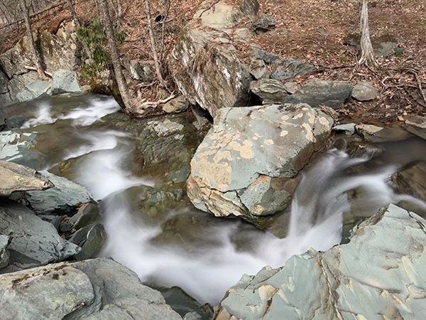
The top cascading section that is right beside the road. (031F-262353)
SHOW MORE
Driving Directions
Open driving directions in map appThe waterfall is right beside Clarks Creek Road (SR 1136), 1.4 miles from NC 194 and 2.4 miles from NC 105.
Hiking Directions
Quick Glance
Look out the window to see top section. Walk down along road for a poor view of the lower, more significant portion.
Detailed Look
Details not needed.
| Accessibility: | Roadside view |
| County: | Watauga |
| River Basin: | Watauga |
| Watercourse: | Clark Creek |
| Watershed: | Small |
| Type and Height: | Cascading and steep falls, 32 feet high |
| Landowner: | Private |
| Beauty Rating: | 2 or 3 There is an ugly building at the base of the falls. |
| Elevation: | 2840 feet |
| USGS Map: | Valle Crucis |
| Hike Difficulty: | View roadside |
| Hike Distance: | — |
| Waterfall GPS: | 36.184401, -81.778316 This is for the pullout at the top of the falls. |
| Parking GPS: | 36.184401, -81.778316 |