Waterfall on tributary 1 of Oconaluftee River
!
If you’re driving Newfound Gap Road in Great Smoky Mountains National Park during a very wet period, it might be worth slowing down for this waterfall and looking out the window as you drive by. If you happen to catch it during a heavy thunderstorm, you might even decide to stop and snap a picture. But in all honesty, this is one you can probably ignore without missing anything. The creek can dry up completely at times.
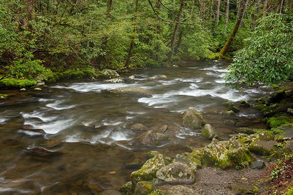
With that said, I recommend you stop, regardless of the conditions. There’s a large pullout beside Oconaluftee River, directly opposite the waterfall, and the river always looks good.
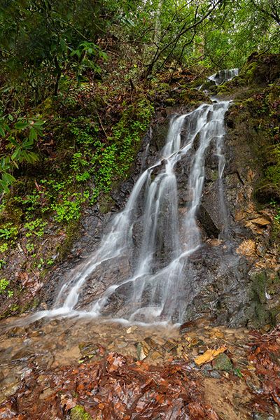
I got lucky and caught it during exceptionally good conditions. (15-11-255409)
Driving Directions
Open driving directions in map appThe waterfall is beside Newfound Gap Road (US 441), north of Cherokee. It’s 0.3 miles south of Collins Creek Picnic Area. There is a large pullout on the Oconaluftee River side of the road. The waterfall is directly opposite the south end of the pullout.
Hiking Directions
If your car is pointing north, look out the driver’s side window.
| Accessibility: | Roadside view |
| County: | Swain |
| River Basin: | Little Tennessee |
| Watercourse: | Tributary of Oconaluftee River |
| Watershed: | Itsy bitsy |
| Type and Height: | Steep, 18-foot cascade Height measured with rangefinder. |
| Landowner: | Great Smoky Mountains NP |
| Beauty Rating: | 1 It’s a little better when it has good flow. |
| Elevation: | 2360 feet |
| USGS Map: | Smokemont |
| Hike Difficulty: | View roadside |
| Hike Distance: | View roadside |
| Waterfall GPS: | 35.563865, -83.331561 |
| Parking GPS: | 35.563991, -83.33155 |
Photo Gallery
Click a photo to enlarge.